
Sign up to save your podcasts
Or

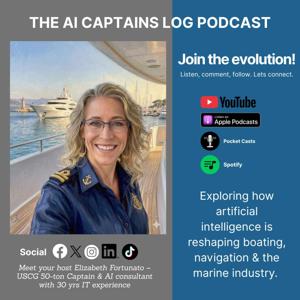

Summary
In this conversation, Elizabeth Fortunato, the AI Captain, discusses the revolutionary advancements in ocean mapping technologies, emphasizing the transition from traditional static charts to dynamic, living charts created through a combination of satellite imagery, underwater drones, and AI. She highlights the importance of these technologies in enhancing our understanding of the ocean’s depths and conditions, making navigation safer and more efficient.
Takeaways
* The ocean charts are evolving into living charts.
* Satellite technology is crucial for modern ocean mapping.
* Underwater drones can operate for over 30 days at sea.
* AI is enhancing the accuracy of ocean depth measurements.
* The endurance layer captures data that human crews cannot.
* Multiple autonomous vessels can map vast areas quickly.
* Satellite derived bathymetry allows for depth measurement without physical contact.
* Technological advancements are making ocean exploration safer.
* Mapping coral reefs is now possible without disturbing them.
Chapters
00:00:00 Hello, and welcome to the AI Captains Log.
00:00:27: But in 2026, the living chart is being built
00:00:45: The second layer is the endurance labor,
00:01:19: Next layer, the third layer, is the swarm.
00:02:07: Now, let’s talk about the first layer from the sky.
00:02:27: Using 2026 AI, NOAA analyzes imagery from space to measure how light changes and hits the bottom.
00:02:57: What’s the fusion?
00:03:17: What’s my take?
00:04:14: How does it all hit your helm?
00:04:45: If a robot from the Ocean Infinity or Chance identifies a new shoal,
00:05:13: The Living Chart is your new silent partner.
00:05:36: You can find me on Substack, Spotify, YouTube podcasts.
Frequently Asked Questions
What is a living chart?
A living chart is a dynamic mapping system that incorporates real-time data from various technologies to provide accurate insights into ocean conditions.
How does satellite-derived bathymetry work?
Satellite-derived bathymetry uses AI to analyze changes in light as it hits the ocean floor, allowing for depth measurement without direct contact.
What are the benefits of using ocean drones?
Ocean drones can operate for extended periods, collecting data in challenging conditions, which is essential for accurate mapping and monitoring of the seafloor.
How can I access real-time ocean data?
Mariners can access real-time ocean data through chart plotters that subscribe to live feeds, providing updates on changing conditions directly to their devices.
Links
Thanks for listening to the AI Captains Log! Subscribe for free to receive new posts, see full articles, and support my work.
https://substack.com/@aicaptainslog
 View all episodes
 By Boating Re-Programmed
Summary
In this conversation, Elizabeth Fortunato, the AI Captain, discusses the revolutionary advancements in ocean mapping technologies, emphasizing the transition from traditional static charts to dynamic, living charts created through a combination of satellite imagery, underwater drones, and AI. She highlights the importance of these technologies in enhancing our understanding of the ocean’s depths and conditions, making navigation safer and more efficient.
Takeaways
* The ocean charts are evolving into living charts.
* Satellite technology is crucial for modern ocean mapping.
* Underwater drones can operate for over 30 days at sea.
* AI is enhancing the accuracy of ocean depth measurements.
* The endurance layer captures data that human crews cannot.
* Multiple autonomous vessels can map vast areas quickly.
* Satellite derived bathymetry allows for depth measurement without physical contact.
* Technological advancements are making ocean exploration safer.
* Mapping coral reefs is now possible without disturbing them.
Chapters
00:00:00 Hello, and welcome to the AI Captains Log.
00:00:27: But in 2026, the living chart is being built
00:00:45: The second layer is the endurance labor,
00:01:19: Next layer, the third layer, is the swarm.
00:02:07: Now, let’s talk about the first layer from the sky.
00:02:27: Using 2026 AI, NOAA analyzes imagery from space to measure how light changes and hits the bottom.
00:02:57: What’s the fusion?
00:03:17: What’s my take?
00:04:14: How does it all hit your helm?
00:04:45: If a robot from the Ocean Infinity or Chance identifies a new shoal,
00:05:13: The Living Chart is your new silent partner.
00:05:36: You can find me on Substack, Spotify, YouTube podcasts.
Frequently Asked Questions
What is a living chart?
A living chart is a dynamic mapping system that incorporates real-time data from various technologies to provide accurate insights into ocean conditions.
How does satellite-derived bathymetry work?
Satellite-derived bathymetry uses AI to analyze changes in light as it hits the ocean floor, allowing for depth measurement without direct contact.
What are the benefits of using ocean drones?
Ocean drones can operate for extended periods, collecting data in challenging conditions, which is essential for accurate mapping and monitoring of the seafloor.
How can I access real-time ocean data?
Mariners can access real-time ocean data through chart plotters that subscribe to live feeds, providing updates on changing conditions directly to their devices.
Links
Thanks for listening to the AI Captains Log! Subscribe for free to receive new posts, see full articles, and support my work.
https://substack.com/@aicaptainslog