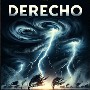
Listeners across America, weather experts are sounding the alarm for a potentially dangerous outbreak of windstorms spanning the Plains and Midwest as of Friday, August 29, 2025. Fox Weather is reporting a “potential derecho spawning tornadoes, hurricane-force winds threatens several states across Plains, Midwest,” with these storms set to organize late Friday into the early morning hours of Saturday.
As the weather pattern unfolds, forecasters say conditions are primed for a large, fast-moving cluster of thunderstorms to develop, fueled by oppressive late-summer heat lingering across the region. According to the Texas Storm Chasers’ latest update on August 29, severe storms began moving in from New Mexico into the Texas Panhandle Friday evening, with confirmed gusts in Oklahoma and Kansas already reaching 70 miles per hour and hail the size of tennis balls. The storms are forecast to merge overnight, pushing southeast through the Panhandle, Big Country, and Concho Valley with winds predicted to exceed 70 mph in the most intense cells, frequent lightning, and rainfall totals up to four inches in isolated spots.
Fox Weather notes that this volatile setup could generate a derecho—a violent, sprawling windstorm associated with a line of rapidly moving thunderstorms. Derechos are notorious for their long-lived, destructive straight-line winds that can sweep across multiple states, toppling trees, tearing down power lines, and smashing windows over hundreds of miles. When trained meteorologists refer to a derecho, they’re talking about a windstorm that leaves a swath of damage at least 250 miles long with several gusts exceeding 74 mph. In rare cases, tornadoes can also spin up along the leading edge, further complicating the threat according to Fox Weather’s ongoing coverage.
Communities from the Texas Panhandle northward into the Midwest are urged to prepare for overnight severe weather and be alert for rapidly evolving warnings. Sudden, destructive gusts and localized flash flooding could make travel dangerous or life-threatening, especially after dark. Texas Storm Chasers urges drivers to exercise extreme caution—flooding is often invisible on the road at night and can quickly strand vehicles.
Meteorologists highlight that a derecho can shift from localized thunderstorms to a full-blown regional disaster in a matter of hours. In past events, derechos have caused millions in damage, widespread power outages, and weeks of recovery work for affected towns. The pattern unfolding now is being called “dangerously similar” by multiple outlets, and residents from Amarillo to Omaha and eastward should remain vigilant into early Saturday morning.
That’s the latest update as of August 30, 2025. Thank you for tuning in, and be sure to come back next week for more. This has been a Quiet Please production. For more, check out QuietPlease dot AI.
Some great Deals https://amzn.to/49SJ3Qs
For more check out http://www.quietplease.ai
This content was created in partnership and with the help of Artificial Intelligence AI


 View all episodes


 By Inception Point Ai