
Sign up to save your podcasts
Or

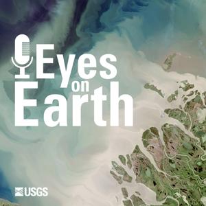


The U.S. has plenty of data on wildfire risk. There are local and regional risk assessments, complex datasets like LANDFIRE and tracking tools like the EROS Fire Danger Monitor, as well as a host of resources and research projects devoted to the subject. But much of that information is steeped in the language of fire science and difficult to comprehend for those outside it. In this episode of Eyes on Earth, we hear from Frank Fay of the USDA Forest Service, who describes a new website that represents the first national tool on wildfire risk designed with communities and the general public in mind. The tool was built with data from the LANDFIRE program and numerous other sources, and offers a window into fire risk for every community in the U.S.
Landsat satellites offer a wealth of information to scientists studying ecosystem health and recovery. Data products derived from Landsat open even more areas of inquiry. Landsat Burned Area products, for example, can help researchers identify previously unknown fires that took place from 1984 through the present. In this episode of Eyes on Earth, we talk to one of the scientists behind that product about Landsat’s role in monitoring ecosystem health and recovery.
The Mendenhall Program offers a range of two-year post-doctoral research fellowships within the U.S. Geological Survey. Heather Tollerud took advantage of the program in 2015 to study drought and land cover at the USGS EROS Center, and has since become a key player in the Center’s innovative Land Change Monitoring, Assessment and Projection (LCMAP) initiative. In this episode of Eyes on Earth, we hear how Dr. Tollerud went from studying the harsh playas of northwestern Nevada to leading research and development for a national-scale project at the USGS. We also hear about a current Mendenhall fellowship opportunity that’s seeking a postdoctoral researcher to join the LCMAP team.
In the West African nation of Ghana, tropical forests are more than landscape. They are woven into language, custom, and culture. They are also the source of timber for home heating and industry, as well as barriers to agricultural production. Those are just a few of the reasons why deforestation has come alongside the nation’s rapid population growth. In this episode of Eyes on Earth, an EROS scientist and Ghana native talks about how Landsat satellites help track deforestation and offer guidance on forest regrowth.
The Arctic is changing at a more rapid rate than the rest of the planet. Some of the most significant changes are tied to the thawing of near-surface permafrost, the layers of frozen soil containing vast stocks of stored carbon. Scientists at EROS have used remote sensing tools to map the extent of near-surface permafrost in Alaska, offering a baseline for further research as change continues to ripple through the state.
From the publisher's feed
Eyes on Earth is a podcast on remote sensing, Earth observation, land change and science, brought to you by…
2 Listeners
6 Listeners