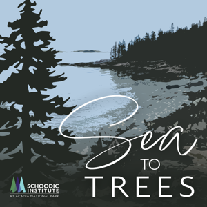
Sea to Trees

Sea to Trees

By National Park ServiceScienceEducationNatural Sciences
Download on the App Store

Sea to Trees episodes

  • Restoration | The Great Summit
    From social trails to heavy rain events, the summits in Acadia National Park are experiencing a lot of degradation. In this episode, we’ll discover how a backpack full of dirt can help bring life back to Acadia’s mountains.

    Schoodic Institute at Acadia National Park: https://schoodicinstitute.org/

    ---

    TRANSCRIPT:

    ---

    Episode 1_FINAL TRANSCRIPT

    Catherine Devine 00:05 Hi, everyone, welcome back to Sea to Trees. This episode opens with a little story about one of the best walks I've ever been on. Let me set the scene. It was late winter in the high desert, which means it was around 50 degrees Fahrenheit. And I was about to head down one of those secret paths not advertised to tourists. As these things tend to go, it was my friend's father who lives in the area, who told me about this secret spot. Though, to be honest, I'm not so sure how secret it was considering I found some more detailed instructions online. As the instructions said, I followed the path until I saw a small gently worn trail off to the right. I turned right down the skinny path and followed it. It got narrower and narrower until it opened up to the most serene looking bunch of natural hot springs I've ever seen. It was so cool. Spa-like private, and the insider nature of it all give me a small rush of adrenaline. And the best part was that it was secret. A discovery off the beaten path, an adventure. It's the best, right? Well, it's actually kind of the worst. And I wouldn't have done it if I knew the gravity of my actions. That off the beaten path I took. It's pretty harmful. It's called the social trail. And you've probably made one too. You're listening to Sea to Trees, a podcast that tells the stories of the science happening in and around Acadia National Park. From the rocky shoreline to the evergreen forests to the granite mountain tops. The second season of the show seeks to answer the question, what does it mean to conserve in the face of climate change? Social trails, unlike official trails, these users created paths form over time cutting through protected habitat. Once the vegetation is worn down, it starts to look like an official trail, which invites more foot traffic, and the cycle continues. They've become managerial nuisances for national parks all across the country, including Acadia National Park on the coast of Maine, a place that's been experiencing the effects of an especially brutal cocktail of both social trails and more frequent heavy rain events.

    Chris Nadeau 02:34 All the mountain summits in the Northeast are absolutely amazing places because of that, because they're so amazing, right hundreds, if not millions of people come up to the summits each year. And that has an impact on the vegetation up here, right. And so, we see a lot of degradation. And if we continue to let that happen, then we'll just see more and more degradation. And then with heavy rain events like we get now and climate change, that erosion just continues to happen even more. And so, it's really our duty to try to figure out how we can restore these places so that the next generation of people will be able to come here and see these amazing places and see these really unique plants that really many of them only occur on mountain summits in Acadia. So, keeping them here is super-duper important.

    Catherine Devine 03:20 That's Chris Nadeau, the climate change adaptation scientist at Schoodic Institute. He's talking about the impacts of social trials on the summits in Acadia National Park. Basically, social trials plus heavy rain events equal lots of soil erosion and loss of vegetation. And this isn't a projection. Acadia is experiencing the effects right now. The Summits were once lush and green and lichen soaked. Now they have more bare rock granite and loose pebbles. It's pretty drab looking. So far, the efforts to minimize and reverse this degradation haven't been too successful.

    Chris Nadeau 03:55 The park noticed that there was a lot of degradation of the vegetation on Acadia's mountain summits. And so, they tried to start roping off some areas to see if just keeping people off those areas would help the vegetation come back. But what we found is that the vegetation doesn't come back.

    Catherine Devine 04:10 And the reason the vegetation doesn't come back? It's all about soil. On a basic level, what soil does is it essentially provides a home for plants to root grow and obtain nutrients. Plant roots collect nutrients held in the soil. The roots then reach towards water sources and pull the water towards the stem and leaves. And since plants uptake nutrients through water, bacteria and fungi in the soil break nutrients down so they become water soluble for the plants to use. Soil also anchors plants, giving them something to grab hold up and stabilize. So yeah, there's a lot going on in the soil. I don't think it gets enough credit. But basically, what's going on in the summits of Acadia is that there isn't enough soil for vegetation to grow in. Yeah, as I said it's because of social trails and heavy rain events. Knowing this Schoodic Institute and partners including friends of Acadia and NPS set out to find a solution.

    Chris Nadeau 05:07 And so, about seven years ago, the Schoodic Institute and other partners, including the National Park Service and native plant trust, started some experiments to try to understand how can we restore vegetation on mountain summits. And we really found three things. One roping off areas doesn't work. Two, we needed to bring soil to the summit, and then three, if we bring the soil, the plants will just come, they'll colonize the soil that we bring up to the summit on their own.

    Catherine Devine 05:35 I found a lot of hope and what Chris said, bring the soil and the plants will come. Give nature the space and resources to do its thing, and the vegetation will vegetate. Easy, right? We just need to get some fertile soil to the tops of the mountains and we're all good. Problem solved. Vegetation will grow again. In theory, this sounds fairly straightforward, but in practice, it's a bit of a different story.

    06:03 **sound of people sanitizing soil**

    Catherine Devine 06:12 That's Alex Carey. She's the restoration research associate at Schoodic Institute. She's spent countless hours sterilizing dirt to aid in one of the summit restoration projects at Schoodic. When I first heard that Alex was spending many hours sanitizing dirt. I was a little confused. Up until that point, I thought dirt was always well dirty. Let me explain. Since the dirt came from outside the park, it needs to be heated up to at least 180 degrees to kill any fungus or invasive plant seeds that could be damaging to the park. After the dirt gets sanitized, it needs to make its way to the summits of three different mountains in Acadia, Cadillac, Sargent and Penobscot. Getting soil up Cadillac Mountain is a pretty easy task, because there's a road to the top. But Sergeant and Penobscot have no roads, just trails, which makes this entire process a whole lot more complicated. So, the researchers had a brainstorm. They had to figure out how to transport a whole lot of soil over 1000 feet up to the tops of these mountains. They had a few options to consider a big one being using a helicopter to fly the soil to the summits. But that came with its own set of logistical challenges, mainly due to funding. But then, Chris Nadeau along with friends of Acadia and the National Park Service had a better idea. A soil hike. An event that would call on community members to carry some of the sterilized soil on their backs up Sargent and Penobscot mountains. They called it Save Our Summits. There'd be three waves of hikers, one at 7am, one at 8am and one at 9am. Everyone would get a black sack to fill with the weight of soil of their choosing. Hikers would fill their sacks with sterilized dirt at the base of the mountain, place their sack in their backpack and hike approximately two miles to the summit of either Sargent or Penobscot mountain, hikers' choice. I showed up to the event around 6am. The turnout was already surprisingly big. As I said the event was a joint partnership between Schoodic Institute, the National Park Service and Friends of Acadia, there had to be at least around 40 people working the event alone. I hiked up early with some of Schoodic Institute's restoration crew and NPS employees. They had to place signs along the trail and at the summit before the first wave of hikers started. The hike was much harder and steeper than I anticipated. It had rained the night before, so some of the rocks were pretty slick. About 45 minutes later, we made it and at about 8am the volunteers started rolling in. I headed over to Sargent Mountain to see how the turnout had been going. Emma Lanning, a biological science technician for the National Park Service was staffing the station.

    Emma Lanning 09:50 So far, it's pretty early in the day. So, we've only had a couple people I think four people up here so far, but they carried a lot of soil. I think the first person had like 30 pounds of soil in their backpack. So, everyone signed up beforehand. So, it was kind of a mix of locals and people visiting, even people who work for the park, Schoodic Institute, or some of our partner organizations on their day off helping out.

    Catherine Devine 10:15 One volunteer said it was his third trip. Some of the volunteers were just kids.

    Young Volunteer 10:23 It was really fun, it was difficult. All dyadic take several breaks. But I really like the honors of bringing oil up to help get planning on vegetation.

    Catherine Devine 10:39 In the end, more than 1500 pounds of soil was transported from base to summit, and absolute success. But they're not quite done yet.

    Chris Nadeau 10:50 We got 1500 pounds up during the Save Our Summits event with 72 volunteers. But we didn't get all the soil up during that time. And so, we've been doing smaller events. You know, every couple of weeks or so will take up a volunteer group. And we've been able to move, you know, last event we did I think had 30 people, give or take 30 people, and we got up another 500 pounds, we need three or four more trips like that, before the fall. To get it all up.

    Catherine Devine 11:19 Do you find people are fairly eager?

    Chris Nadeau 11:22 Yeah, it's been amazing. I mean, people just really want to help the park. I mean, they come here from far away, because the parks are so amazing, and they love it. And then the locals just also a lot of them really love the park. And so, they've just been super eager to help. And in fact, we have to hold people, people want to take way more weight than we're comfortable letting them carry up the mountain. And we have to kind of tell people like, you know, please take a little less, because they're worried about your safety. And so, it's just amazing to see how much people want to help out. So yeah, we have many, many people asking us when they can do it again.

    Catherine Devine 11:56 It seems like Chris and his team will have no problem getting all the soil up there, which is great. But what happens next, how is this soil put to work? Chris says the next few weeks of the project is all about mapping. And then a few weeks later, it's all about my favorite fruit, coconuts. That doesn't sound right, let me explain. To prevent the soil from just blowing off the mountain. Chris and his team are covering it with a coconut mesh fiber. So maybe not coconuts. Exactly. But coconut fiber, slightly less delicious. Let's hear what Chris has to say about it.

    Chris Nadeau 12:37 So, in the rest of the summer, we'll be mapping areas that are degraded up on their summits, so Sargent, Cadillac and Penobscot mountains. And so we'll be looking for these areas where there was a nice island of vegetation in the past, but now you can see a trail that goes right through the middle of it. Or you can see an edge that people have walked on the vegetation, and now the soil has washed away from that edge. So, we're looking to repair those edges and, or those trails. And the idea is really to get that vegetation back but to stop further damage, right, because once a trail is made through the middle of an island of vegetation, then we get a heavy rain event and the edges of that trail or road and the trail gets a little bigger and the vegetation area gets a little smaller than next year, same thing and eventually the island will just be gone. So, we want to fix those spots so that we don't get further degradation in these areas. So, in the fall, once we kind of know where these degraded areas are, we'll be spreading soil to try to fix these areas. And so we'll go to a spot that, for example, has a little trail, we'll place about an inch of the soil that we've carried up there an inch deep over the entire trail area. And then we'll cover that with this coconut mesh fiber that holds the soil on the mountain until some vegetation can grow in, in the soil to hold it on. And then we'll just let that bat grow and naturally get recolonized.

    Catherine Devine 14:02 But the experiment doesn't end there. The plan is to plant seeds on half of the summit soil plots and leave the other half of them as is, then Chris and the team will be able to deduce which strategy produces more vegetation. Does vegetation grow best when the soil is left alone in the coconut fiber? Or does it need a little support with the addition of seeds? Similar revegetation projects have been done before. The vast majority of restoration projects tend to leave out one familiar fuzzy ground cover... Moss,. Mosses and lichens are a huge component of the ecology on Acadia summits. But how do you restore them?

    Chris Nadeau 14:43 Often how they're restored is you just dig up an entire mat so like a five foot by five-foot area of moss and lichen mat and just move that to a different place and pop it down. But that's not something we can do because we'd be degrading one area basically to restore another and so we're trying some four methods to restore mosses and lichens in these places. And one potential method is just to collect a cookie cutter size piece of moss and lichen from a natural area, grind it up, and then just spread those ground up moss and lichen propagules on to the soil. Another option is the same thing, collect a cookie cutter size section of moss and like and grind it up, put it into water and make like moss and lichens slurry. And then you just spray that slurry out on the soil. So, we'll be potentially testing a couple of those methods. And we're testing those in the lab now. But I think in the fall, we'll be applying one of those methods in some of the applications. And one of the really cool things about that, so one of the big threats up there for this restoration is climate change. And so, things are, you know, getting a lot hotter, obviously, we're also seeing longer periods between rain events. And so, we'll get a heavy rain event and then we'll get nothing for a really long time, a week or two and then we'll get another heavy rain event. And plants really struggled to survive in that dry period between rain events when it's really hot. And so, we're worried that we'll do all this work for the restoration. But plants will just die in restoration pots because of climate change. But we're hoping maybe mosses and lichens can alleviate that stress. And so, one thing mosses and lichens do really well is they hold moisture in the soil during dry periods. And so, if we can restore mosses and lichens, maybe they'll be able to hold moisture in the soil and allow other plants to persist in these really dry periods and make our restoration a lot more successful.

    Catherine Devine 16:39 When producing this episode, I often had this feeling that restoration projects are running on this sort of ever quickening climate treadmill, trying to keep ecosystems as they are, while the effects of climate change compound. I took my concerns to Ivan Fernandez, a soil scientist at the University of Maine, hoping he could provide some optimism. What is there to do to save a lot of this climate research and restoration efforts from this Sisyphean like fate?

    Ivan Fernandez 17:10 I look at it through a lens of we're experiencing a lot of change. And of course, a lot of it is not good. But there's also just a chunk of the not good. That is kind of not preferred, meaning we well, where you're working, you know, we want Acadia to be the Acadia that we've always known and loved. And the reality is, we will never have the 20th century climate system again. And so, what do we want when we think about restoration, and resilience and adaptation? And all the kinds of stuff we do under those umbrellas. Part of being optimistic is sort of questioning ourselves on what we are resilient to? And is it realistic? And so, in a lot of the conservation world, that's been a challenge, because it's more about preserving function than form. It's more about preserving a system that has plants and birds and butterflies and nutrient cycling and hydrologic, you know, all of those things, not this specific species that always was in this specific position. Because that was in a specific climate that we'll never see again. And so, some of it, of course, yes, will persist because we're deep within the envelope of that sort of the habitat niche of those species, but in others, were at the edge of it, or were beyond it. And so, we're wrestling with, in some cases, we’re wrestling with recreating or preserving a system that is simply doomed but doomed in only certain characteristics. And if we rely on the science to, you know, to inform our best efforts, and we embrace the kind of system that will be resilient in the future, and work to preserve that, then we should be optimistic that there's something we can do, instead of just sitting here and watching it all just sort of washed away. And, and so there's one part of that sort of sense of hopelessness, that I reject in the sense of, there's a lot we can do. It's just we have to have a mindset of what's the realistic goals, the more appropriate goals in light of the reality of what we know is taking place in an ecosystem change.

    Catherine Devine 20:11 I really like Ivan's outlook. It's not the most soothing outlook I've heard. But I think it's one of the more honest projections. And it's extremely refreshing, especially in a current public discourse that often leans on hyperbolic claims that tend to contribute to feelings of hopelessness and powerlessness in face of climate change. I definitely struggle with climate anxiety and feelings of helplessness myself. I mean, who doesn't? But then I think of Save Our Summits, and how many people turned out to help, even though it was hard and long and grueling. People want to do something, and when they can, they show up in droves. And that is something to be optimistic about. As for Chris and his team, they'll wait and see. It'll take a few years to gather any conclusive evidence about their studies. But this information will give us a great shot at building a more resilient future for Acadia, Maine and the world. Thanks so much for listening to Sea to Trees, a podcast from Schoodic Institute at Acadia National Park. Acadia National Park is on traditional lands of the Wabanaki, people of the dawn. Stay tuned for our next episode. It's a wild bird chase. A big thanks to this episode's guests, Chris Nadeau, Ivan Fernandez, Alex Carey, and Emma Lanning. Sea to Trees is hosted, produced and edited by me. Catherine Devine, Catherine Wang, provided production support. And Catherine Schmitt is our senior editor. Our music was written by Eric Green, performed with Ryan Curless and Stu Mahan and recorded at North Blood studios in Midcoast, Maine. The cover art was created by Sarah Luchini. Sea to Trees is generously sponsored by the Cathy and Jim Gero early career fellowship, the National Park Foundation, National Park Service and Schoodic Institute at Acadia National Park, a nonprofit partner of the National Park Service, inspiring science, learning, and community for a changing world.

    23 min
  • Citizen Science | Project ASCO
    Maya Pelletier calls rockweed, a type of seaweed, “the van Gogh of the intertidal.” How can citizen science help paint a picture of the state of rockweed on Maine’s coast?

    Schoodic Institute at Acadia National Park: www.Schoodicinstitute.org

    Project ASCO 2023 Interest Form: https://docs.google.com/forms/d/e/1FAIpQLSebLgZFFoGSiW8uoz1tRMk5RRe2x4IHzjr3FlPc5d0guIE0dw/viewform

    Schoodic Notes: https://schoodicnotes.blog/

    ---

    TRANSCRIPT:

    ---

    Maya Pelletier calls rockweed, a type of seaweed, “the van Gogh of the intertidal.” How can citizen science help paint a picture of the state of rockweed on Maine’s coast?[Soundscape from Bass Harbor Head Light including buoy bells, waves lapping, and birdsong]

    Olivia: Sea to Trees is brought to you by Schoodic Institute at Acadia National Park. I’m Olivia Milloway.

    Maya: So what we see here in the intertidal is this organism that has these green tips and dark brown base, and it forms all these interesting contours when it drapes over the rocks, and it almost looks like a van Gogh painting, so that’s why I like to call it the van Gogh of the intertidal.

    Olivia: That’s Maya Pelleteir, the Cathy and Jim Gero Acadia Early Career Fellow in Science Research here at Schoodic Institute, talking about an organism she’s spent the last year studying. It’s photosynthetic, meaning it produces energy from sunlight, but it’s not a plant. It’s not an animal or fungus, either–it’s an algae. To be specific, it’s a marine macroalgae, or seaweed, called Ascophyllum nodosum. Here on the coast of Maine, Ascophyllum is known by its common name, rockweed. Rockweed grows in the intertidal zone, the area between the low tide and high tides. Maya and I were observing the rockweed’s “van Gogh effect” from Frazer Point Picnic Area thanks to a low tide. When the tide has receded down the shore, the rockweed drapes over the rocks and mud, creating the brushstroke-like contours Maya described. Then, when the tide comes back in, the rockweed, buoyed by small pockets of air, floats to the surface and moves back and forth with the motion of the waves. The tide was starting to come in at Frazer Point, so we began carefully walking across the seaweed-covered rocks to answer one question: how much rockweed is there on the entire coast of Maine? You’re listening to Sea to Trees, a podcast that tells the stories of the science happening in and around Acadia from the rocky shoreline to the evergreen forests to the granite mountain tops. In this first season of the show, we’re exploring the ever-growing field of citizen science and how it can help answer questions about our changing world. In this third episode, we’re going to where the trees meet the sea–the intertidal zone.

    Maya: In Maine we have a couple of different types of intertidal, so you are probably familiar with things like sandy beaches, we don't really have those here but we have a lot of boulders and a lot of, you know, rough coastlines with lots of bedrock, so that's' what we would think of as the rocky intertidal.

    Olivia: We actually do have a sand beach in Acadia–so rare in the area that it’s simply called Sand Beach. The majority of Maine’s coastline is either rocky, like Maya said, or made up of mudflats, which are harvesting areas for Maine’s clammers and marine wormers.

    Olivia: What’s life like living in the intertidal?

    Maya: Uh, well, if you're an intertidal organism, you definitely have a rough go of it.

    Olivia: The rocky intertidal zone is a hard place to live–with the constant battering of high energy waves coming in from the ocean and regular drying out periods when the tide is low, the critters living there need to adapt to constant change. Maya summed it up:

    Maya: It ain’t easy.

    Olivia: But still, the rocky intertidal zone is teeming with life: rock crabs, northern sea stars, blue mussels, frilled anemones, green sea urchins, and hundreds of other mollusks, crustaceans, and seaweeds. Rockweed plays a significant role in shaping life in the rocky intertidal.

    Maya: Ascophyllum is a foundation species, which means that it helps structure the ecosystem. So, at high tide, it forms these 3D structures that gives habitat and hiding spaces for a lot of little critters like fish and snails and crabs, and then at the low tide, it all flops over and it creates a microhabitat beneath because of the ability that it has to maintain the moisture and a cool temperature beneath the seaweed.

    Olivia: Beyond its ecological importance, rockweed is also an economic resource. I spoke with Ari Leach, a biologist with the Maine Department of Marine Resources who manages the shellfish, marine worm, and seaweed resources for the Southern half of the state.

    Ari: There are records of rockweed being hand harvested early 1900s, it’s been a resource for many different areas along the coast for decades, but the commercial rockweed harvest really got going in Maine in the 70s.

    Olivia: Once harvested and processed, rockweed is used as animal feed, fertilizers, and thickening agents in food. And, Ari says that annual rockweed landings–the amount that’s harvested each year–is only increasing.

    Ari: Over the past 20 years the harvester landings that are reported every year to DMR, both millions of pounds harvested and total value of pounds harvested, it’s only gone up. It’s not like lobster, which is still our number one, but every year I see an increase in landings and an increase in interest from both industry and just regular public sector folks, so I anticipate it will keep growing.

    Olivia: This rapid growth in Maine’s rockweed industry has led to conflict between harvesters and property owners over the sustainability of rockweed harvest. Regional closures and other management strategies have been implemented to address this conflict, and even the Maine Supreme Court has weighed in. But, all of the solutions face the same challenge: no one knows how much rockweed there is on Maine’s coast.

    Ari: Over the years there have been some pretty good guesses as to what the biomass in the state is, but without a standardized tool to measure that, a guess is only a guess. And we can't make management decisions based on guesswork. Olivia: Hoping to close this information gap, a few years ago, Schoodic Institute’s Marine Ecology Director, Hannah Webber, piloted a citizen science initiative called Assessing Seaweed via Community Observation, or Project ASCO. Asco is, not coincidentally, another nickname for Ascophyllum. Here’s Hannah.

    Hannah: Project ASCO was created out of a need to understand how much biomass of rockweed there is on the coast of Maine. But it was also created out of a need of having people collect data in a systematic way and in a way that seemed trustworthy to everybody.

    Olivia: Part of what makes these data trustworthy is that they’re collected in a transparent way, opening up the process so that anyone can participate including property owners and rockweed harvesters. John Grotton of North Atlantic Kelp, a midcoast Maine-based company that has worked with local harvesters since the seventies to produce animal feed, fertilizers, and other rockweed products, was glad to participate in Project ASCO.

    John: People on the shore, I think they are realizing that finally. We're going to have to be participants and collaborators. We're the people that are going to be the boots on the ground. We want to have independent parties doing this as well just for verification purposes, but I wholeheartedly believe we as an industry need to be involved in this.

    Olivia: John said that North Atlantic Kelp has their own internal biomass assessment to ensure they’re adhering to regulations and not overharvesting in any area. But, property owners can be skeptical of industry-reported data alone. John hopes that combining harvest data with Project ASCO findings, as well as Signs of the Seasons, another rockweed citizen science project he’s participated in, will give a more well-rounded picture of rockweed’s future.

    John: Sustainability is a concern of ours. We want to have data that shows the fishery is sustainable and it’s viable for future generations. That’s my main concern.

    Olivia: John hopes this collaborative effort will yield updated statewide management solutions; currently, rockweed harvesting regulations vary across the state.

    John: We want uniformity in the rules, and science based rules and fact based rules and some thought behind it. That's why programs like this come into play, they can lend to that management plan and harvest effort and do it in a sustainable way. Ultimately, that’s what we’re all after.

    Olivia: If you count all the peninsulas, inlets, and islands, the coast of Maine is huge–longer than the coast of California. To make Project ASCO work state-wide, to create this trustworthy, much-needed data, Project ASCO needed the help of a lot of volunteers. As the Project ASCO Coordinator, Maya ran fourteen Project ASCO Trainings over the summer, from Biddeford in Southern Maine to Cobscook Bay in Downeast Maine.

    Maya: I’m packing up the Project ASCO gear to head out for a training this morning. We have five quadrats, which are basically….

    Olivia: Maya packs up a Project ASCO kit for each volunteer to take back with them, they have the tools to visit sites on their own to collect rockweed data, on both public and privately owned lands, with landowner permission.

    Maya: ...and some scales. [Sounds of a car being packed up and started]

    Maya: Alright, you buckled?

    Olivia: Yep.

    Maya: Let’s go.

    Olivia: That day, we were headed to a Project ASCO training in Wiscasset, in Midcoast Maine. We met four citizen science volunteers a few minutes from the water and carpooled down to the Wright Landing Boat Launch. We stood at the launch, waiting for the tide to fall while Maya gave us instructions and a safety briefing and a group of clammers brought in the day’s catch.

    Maya: There’s no grace in the intertidal. You don’t need to feel pressure to go as fast as anyone else is going, you should take your own pace and your own route through the seaweed. Do look out for barnacles, barnacles can give you some nice little scrapes, we do have some gloves with us if people want that…

    Olivia: Next, Maya launched into an introduction to rockweed, how to identify it, and some basic biology.

    Maya: This is Ascophyllum, and the way that you tell that it’s Ascophylllum is it looks like linguini. It has air bladders in the center of the fronds here. This one grows very long, you’ll see if this was high tide here it could float up to this tall. So, this is how you get the three dimensional structure I was mentioning before. And something that’s kinda cool is you can tell how old they are by counting air bladders.

    Kerianne: Wait, really? You just blew my mind.

    Maya: Here’s one, two, and you just keep going along the center, three…

    Olivia: Like Maya said, you can estimate how old rockweed is by counting its air bladders. Sometimes the air bladders are farther apart, and sometimes they’re closer together, but the new growth is always a bright neon green in contrast to the darker brown base.

    Maya: ...four, five, six, seven, eight, nine, ten, eleven. It’s eleven years old.

    Project ASCO volunteer 1: Oh my gosh!

    Kerianne: Wow, I didn’t know you could do that, that's awesome.

    Olivia: The volunteer you just heard was Kerianne Gwinell.

    Kerianne: Hi I’m Kerianne Gwinell, and I work at the Herring Gut Coastal Science Center in Port Clyde as an educator.

    Olivia: Kerianne educates students on the relationships between inland watersheds and the ocean, as well as Maine’s coastal economy. She’s incorporated other intertidal-based citizen science projects into her lesson plans and was interested in using Project ASCO, too. She thinks hands-on citizen science projects give her students an entirely different perspective on the waterways around them.

    Kerianne: You know, I also see during the citizen science that's happening, during the project, just these faces of wonder and curiosity that keeps them asking questions and wanting to know more, which is always great, because I don't always know the answer, and then I go and look up the answer, and I learn more in turn.

    Olivia: After we became acquainted with rockweed, Maya led us through the protocol. First, we extended a 30 meter rope through the middle of the rockweed bed so that it sat parallel to the water. This line, or transect, marked the area we would sample along.

    Maya: So, the first step is setting up this transect so we can place our quadrats, which are little picture frames. They're 50cm by 50cm, and we'll place them along our rope transect so we can get consistent measurements that we can then generalize to the entire area.

    Olivia: Quadrats are tools that are commonly used in ecological research–ours were simply PVC pipe squares that create plots to work within. Instead of counting and measuring all the rockweed along the transect, which would be a near impossible task, we instead only counted what was growing from within the quadrats. Once we placed the quadrats along the transect, we started the bulk of the data collection with a process Maya affectionately called wrangling.

    Maya: This is the wrangling process. [Laughs, sounds of squelching seaweed being moved around] So that's [more laughter]

    Olivia: Maya demonstrated how to carefully untangle each individual rockweed from one another in order to figure out which were actually growing from within the plot so they could be counted. One volunteer noted it looked like her daughter's hair–it can get pretty tangled. Since the wrangling process usually disturbs an angry crab or two, we took note of the other critters we saw in the plot.

    Maya: Oh look, here’s a little crab. As you can see, we found it in the quadrat.

    Kerianne: Crab, yes!

    Maya: So we’ll put down, “crab, yes.” [Laughter]

    Olivia: After all the seaweed was wrangled, we counted the number of individuals, then prepared to measure and weigh the seaweed. After a quick demonstration, Maya instructed the volunteers to break off into pairs, find a quadrat, and practice the protocol. Kerianne and another volunteer started on their own plot.

    Kerianne: [Click of tape measure being stretched out] So we are at 87 cm.

    Project ASCO volunteer 2: Mik, we got nine.

    Olivia: Spending time with Kerianne and hearing how citizen science projects fill her students with both wonder and endless questions, reminded me of two volunteers I met at a training earlier in the summer. While not students in a classroom, Ann Hoffner and Tom Bailey came to Project ASCO as curious, lifelong learners. Before the couple moved to Maine, they lived on a sailboat for over a decade, collecting their own weather and atmospheric data.

    Ann: Well I guess from my perspective, again from the weather and the boat stuff, getting observations out there. There’s not even enough scientists to be able to do this hands-on stuff, observatory stuff. and I guess that’s to me what’s exciting, like the collecting, “Oh wow!” and then having something useful to do with that data.

    Olivia: Tom said that, growing up in the Sputnik Era, he was encouraged to take science classes and enjoyed learning, but after going into an unrelated field he found that there weren’t opportunities to follow his scientific curiosities.

    Tom: But science became the realm of the scientist and didn’t invite participation by individuals and nonscientists. And this is kinda a great opportunity, also expanding our own understanding of our own particular environment and area.

    Ann: And it’s cool.

    Tom: And what?

    Ann: And it's cool, it's neat to participate.

    Tom: Seaweed, man, who doesn't love seaweed?

    Olivia: Back at the training in Wiscasset, the volunteers were practicing weighing the rockweed–it takes a bit of finesse. Though the technique is still a work in progress, the method is nondestructive, meaning the seaweed doesn’t have to be cut to be weighed. A mesh weighing bag works like a sling to hold the rockweed up off the rocks, and, like the quadrats, the weighing bags are homemade. I asked Hannah who made the bags, and she told me about the crucial role a citizen scientist has played in Project ASCO without ever collecting any data.

    Hannah: I knew that I couldn't sew these bags, and I went to our then head of housekeeping who knows everybody, and I asked if she had a sewing person on staff who could do this weirdo thing, and she said oh yeah, Peg is amazing. So, Peg Rush makes our bags for us. Peg, too, has refined the model to make it more sturdy and durable bag so it doesn’t fall apart as easily in the intertidal.

    Olivia: While she was using Peg’s bags to weigh the rockweed in her plot, I asked Elin Peterson, a volunteer from Phippsburg, Maine, what brought her to the training at the Wright Boat Launch.

    Elin: Well sure, I’ve spent many summers on the Maine coast with my children growing up and spent many many hours exploring the tidal pools and the intertidal with my kids and yeah, it’s an environment that I love. And I have gotten involved in other citizen science projects as well in Maine, you know bird counts, monarch watch, and the Maine Big Night looking at amphibian migration in the spring.

    Olivia: What has been your experience with citizen science? Has it changed the way you interact with the natural world?

    Elin: Well, you certainly see what you’re not seeing ordinarily, you know. You just never knew to look for all these amphibians moving when conditions are right in the spring, and now I won’t be able to look at a seaweed bed and not think about what’s growing there, and how it’s growing, and what’s living underneath, and how climate change is impacting it.

    Hannah: The intertidal zone, wherever it exists, is a place that people find deeply engaging, so why not ask people to go out to a place that they already love to help us by providing some data? It’s a good way to get people to engage with the natural environment. They would engage otherwise, I'm not really opening a door but I’m saying, hey look at this part of the room you might not have looked at otherwise.

    Olivia: Through my reporting for Sea to Trees, I’ve gained a respect for the power of citizen science as a research tool. Citizen scientists contribute knowledge that scientists otherwise wouldn’t have, allowing for comparison between modern-day and historical biodiversity, like through Landscape of Change. When rockweed managers, scientists, harvesters, and property owners expressed a need for more information on rockweed, citizen scientists answered the call up and down Maine’s coast. I think what’s stuck with me the most, is how citizen science gives participants a deeper understanding of, and appreciation for, the world around them. In Episode 1, we heard how Dragonfly Mercury Project volunteers learn about mercury pollution in their own communities, and in Episode 2 we learned that using iNaturalist can make any backyard or city park ripe with adventure. In this last episode, we realized the beauty, and ecological importance, of unexpected textures and colors in the intertidal zone, as well as the joy of learning at any age.

    Olivia: But, the challenge with citizen science is that these benefits are limited to who participates to begin with. Citizen scientists tend to be overwhelmingly white, economically advantaged, and more likely to hold advanced degrees. The same holds true here in Acadia, and with the volunteers I interviewed for this podcast. There are barriers to accessing outdoor spaces where citizen science happens, and not everyone feels welcome in national parks in the first place. As Acadia and other parks work to become accessible to diverse visitors, citizen science projects, too, should grow and evolve to engage communities in research questions that matter to them. Not only will the science itself become more relevant and meaningful, but more people will experience the joy of learning that often comes with participating in citizen science. In a poem called “Sometimes,” Mary Oliver wrote, “Instructions for living a life: Pay attention. Be astonished. Tell about it.” I think Mary’s instructions get at the heart of what citizen science can accomplish. Acadia, and National Parks in general, are excellent places to live a life on Mary’s terms. And, doesn’t everyone deserve to pay attention to the world, to be astonished by it?

    Olivia: I’m reminded of the first conversation I had for Sea to Trees with a citizen scientist named Margie Patlak who uses iNaturalist to learn about the insects around her home.

    Margie: So yeah, the more I learn about the natural world the more it flabbergasts me, it’s just amazing everything that’s out there. It’s sort of like when you look at the stars and all you can see is the Big Dipper, the universe doesn’t seem vast. But, when you can recognize all those other constellations, if not use a telescope to see galaxies, the world becomes much more immense. Some people find that overwhelming, you know, that they’re used to themselves having a greater importance, but I feel like if you can connect to a greater sphere, then you become more immense, right? It’s both humbling but also, uh, enlarging.

    Olivia: Whether through participating in citizen science projects, visiting a park in your neighborhood, or learning more about your own community, I hope you can find your own way to connect to a greater sphere.

    Mikayla: Thank you for listening to Sea to Trees, a podcast from Schoodic Institute at Acadia National Park. Acadia National Park is on traditional lands of the Wabanaki, People of the Dawn. This show was made by Olivia Milloway, the Cathy and Jim Gero Acadia Early Career Fellow in Science Communication. Catherine Schmitt is our senior editor. Additional editorial and production support was provided by Mikayla Gullace, Maya Pelletier, and Patrick Kark. Our music was written by Eric Green, performed with Ryan Curless and Stu Mahan and recorded at North Blood Studios in Damariscotta, Maine. The cover art was created by Sarah Luchini. Laura Sebastenelli of Schoodic Notes recorded the soundscape at Bass Harbor Head Light Station heard at the beginning of the episode. Special thanks this episode to Maya Pelletier, Ari Leach, Hannah Webber, and John Grotton for sharing their expertise with us. Also, thanks to all the Project ASCO volunteers, and especially to Anne Hoffner, for all their hard work. As a nonprofit partner of the National Park Service, Schoodic Institute inspires science, learning, and community for a changing world. To learn more, visit schoodicinstitute.org.

    25 min
  • Citizen Science | Landscape of Change
    In the 1880s, the Champlain Society documented the flora and fauna on the land that would become Acadia National Park. If the Champlain Society were around today, would they use iNaturalist? Schoodic Institute at Acadia National Park: www.schoodicinstitute.org

    Olivia’s Balsam fir observation on iNaturalist: https://www.inaturalist.org/observations/146220670

    Dragonfly wing coloration study: https://www.pnas.org/doi/10.1073/pnas.2101458118

    Schoodic Notes: https://schoodicnotes.blog/

    ---

    TRANSCRIPT:

    ---

    [Soundscape from Bass Harbor Head Light including buoy bells, waves lapping, and birdsong]

    Olivia: Sea to Trees is brought to you by Schoodic Institute at Acadia National Park. I’m Olivia Milloway.

    Seth: Science is for everyone, and everyone is for science! Today, we’re inviting you to participate in our third, what we call four B’s: birds, barnacles, bugs, and…. Birches!

    Olivia: That was Seth Benz, Schoodic Institute’s Bird Ecology Director, with Nick Fisichelli, the CEO, chiming in at the end. Back in August of 2022, Seth welcomed a group of volunteers who had gathered on Schoodic Institute’s campus. Even though it was still morning, temperatures were already in the 80s, and the twenty or so volunteers–the youngest, just five years old–were eager to start the day’s activity: the Birds, Bugs, Birches, and Barnacles BioBlitz. A BioBlitz is a short but concentrated effort to document the species living in a given area. Another word to describe this catalog of life is biodiversity. Biodiversity describes variation among individual genes, species, and entire ecosystems. Acadia’s biodiversity was one of the reasons the park was founded back in 1916. Acadia straddles the transition zone between temperate deciduous forests of the south and spruce-fir boreal forests of the north, providing a myriad of habitat types that offer homes to dozens of species of mammals, hundreds of species of birds, and nearly a thousand species of plants. Encompassing a mosaic of different ecosystems within its glacially-sculpted mountains and lakes, Acadia’s streams, wetlands, and upland forests are connected to over 40 miles of rocky shoreline and 80 or so coastal islands in the cold, productive waters of the Gulf of Maine. Porcupines, loons, and otters are neighbors to peregrine falcons, spotted salamanders, and mink. Acadia provides an important opportunity for animals to move uninterrupted from the sea to the trees along Maine’s coast. Despite the protection that comes with being a National Park, Acadia’s biodiversity is changing, and it’s important for the park to understand how in order to best protect its natural and cultural resources now and into the future. People in and around Acadia have been documenting biodiversity since before it was a park, and Seth told the volunteers that BioBlitzes are important tools to continue to document and understand how the environment is changing.

    Seth: Here in Acadia National Park, we've been keeping track of things for over 150 years. We're very fortunate to be one of the few national parks in the country to have such a lineage of historical information all the way up to present. So, you're part of that effort, which we think is really important. It allows us to track what’s happening with all kinds of different insects, even trees, lichens, all those sorts of things. Once we get an explanation we’ll be maybe an hour and a half in the field taking photographs, then we’ll come back here…   Olivia: You’re listening to Sea to Trees, a podcast that tells the stories of the science happening in and around Acadia from the rocky shoreline to the evergreen forests to the granite mountaintops. In this first season of the show, we’re exploring the ever-growing field of citizen science and how it can help answer questions about our changing world. In this second episode, we’ll learn about iNaturalist, a web-based tool making citizen science and biodiversity data more accessible than ever. We’ve talked about iNaturalist a few times on the show already–so what is it, exactly?

    Carrie: iNaturalist was created to connect people to nature through technology, and we are still doing that today. The way that iNaturalist does that is by providing a way for people to share their encounters with biodiversity, and collectively what emerges is an incredible dataset that tells you when and where different species were found all over the Earth.

    Olivia: That was Carrie Seltzer, the Stakeholder Engagement Strategist at iNaturalist. If you’re using iNaturalist, you can create a record of the biodiversity you’ve encountered by sharing observations.

    Carrie: An observation is a record of an organism in a place at a time. Mostly, observations are photo-based. You can also record sounds within the app and share those, but most of it is photo based. So you can either take a new photo if you're out in the field right now, see something cool, or you can pull in photos that you have already taken.

    Olivia: If you can’t identify the organism–or, maybe you know it’s an evergreen tree, just not which one–iNaturalist’s powerful artificial intelligence will suggest potential matches. If even the AI is stumped, you should still upload the photo–this is where the knowledge and talents of other iNaturalist users comes in handy. Scientists and citizen scientists who are experts in their fields, identify these “unknown” observations or suggest corrections. I went into the forest around Schoodic Institute’s campus to test out the app.

    Olivia (outside): So I am walking through the woods right now, and because I’m in the park I don’t have really good cell service, but that’s okay because whatever photos I take now I can upload when I’m back on wifi. Okay, so I’m seeing a conifer, which is a type of tree that has cones and needles, and I think this one is a balsam fir, but I’m not 100% sure. So, I’m going to go ahead and click the observe button in the app, take a few photos, and see if the iNat community can back me up on this ID.

    Olivia: Taking photos of what I’m seeing outside is probably my favorite part of using iNaturalist because, regardless of if I have any clue of what I’m seeing, it makes me stop and think: what’s unique about what I’m seeing that could help someone identify it? Species ID is fun for me because it feels like I’m solving a puzzle; if you have just one piece of the puzzle–like for example, the tree I found that day had needles–that could only get me so far, because, well, lots of trees in Acadia have needles. But, if I can say something more specific, like the needles were about an inch long–I have a bigger piece of the puzzle. I decided to take a photo of the needles with my thumb for scale, so a potential identifier could infer their relative size. I looked for other characteristics that could be additional pieces to the species ID puzzle.

    Olivia (outside): Now, I don’t know what the bark of a balsam fir is supposed to look like, but I do know that white pine, which is another common conifer species around here, has a really distinctive bark, so I’m going to take a photo of this tree’s bark. And, another thing I can think of is cones. A lot of conifers will have very distinctive cones whether that’s size or shape, but I’m not seeing any cones on this one, so I’m going to take a few steps back and I’m going to take one more photo of the whole tree because the general size and shape can be indicative of what the species is as well. Okay. Time to head back to wifi and get this uploaded.

    Olivia: Once back inside, I uploaded the observation, and iNaturalist also suggested balsam fir as an ID. I waited for a community member to come along and confirm the species; once any observation gets two agreeing identifications it’s considered “research grade” and is available for scientists.

    Carrie: iNaturalist now has a massive amount of biodiversity data and we've got records from every inhabited country in the world. Our role is really to make the data available, and get out of the way.

    Olivia: iNaturalist makes millions of “research grade” data points available for download and use by scientists, with new observations added each day. Schoodic Institute projects, like Landscape of Change, have made use of these data.

    Catherine: Landscape of Change is a collaborative project led by Mount Desert Island Historical Society, with Schoodic Institute, Acadia National Park, College of the Atlantic, Mount Desert Island Biological Laboratory, and a Climate to Thrive, to use historical data to document the changing environment of Mount Desert Island.

    Olivia: That was Catherine Schmitt, Schoodic Institute’s Science Communication Specialist. Landscape of Change was inspired by the work of the Champlain Society, a group of Harvard Students who, in the summers of the 1880s, camped on Mount Desert Island and conducted the first comprehensive natural history survey of flora and fauna on the island.

    Catherine: And they kept really detailed records, and they wrote it all down in thousands of pages of logbook entries and scientific reports. If they were out there today, they would absolutely be using iNaturalist.

    Olivia: These logbooks are a part of a long legacy of natural history records in the land that would become Acadia National Park, including Wabanaki knowledge and the work of naturalists and scientists. While researching for another story on Acadia’s rich scientific history, Catherine found the Champlain Society’s records in the collections of the Mount Desert Island Historical Society. Catherine: As soon as I saw all of their lists of species and their measurements of the island and their surveys of the shoreline, I knew immediately that there were scientists out there who would be interested in this information. As part of Landscape of Change, we had a lot of work to do to make the data usable. We had to digitize, so scan thousands of pages of notebooks. We had to take thousands of pages of 19th century handwriting and transcribe it.

    Olivia: They also had a comprehensive list of insects in Acadia from an early 1900s study from the Mount Desert Island Biological Laboratory. After compiling and digitizing the historical data, Landscape of Change put out a call to citizen scientists to collect new data on birds and pollinating insects using iNaturalist and another citizen science database that’s just for bird observations called eBird. iNaturalist and eBird users detected more than two hundred species of birds in Acadia, which is more than twice what the Champlain Society saw.

    Catherine: But it's in the abundance that we really see big differences. So over the last 140 years, of those species that the Champlain Society did document, 8% of them have increased, most of them did not change at all, so if they were common back then, they are still common today. And 14% of them have decreased in abundance. But the question that everybody has when they see these results is why, and what’s causing these changes.

    Olivia: While it’s less clear why the changes are happening, climate change and loss of suitable habitat likely play a role. In the future, the Landscape of Change project partners plan to use data from harbormasters, lighthouse keepers, and sailors to track sea level rise and shoreline change over time.

    Catherine: When we're thinking about how can we tell the effect climate change is having on places like Acadia, historical records are really important because they can help to show us real information by real people recorded in their own words of what places were like 50 years ago, 100 years ago, 200 years ago.

    Olivia: Close to 2000 people contributed observations to the Landscape of Change Project, generating new data to compare with the past.

    Catherine: One of the benefits to projects like this is it gives the community some common ground for conversations about how this place is changing and what we're going to do about it.

    Olivia: Kyle Lima of Schoodic Institute who analyzed the data for the Landscape of Change report also reflected on the value of the effort.

    Kyle: Another benefit of Landscape of Change is showing all the people who have been partaking in our organized BioBlitzes, or just going out on their own and observing things, like it’s not just for nothing, right. It’s being used, and it’s all of great value. So, it’s a really cool project, and I’m glad that it can finally give back a little bit to the public to all those people that have given so many hours to iNaturalist and other citizen science projects. I think that that’s something that we have not done in the past as well, we being scientists as a whole.

    Olivia: Biodiversity information is just the start of the knowledge scientists can garner from iNaturalist observations. Some observations document species interactions, like a beetle pollinating a flower, or rarely seen behaviors like lizard mating. New species have also been documented using iNaturalist, as well as inspiring new questions about well-known organisms, like dragonflies. Michael Moore, a researcher now at Washington University in St. Louis, was using iNaturalist when he noticed that male dragonflies have differing wing colorations depending on their geographic region. After conducting experimental studies and analyzing the iNaturalist data, Moore concluded that there is an evolutionary relationship between temperature, male dragonfly wing color, and mating success. As temperatures continue to rise due to climate change, male dragonflies could lose their wing colorations, making them less appealing mates to female dragonflies.

    Carrie: All these pieces together told a story that would have been maybe never even conceived of without the tens of thousands of observations of these dragonflies on iNaturalist. And I love that example because it’s just so cool to see how the existence of all the iNaturalist data created a question and an idea and the ability to start answering it in a way that just wasn’t feasible before.

    Olivia: In all of its data uses, iNaturalist has a dual goal of connecting users with the natural world, and each other, which is what makes it such a powerful tool for engaging the public.

    Carrie: We are interested in data that's connected to a person that that person cares about. And that's what makes this whole thing work. Because, I have seen these things and I thought they were cool and I care about them, and other people think they're cool and are interested in them and they want to identify them. And I think that it scratches this itch of curiosity and this personal record keeping, you know, in the same way that birders love to keep life lists, right. This is like a life list of all life. [Laughs]

    Olivia: Back at the BioBlitz in August 2022, Liz Halasz, a Schoodic Institute technician, gave volunteers a quick iNaturalist training to prep them for their activity.

    Liz: So before I get started, how many people have done BioBlitzes before or are familiar with the app iNaturalist? Okay, got a few hands, that’s good! For people who are not familiar, that’s totally fine, all of these skills we teach today are, I think, pretty easy to learn…

    Olivia: Groups headed down the Sundew Trail, into a meadow by Rockefeller Hall, and to a pollinator garden planted in one of the parking lots. Mara Halloran, another of Schoodic Institute’s technicians, brought a group down the Sundew Trail, which starts in an evergreen forest.

    Kit’s partner: That little one, that little sapling’s a Christmas tree?

    Mara: It’s a balsam fir.

    Kit: Is it really? Where?

    Kit’s partner: Right there.

    Kit: No way. Did you see the balsam fir?

    Nick: Ah look, a little tree seedling! Alright!

    Mara: Little guy, so cute!

    Nick: Here’s a nice one right here, too.

    Mara: Yeah, they’re everywhere! The little baby balsam firs.

    Kit’s partner: Look, did you get the picture of it?

    Kit’s daughter: Yeah, hold on…

    Olivia: Kit and her family were taking photos of the balsam fir peeking through the moss on the forest floor. They were visiting Acadia National Park from New York.

    Kit: Well, we were looking for fun, educational activities for our child and for our family, something to experience together in the wild, and this is what we came up with.

    Olivia: Abe Miller-Rushing, who we met last episode, came to the event and brought his child, Harper.

    Harper: My name is Harper and I am 12 years old.

    Olivia: So, Harper, have you used iNaturalist before?

    Harper: Yeah, I’ve used it a lot in the woods behind my house.

    Olivia: What sort of stuff do you find out there?

    Harper: I find a lot of lichens and moss, and I find a lot of daddy long legs.

    Olivia: So, you’re kinda like an iNaturalist expert, right?

    Harper: Eh, probably.

    Olivia: You think you’re a pro at using the app?

    Harper: Yeah, I use it a lot.

    Olivia: Why do you use it so much?

    Harper: I like that it helps you identify things, and I just like charting down stuff I find in the woods. I’ve looked at a tree grow multiple times, and I can see it flower and stuff like that.

    Olivia: Harper was excited to find whatever the forest had to offer that day.

    Olivia: What are you looking for down here?

    Harper: Just like, whatever we can find. I’m kind of hoping for either a salamander or a centipede.

    Abe: Yeah, or millipedes, or pill-bugs that live under here. This one does not look like it has a ton of animals under it though.

    Harper: It does have some molds and stuff.

    Abe: A lot of fungus.

    Harper: Yeah.

    Olivia: The next spot was more fruitful.

    Olivia: What is that?

    Harper: A slug! I'm not sure what type, but it's a small little slug, it's very cute.

    Olivia: What did you do to find that slug?

    Harper: I lifted up a rock where I could see it was pretty wet, and under it is usually stuff like slugs or worms, they like it under there.

    Olivia: So you're taking a picture of it now?

    Harper: Yeah.

    Olivia: Teachers, too, came to the BioBlitz, interested in learning about iNaturalist as a tool for their classrooms.

    Colette: Hello, my name is Collette Jadis and I’m a teacher in alternative education at Searsport District High School. This program is specifically for students who really are just not able to succeed in the regular classroom. So we have different programs for special education, we have different programs for behavior. And so I’m here today with my co-teacher and we’re experiencing citizen science and this BioBlitz because we’d like to do something like this with our students.

    Olivia: In recent years, Colette has spent more time outside with her students, and sees the benefits it brings to their learning. I asked how iNaturalist could supplement these lessons.

    Colette: I think to give them a tool that they can explore and see what they connect with. Every student isn’t going to connect with it, we know this, but unless we give them exposure to things, they don't even have the choice, right? So for me it's about exposing them to some really cool different thing, maybe they take it further in that moment or this year, maybe it’s next year, maybe it’s just planting the seed. I mean I just see it’s a win-win-win all the way around whether they use it right away or not.

    Olivia: At the end of the BioBlitz, the group gathered to share what they’d found, and Seth reflected on the day.

    Seth: We had a lot of fun. We had a young chap, about five years old, he’s a budding naturalist. Everybody sort of rallied around him and his interests. His first question to me was, “What is gravity?” and so we went from there. I don’t know what he went away with, but. We have 197 observations, 99 species…

    Olivia: What I’ve learned through my reporting on iNaturalist is that it’s a platform that’s meeting a bunch of needs at once, and gets families out to learn about the natural world together, pondering everything from dark eyed juncos to the fundamental force that holds us all together.

    Seth: Anything besides a herring gull?

    Lena: I saw a Junco, a dark-eyed junco.

    Nick: Nice, Lena.

    Seth: And you were by the water?

    Lena: Yeah.

    Seth: Anything else down there, any common eiders maybe or black guillemots? Nothing? Just the gull? Well, I mean, not just the gull, the herring gull…

    Olivia: Just a few hours after I posted my observation, an iNaturalist user named Michael Stien confirmed my balsam fir ID. Michael is one of those users who identifies lots of other user’s observations–at the time of our interview, exactly 23,747 observations. I reached out to ask him how he came to spend so much of his time this way.

    Michael: I first started using iNaturalist when a plant biology professor of mine encouraged us to do a BioBlitz project in Oregon. And, I had never used iNaturalist before, and I wasn’t even that interested in plants at the time actually.

    Olivia: Michael soon became interested in the ecological and cultural significance of the trees around him in Portland, Oregon, where he graduated from Lewis and Clark College in 2022. Michael liked using iNaturalist to see how trees like douglas fir and mountain hemlock were distributed across the region as well as learning how to identify them with the help of others. He started dedicating time to identifying trees on the app.

    Michael: For balsam fir, specifically, the first things I look for are leaves about an inch long, that are on a really distinctly flat plane.

    Olivia: In addition to size, Michael makes note of the shape of the needles, and how they’re attached to the branches. These tiny differences that set trees apart is what keeps bringing him back to identifying these same trees over and over again on iNaturalist.

    Olivia: When I started using iNaturalist, I definitely relied heavily on the identification skills of others. So I figured I might as well try my hand in helping others and learning what key identifying characteristics actually separate those genera and those species, and hopefully confirming identifications so others can see those small distinct traits that I might see. I turned it into a hobby. It replaced like word puzzles for me probably, I think. I don’t know, I guess it’s just fun to do! [Laughs]

    Seth: I will say to citizen science in general, especially with the biodiversity work that we do, that is the most gratifying and sort of wellbeing feeding for me. The thing that I like is even though they’re doing that stuff here, biodiversity work you can take with you to your home place. Any backyard, any park patch, anything like that. You don’t have to come to a National Park to experience that. Citizen science is providing tools where people can do this in their backyards. And if we’re all doing that and paying more attention, we learn more about our relationship with nature, and hopefully that’ll change the trajectory of the way we humans are dealing with nature.

    Olivia: So far this season, we’ve kept our feet firmly planted on the ground. For this next episode, we’re heading to where land meets water: the intertidal zone.

    Mikayla: Thank you for listening to Sea to Trees, a podcast from Schoodic Institute at Acadia National Park. Acadia National Park is on traditional lands of the Wabanaki, People of the Dawn. This show was made by Olivia Milloway, the Cathy and Jim Gero Acadia Early Career Fellow in Science Communication. Catherine Schmitt is our senior editor. Additional editorial and production support was provided by Mikayla Gullace, Maya Pelletier, and Patrick Kark. Our music was written by Eric Green, performed with Ryan Curless and Stu Mahan and recorded at North Blood Studios in Damariscotta, Maine. The cover art was created by Sarah Luchini. Laura Sebastenelli of Schoodic Notes recorded the soundscape at Bass Harbor Head Light Station you heard at the beginning of the episode. Special thanks this episode to Seth Benz, Carrie Seltzer, Catherine Schmitt, Kyle Lima, and Michael Stein for sharing their expertise with us. Also, thanks to the citizen scientists who came to the Birds, Bugs, Birches, and Barnacles BioBlitz and the Schoodic Institute technicians who made it happen. As a nonprofit partner of the National Park Service, Schoodic Institute inspires science, learning, and community for a changing world. To learn more, visit schoodicinstitute.org.
    28 min
  • Citizen Science | The Dragonfly Mercury Project
    The nation’s largest assessment of mercury contamination started as a project between scientists, teachers, and students at Acadia National Park. How has the help of more than 6,000 citizen scientists improved our understanding of mercury pollution across the US?

    Schoodic Institute at Acadia National Park: www. schoodicinstitute.org

    The Dragonfly Mercury Project: https://www.nps.gov/subjects/citizenscience/dragonfly-mercury-project.htm

    Schoodic Notes: https://schoodicnotes.blog/

    ---

    TRANSCRIPT:

    ---

    [Soundscape from Bass Harbor Head Light including buoy bells, waves lapping, and birdsong]

    Olivia: Sea to Trees is brought to you by Schoodic Institute at Acadia National Park. I’m Olivia Milloway.

    Olivia: What do a wild seaweed harvester, a middle-schooler with a love for centipedes, and a nature writer have in common? All three carry the honorary title of citizen scientist.

    Margie: I'm Margie Patlak, and what else you do you need me to say? [Laughs] The weather here is perfect, and it's always a beautiful day in Maine.

    Olivia: That was Margie, the nature writer. She spent the majority of her career writing about biomedical research, but has lately turned her attention toward the natural world, more specifically, the insects around her home in Corea, Maine. Margie is a citizen scientist because she helps record information that can be used to reach a greater understanding of a scientific question. The tool she uses is iNaturalist, a user-sourced global database of biodiversity, to identify insects she finds in her yard and wants to write about. In turn, the photographs she uploads are available for researchers to analyze, tracking where certain species show up across the globe.

    Margie: It's like a win-win situation, because I’m going out and taking pictures and submitting it to iNaturalist so I get to know what it is and do my own research, but the scientists get to know that that insect is around and it helps them with their research.

    Olivia: Margie first learned about iNaturalist at a Schoodic Institute citizen science training a few years ago.

    Margie: I’m not the most digitally savvy person, but because I was able to get such good instruction in the workshop and we were able to practice it, I got it under my belt, and, you know, it’s with me all the time. I mean, I’m always trying to document and figure out what it is I’m seeing out in nature.

    Olivia: You’re listening to Sea to Trees, a podcast that tells the stories of the science happening in and around Acadia from the rocky shoreline to the evergreen forests to the granite mountaintops. In this first season of the show, we’re exploring the ever-growing field of citizen science and how it can help answer questions about our changing world. In this first episode, we’ll learn more about the practice of citizen science here in Acadia National Park.

    Abe: Citizen science is science that involves the public at some stage of the process, and that could be any part of the scientific process from the asking of questions to the collecting of data, to the analyzing or interpreting the data.

    Olivia: That was Abe Miller-Rushing, the science coordinator for Acadia National Park. We met on Thompson Island, which, on that day, was especially buggy. Abe says that volunteers play an important role in the park's understanding of natural and cultural resources.

    Abe: Citizen science is in fact the main way we know about birds in Acadia National Park, and in fact most national parks is my guess, that even our inventory and monitoring of birds in Acadia is done through citizen science–so volunteers going out and monitoring birds during the breeding season.

    Olivia: Abe used the phrase inventory and monitoring, with inventory meaning the process of documenting the range of natural resources in Acadia, and monitoring to denote paying attention to how these resources are changing through time. Inventory and monitoring is a part of the National Park Service's responsibility, and it’s not just birds that citizen scientists are helping to document.

    Abe: And it turns out that most of what we know about how the environment, how plants and animals are responding to climate change is from citizen science in the first place. A lot of what we understand about how the timing of the seasons is changing is from citizen science, people just noting when birds were arriving or when plants were flowering in their gardens, or in the woods on walks. And so citizen science has told us a lot about how the environment is changing, and we need to continue that going forward.

    Olivia: In his doctoral research, Abe used the journals of Henry David Thoreau to show how the climate around Walden Pond had changed over the last century and a half. But besides their contributions to understanding how the biological timing of seasons is changing–what scientists like Abe call phenology–similar historical journals dating back to the 1800s have helped Schoodic Institute researchers understand how species are changing in Acadia. More on that in episode two. Personal records have also been crucial to documenting sea level rise in Acadia, including where Abe and I met for this interview.

    Abe: So, right now we are on Thompson Island, which is near the head of Mount Desert Island where most of Acadia National Park is, and Thompson is a part of Acadia. This has actually been a really important place for citizen science and to document the impacts of climate change to the park. We had one volunteer in the park who, on his own, was documenting how Thompson Island has been eroding and how most of the firepits and picnic areas that were originally planned in this picnic area part of the park have eroded and are now in Frenchman Bay rather than on the island.

    Olivia: This volunteer citizen scientist, Steve Perrin, contributed to many projects in Acadia, including a watershed map. For over a decade, he tracked erosion and sea level rise at Thompson Island, comparing the current state of the shoreline to historical photographs.

    Abe: This erosion is continuing as a result of climate change, and really will likely continue going forward and is one of the visible ways that climate change is affecting the park and the places that people enjoy.

    Olivia: The coastal areas around Acadia are also home to clams, worms, and other marine resources that sustain the livelihoods of commercial harvesters.

    Abe: We’re surrounded by mudflats that are currently underwater but at low tide they’re exposed and this becomes a really important place for clamming and marine worm harvesting. Right now we have a lot of seagulls hanging out in the grass and the picnic area around us.

    Olivia: Clam and marine worm harvesters, too, are contributing their knowledge to collaborative efforts to protect and restore intertidal areas in the park.

    Olivia: Citizen scientists can help contribute to research in many ways, whether it’s through developing questions, collecting data, or analyzing that data. In the examples Abe brought up–monitoring breeding birds, blooming wildflowers, and sea level rise–contributions of citizen scientists have helped park staff cue into larger trends, providing the opportunity for them to consider specific follow-up studies or management strategies. Hannah Webber, Schoodic Institute’s Marine Ecology Director, has leveraged the help of citizen scientists in this way to study the reproductive cycle of sea stars.

    Hannah: So in 2020, a friend of mine reached out and said, “Hey I'm seeing all these sea stars, it seems like we’re having a boom this year.” And I said, “Hey, wow, maybe we’re seeing a boom here too,” and we said, “Let’s create a citizen science call to action.”

    Olivia: This friend was Heather Richard, who is now a graduate student at the University of Maine.

    Hannah: I think we called it “Call to Five Arms,” it was quick, it was less than a month in 2020, we said just go out in this time period, let us know where you’re seeing sea stars and how many, and people just sent us pictures. It was awesome. I just got off the phone with someone who was like, “I’m picking up this study of the boom bust cycle of sea stars up and down the coast of Maine because of your project, because you generated all this knowledge about, about this particular sea star boom.” And that is not myself or my co-creator of that project, that’s somebody else who just has gotten some funding and is picking up and running with it. They wouldn’t have been able to do that without citizen science.

    Olivia: One note on terminology–the term “citizen science” doesn’t mean that you need to have any particular citizenship status to participate; it’s meant to be inclusive rather than limiting.

    Abe: We definitely don’t want the terminology to get in the way of who gets included. You can be any age to do citizen science, I’ve done citizen science where kindergarteners use popsicle sticks to label dandelions in their schoolyard and monitor those.

    Olivia: Actually, students and retirees are the folks who most often participate in citizen science projects here in Acadia National Park. In addition to producing useful data about the park, citizen science is a powerful opportunity for engaging the public with the scientific process.

    Abe: It’s not some big mysterious thing that only super duper experts can do, it’s something that all of us can participate in. It’s asking and answering questions.

    Olivia: Supporting science, and making that science accessible to park visitors is a large part of Schoodic Institute’s work as one of seventeen Research Learning Centers in national parks across the country.

    Abe: Schoodic Institute supports all of the science that happens at Acadia, citizen science or otherwise. A big function that Schoodic Institute plays here in Acadia and throughout the National Park Service is to help us test different ways of doing citizen science, identify the ways that work best, both for the science and the educational outcomes for the participants, and then to transfer and do that citizen science elsewhere in the national parks.

    Olivia: A prime example of Schoodic Institute’s role of experimenting with different ways of doing citizen science is the Dragonfly Mercury Project, a citizen science project that’s now at more than 140 national parks whose precursor was developed here in Acadia.

    Hannah: The Dragonfly Mercury Project, or DMP is a nationwide effort of the National Parks Service, US Geological Survey, Appalachian Mountain Club, Dartmouth College, and a host of other partners to use dragonfly larvae as a methylmercury biosentinel.

    Olivia: Let’s break that last part down–first, methylmercury. Nowadays, mercury is widely known to be toxic for humans and the environment. But, it used to be used widely in agriculture, industry, and even household products. It wasn’t until 2009 that the international community reached an agreement to control mercury pollution, and mercury continues to be emitted by coal-fired power plants today. Methylmercury has a different chemical structure to pure elemental mercury–that silvery stuff that’s liquid at room temperature– making it easily dissolved in both fresh and saltwater and readily available to be taken up from the environment by fish and other aquatic species. Next, what’s a biosentinel?

    Hannah: So this is a living organism that can sort of act as a bellwether, a marker of how much of any particular pollutant or toxin you’re interested in looking at. So really, just something that’s alive, bio, and sentinel, you know, sort of a lookout.

    Olivia: For this project, dragonfly larvae are used as methylmercury biosentinels, or these living indicators of mercury pollution. The dragonfly larvae collected by citizen scientists are shipped to a United States Geological Survey Lab where they are analyzed to understand patterns of mercury pollution across a wide landscape. But how did we get to a project that’s involved more than 6,000 volunteers at over 140 national parks across the country? Before she became Schoodic Institute’s Marine Ecology Director, Hannah worked on the precursor to the Dragonfly Mercury Project, which was called the Acadia Learning Mercury Project at the time. This initiative brought researchers together with teachers and students to answer specific questions about mercury pollution.

    Hannah: The project started here at Schoodic Institute with a researcher from the University Maine who was really instrumental, was the driving force behind starting Dragonfly Mercury Project, and that’s Sarah Nelson. who was at the time at the University of Maine and is now at Appalachian Mountain Club as the Director of Research there. And, Sarah worked with Bill Zoellick, who is emeritus here now, and engaged high school students in collecting samples of soil or leaf litter or organisms to analyze them for mercury to understand how mercury was moving through the environment.

    Olivia: Hannah was a facilitator of sorts, calling herself the “glue person” of the Acadia Learning Mercury Project. She helped the scientists, teachers, and students work together to reach their own goals through this collaborative partnership. As a part of the program, students from different schools had the opportunity to share their work with each other, which helped Sarah come to a realization.

    Hannah: There were some students who were presenting to each other one day and one of them said, “Why is it that your invertebrates have more mercury than ours?” and Sarah Nelson was listening, an attentive, amazing, incredible, still is, partner on this project, and recognized that the school with invertebrate samples coming from water bodies that were above wetlands were lower in mercury than students with invertebrates coming from water bodies that were below wetlands. And so, she had an amazing and incredible “aha” moment of what if aquatic macroinvertebrates could be biosentinels for methylmercury and of how mercury moves about a landscape. And then, it was a process of trying to figure out which macroinvertebrates would be best to use for biosentinels.

    Olivia: Aquatic macroinvertebrate is a term that refers to any organism living underwater without a backbone, like worms, snails, or insect larvae, that can be seen without the help of a microscope. Dragonflies, along with caddisflies, beetles, and other insects have an aquatic larval stage. This project helped show that dragonfly larvae are an ideal methylmercury biosentinel.

    Hannah: They’re long-lived, they stay in the same water body, they are predators, so they will take up mercury from their prey, and they’re ubiquitous.

    Olivia: Dragonfly larvae are predators–they eat other aquatic macroinvertebrates and even small fish. Like other heavy metal toxins, mercury accumulates as it moves up the food chain from prey to predator. That’s why you’ve probably seen advisories to limit consumption of fish at the top of the food chain, like tuna or swordfish, or not to eat fish out of certain freshwater bodies.

    Sarah: What we're to do with biosentinels is really, I think of it as lighting up a map; places that have a relatively high risk for mercury contamination, and relatively low. It was a bit of a eureka moment to realize that we could use dragonflies to tell us something about the spatial pattern of mercury in different streams, lakes, wetlands, around New England, and the project expanded from there.

    Olivia: That was Sarah Nelson, who was watching the student presentations that day and connected the dots. The Acadia Learning Mercury Project was a resounding success–Sarah got much-needed data on mercury pollution, and refined her project design through insights from students. Teachers got an educational opportunity to engage their students with real science, and students participated in meaningful work.

    Hannah: The Dragonfly Mercury Project, often that project is collecting dragonfly larvae but there's a whole exploration of what are in these ponds and wetlands for biodiversity writ large, not just the dragonfly larvae. Maybe that’s not data that’s important to you but they are to your participant, and allowing that space for it to not just be single-mindedly about your project really kind of opens the doors as well. Citizen scientists are the most amazing people, they want to contribute, they also want to learn, they want to grow themselves but their needs and motivations have to be met for there to be good citizen science.

    Olivia: As the Acadia Learning Mercury Project continued to evolve and gain new partner organizations, its outgrowth spread from Maine to Vermont to New Hampshire, ultimately becoming the Dragonfly Mercury Project that is still running today. Made possible by the samples collected by citizen scientists, a 2020 study analyzed mercury concentrations in 100 National Park Service Units across the country. The study showed that dragonfly larvae could be used to estimate mercury contamination risk to people and wildlife. While dragonfly mercury concentrations varied widely, Acadia had the second highest recorded mercury level of the more than 450 sites in the study.

    Sarah: Acadia tended to fall sort of in the moderate to high impairment risk, along with much of, really, the Northeast and New England, which isn’t entirely a surprise. We’ve had pollution from emissions sources in the air and the prevailing wind directions really carry that pollution across the country, and have deposited it a lot in Acadia the Northeast. I will say Mercury is also a global pollutant, so what happens around the globe affects us, but not a surprise that the Northeast tends to be a little bit higher.

    Olivia: The Dragonfly Mercury Project is now the nation’s largest assessment of mercury contamination and environmental risk, and Sarah said it’s helped establish a baseline of mercury contamination data at public lands across the country.

    Sarah: We now have baseline data for all of these national parks. I think over 140 parks at this point have participated. So, most of these places really didn’t have any, or very much mercury data before this project. Some have fish data, which USGS has also worked on, but it’s kind of keeping the mercury issue at the forefront, because it still is an issue in many places, there are fish consumption advisories for people, concerns about wildlife, and of course in parks we want to keep that front and center.

    Hannah: There have been thousands of citizen scientists involved with this project over its lifetime who come not knowing necessarily about dragonfly larvae, the dragonfly life cycle, macroinvertebrates writ large in water bodies, about mercury or methylmercury. They leave having contributed samples to this effort, and also with a knowledge that there are ways to study the world that they can contribute to and that they can be, are, will be, a part of. So, I think that Dragonfly Mercury Project really meets the standard of engaging and building knowledge and awareness in the citizen scientist while also meeting the other goal of high quality rigorously vetted data.

    Olivia: The Dragonfly Mercury Project in all its successes is just one example of how data collected by citizen scientists can be instrumental to the Park Service’s understanding of our changing environment.

    Abe: There are a bunch of reasons why citizen science is important to Acadia National Park, and to the National Park Service more broadly. With climate change, and other environmental changes, conditions are changing very fast and we need more information and more science than we can collect with just our staff or just academic researchers alone.

    Olivia: Understanding more about how the environment is changing could allow park scientists and managers to better protect natural and cultural resources in our rapidly changing climate. And, bringing the public into the scientific process has far-reaching implications.

    Hannah: Anyone can be a scientist, science is for everyone, and that’s just a critically important message for us to share with people. You can do science, we need your data, everything that we study is something that’s in the commons, and therefore it’s something that we should all be paying attention to. Don’t leave it to just the scientists, it’s something for everybody, and so it is dreadfully important to us to engage people in science through citizen science.

    Olivia: National Parks are supposed to be for everybody, but that hasn’t always been the case and not everyone feels welcome in parks. Creating ways to engage more diverse communities in citizen science projects that matter to them is a priority at Acadia now, and into the future.

    Abe: I would say that citizen science is going to be an essential component of helping the National Park Service continue to do its mission in the future, and that in Acadia, and with the Schoodic Institute, we are helping to understand how we can best do citizen science to help achieve the Park Service’s mission, and help keep these places special for future generations and help give people incredible experiences doing science. Help train the next generation of scientists and stewards.

    Olivia: Join us next episode to learn more about a citizen science tool that has been used in every country across the globe, and fits in your pocket: iNaturalist.

    Mikayla: Thank you for listening to Sea to Trees, a podcast from Schoodic Institute at Acadia National Park. Acadia National Park is on traditional lands of the Wabanaki, People of the Dawn. This show was made by Olivia Milloway, the Cathy and Jim Gero Acadia Early Career Fellow in Science Communication. Catherine Schmitt is our senior editor. Additional editorial and production support was provided by Mikayla Gullace, Maya Pelletier, and Patrick Kark. Our music was written by Eric Green, performed with Ryan Curless and Stu Mahan and recorded at North Blood Studios in Damariscotta, Maine. The cover art was created by Sarah Luchini. Laura Sebastenelli of Schoodic Notes recorded the soundscape at Bass Harbor Head Light Station heard at the beginning of the episode. Special thanks this episode to Margie Patlak, Abe Miller-Rushing, Hannah Webber, and Sarah Nelson for sharing their expertise with us, and to the more than 6,000 citizen scientists who have volunteered their time to the Dragonfly Mercury Project. As a nonprofit partner of the National Park Service, Schoodic Institute inspires science, learning, and community for a changing world. To learn more, visit schoodicinstitute.org.

    26 min
  • Citizen Science | Trailer
    In season one, we’re exploring the ever-growing field of citizen science–the participation of non-scientists in research at any level–and how it can help answer questions about our changing world. Can citizen science shape our relationship with nature?

    Schoodic Institute at Acadia National Park: www. Schoodicinstitute.org

    ---

    TRANSCRIPT:

    ---

    Margie: For many people, nature is just this kinda flat backdrop to their world and they don’t really notice everything that’s in there, and there’s so much, if you can just tune into it, if you can listen to it, if you can get your senses going in understanding it.

    Olivia: That’s Margie Patlak, a summer resident of Corea, Maine. In an effort to “tune in” to nature, each morning last summer, Margie went on what she called an “insect safari” in her backyard.

    Margie: And I’m focusing on insects in specific because they outnumber us on the planet, but most of us aren’t even aware of them, you know because they’re so tiny and we just never notice them. But once I started this project of going on an insect safari every morning and seeing what I could find, then I started to realize that my world was getting bigger and bigger.

    Olivia: Margie is a citizen scientist. Citizen science is the participation of non-scientists in research at any level, whether they’re volunteers helping to collect data or collaborators working to develop research questions and project designs. In Margie’s case, she’s documenting the presence of insects in her own backyard so that a record can exist within iNaturalist, a user-sourced global database of biodiversity. Equally as important to Margie, these insect safaris help her learn about the natural world.

    Margie: So yeah, the more I learn about the natural world the more it flabbergasts me, it’s just amazing everything that’s out there. It’s sort of like when you look at the stars and all you can see is the Big Dipper, the universe doesn’t seem vast. But, when you can recognize all those other constellations, if not use a telescope to see galaxies, the world becomes much more immense. Some people find that overwhelming, you know, that they’re used to themselves having a greater importance, but I feel like if you can connect to a greater sphere, then you become more immense, right? It’s both humbling but also, uh, enlarging.

    Olivia: From Schoodic Institute at Acadia National Park, it’s Sea to Trees, a podcast that tells the stories of the science happening in and around Acadia from the rocky shoreline to the evergreen forests to the granite mountaintops. In this first season of the show, we’re exploring the ever-growing field of citizen science and how it can help answer questions about our changing world. We’ll follow citizen scientists as they wrangle seaweed in the intertidal.

    Citizen scientist #1: It’s cool, I mean it’s neat to participate! Citizen scientist #2: Seaweed. [laughing] Who doesn’t love seaweed?

    Olivia: And use iNaturalist, like Margie. Citizen scientist #3: Ooh, Harper! Citizen scientist #4: Centipede! Come here, little guy.

    Olivia: I’m Olivia Milloway, this year’s Cathy and Jim Gero Acadia Early-Career Fellow in Science Communication. Acadia National Park is on traditional lands of the Wabanaki, People of the Dawn. Sea to Trees is coming to nps.gov and Apple Podcasts March of 2023.

    4 min

About Sea to Trees

From the publisher's feed

Sea to Trees tells the stories of the science happening in and around Acadia, from the rocky shoreline to the evergreen forests to the granite mountaintops. In Season Four, we’re getting up close and personal with three areas in Acadia: freshwater wetlands, granite-topped mountain summits, and boreal forests.

More shows like Sea to Trees

Lore by Aaron Mahnke

Lore

44,994 Listeners

The Bill Simmons Podcast by The Ringer

The Bill Simmons Podcast

30,213 Listeners

Outside/In by NHPR

Outside/In

1,476 Listeners

My Favorite Murder with Karen Kilgariff and Georgia Hardstark by Exactly Right and iHeartPodcasts

My Favorite Murder with Karen Kilgariff and Georgia Hardstark

171,946 Listeners

Pod Save America by Pod Save America

Pod Save America

87,077 Listeners

The Daily by The New York Times

The Daily

111,868 Listeners

RV Miles Podcast by RV Miles Network

RV Miles Podcast

1,344 Listeners

Parkography by RV Miles Network

Parkography

896 Listeners

Morbid by Ash Kelley & Alaina Urquhart

Morbid

99,799 Listeners

National Parks Traveler Podcast by Kurt Repanshek

National Parks Traveler Podcast

120 Listeners

The Wild with Chris Morgan by KUOW News and Information

The Wild with Chris Morgan

3,421 Listeners

Exploring the National Parks by Dirt In My Shoes

Exploring the National Parks

597 Listeners

The Tucker Carlson Show by Tucker Carlson Network

The Tucker Carlson Show

15,951 Listeners

Good Hang with Amy Poehler by The Ringer

Good Hang with Amy Poehler

12,519 Listeners