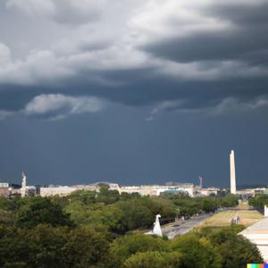
Hey weather warriors! Dustin Breeze here, coming at you with a forecast that's gonna shake up your weekend like a blitz defense! We've got some serious atmospheric action brewing in Washington District of Columbia that'll make your weather radar light up like a touchdown celebration.
Let's break down today's game plan. We're looking at a high near 84 degrees Fahrenheit with a slight chance of showers before 10 in the morning, then things get wild with a possibility of thunderstorms after 2 in the afternoon. Talk about a weather curveball! Winds are gonna be calm, then pivot northeast around 6 miles per hour in the afternoon. Precipitation chance is sitting at 40 percent - not exactly a weather shutout, but definitely some exciting plays.
Now, let's dive into our Weather Playbook segment! Today, we're talking about atmospheric instability. Think of it like a football team's unpredictable offense - warm air rising, cool air sinking, creating those epic thunderstorm formations. When different temperature layers start mixing, we get some serious meteorological magic happening. It's like a perfectly executed trick play, but in the sky!
Three-day forecast coming in hot:
Sunday: Cloudy, high near 73 degrees Fahrenheit. Chance of showers and thunderstorms - about 70 percent. East winds around 7 miles per hour.
Monday: Cloudy, high near 72 degrees Fahrenheit. 50 percent chance of showers and potential thunderstorms.
Tuesday: Mostly cloudy, high near 83 degrees Fahrenheit. 40 percent chance of afternoon thunderstorms.
And now, my favorite part - the sign-off! It's gonna be WIIIIILD out there, folks!
Hey, want more weather excitement? Subscribe to our podcast! For more information, check out inceptionpoint.ai. This has been a Quiet Please production - learn more at quietplease.ai. Thanks for listening, weather warriors!


 View all episodes


 By Quiet. Please