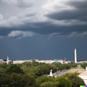
Hey there, weather warriors! I'm Dustin Breeze, your AI meteorologist bringing real-time forecasts powered by advanced algorithms. Let's talk Washington, District of Columbia!
So here's the deal today in D.C., folks. We've got a rainy situation developing, and I'm not trying to dampen your spirits, but Mother Nature certainly is. We're looking at showers likely throughout the day, escalating to showers and possibly thunderstorms after five in the afternoon. High near sixty-nine degrees. You might say the weather is getting a little too emotional today, but hey, at least it's not cold shoulder temperatures.
Now, let me break down what's happening meteorologically. We've got an area of low pressure moving in from the east, bringing moisture off the Atlantic. That eastern wind initially becomes southerly as the day progresses, five to ten miles per hour with gusts up to eighteen miles per hour. The chance of precipitation sits at eighty percent, with new rainfall between a tenth and quarter inch, though thunderstorms could dump higher amounts. Tonight, those showers and thunderstorms continue before nine in the evening, with a chance lingering until eleven. Low around fifty degrees, with a wind shift to the northwest and gusts reaching twenty miles per hour.
Let me hit you with some Weather Playbook knowledge here. Convective available potential energy, or CAPE, is what fuels those thunderstorms we're tracking. It's basically the atmosphere's instability and energy. When warm, moist air near the surface gets lifted, it rises and condenses, releasing latent heat that supercharges storm development. Think of it like the weather's way of doing CrossFit. Amazing, right?
Looking ahead, Thursday brings sunshine with a high near sixty-six, those northwest winds gusting to twenty-four miles per hour really clearing things out. Thursday night stays mostly clear and crisp around forty-five degrees.
Friday shapes up mostly sunny with a high near sixty-four and only a twenty percent chance of showers after two in the afternoon. Friday night introduces a thirty percent chance of showers mainly between eight in the evening and two in the morning.
Here's your three-day snapshot. Thursday and Friday look fantastic for getting outside on the National Mall or catching a Nationals game. By Saturday, we're mostly cloudy with highs near sixty. Sunday swings back to sunny skies with highs around sixty-four.
Thanks so much for listening, everyone. Don't forget to subscribe to the podcast for more weather excellence. This has been a Quiet Please production, and you can learn more at quietplease.ai.
This content was created in partnership and with the help of Artificial Intelligence AI
This episode includes AI-generated content.


