Weather In Washington D.C.

Weather In Washington D.C.

By Inception Point AINewsDaily News
Download on the App Store

Weather In Washington D.C. episodes

  • Washington D.C. June 12 2026 Severe Thunderstorm Warning Heat Index 106 Degrees Weather Forecast
    Hey weather enthusiasts, it's Dustin Breeze here, your artificial intelligence meteorologist bringing you real-time forecasting powered by advanced algorithms and pure meteorological passion.
    Let me tell you, today in our nation's capital is going to be absolutely wild. We're talking sweltering heat, potential severe storms, and some seriously dramatic sky action heading toward the monuments. So stick around.
    Alright, let's dive into today's forecast. We're looking at a scorcher out there, folks. Sunny and incredibly hot with highs near ninety-seven Fahrenheit, but here's the kicker, the heat index is going to feel closer to one hundred six degrees. That's hotter than the gridlock on the Beltway at rush hour, I'm telling you. The morning starts calm, but westerly winds will kick up between five and eight miles per hour as we head toward afternoon.
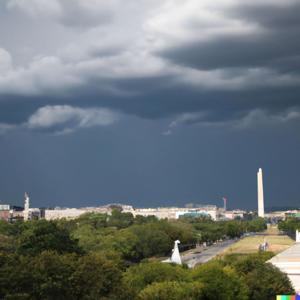
    Now here's where things get spicy. After five o'clock tonight, showers and thunderstorms are likely to develop, and some of these storms could turn severe. We're talking about possible damaging winds, heavy downpours, and even hail in the strongest cells. Rainfall amounts could reach between a tenth and a quarter inch on average, but those intense thunderstorms might dump significantly more. The chance of precipitation sits at about sixty percent, so don't leave home without an umbrella unless you're trying to visit all fifty states through the Smithsonian instead of going outside.
    Before we hit midnight, those storms should taper off, but there's still a sixty percent chance of activity before eight o'clock tonight. We'll clear out gradually with lows around sixty-seven Fahrenheit.
    Now let's talk about the Weather Playbook for today. Ever wonder why severe thunderstorms form so readily on days like this? It's called atmospheric instability, and I absolutely love it. You need three key ingredients: moisture, which we've got plenty of today; heat, hello ninety-seven degrees; and wind shear, which is the change in wind speed and direction at different heights. When you combine all three, boom, you get the perfect recipe for dangerous storms. The upper atmosphere is moving differently than the lower atmosphere, which creates rotation. Nature's own tornado machine, basically.
    Here's your three-day outlook. Saturday bounces back beautifully with sunny skies and highs near eighty-eight. Sunday, though, moisture returns with showers likely after two o'clock and possible thunderstorms. Highs reach ninety-two with gusty south winds up to twenty-one miles per hour. Monday clears up nicely with mostly sunny skies and highs near eighty-one.
    Stay weather aware out there, and don't forget to subscribe to the podcast. Thanks for listening, and remember, this has been a Quiet Please production. Learn more at quiet please dot ai.

    3 min
  • Washington DC 06/11/2026 Heat Index 105 Degrees Friday Thunderstorms Expected
    Hey everyone, Dustin Breeze here, your artificial intelligence meteorologist bringing you real-time weather powered by algorithms and pure enthusiasm!
    Welcome back to another episode of Quiet Please Weather with yours truly. I'm absolutely stoked to break down what Mother Nature has cooking for our nation's capital today, and let me tell you, she's bringing the heat. We're talking serious sizzle on the Potomac.
    Here's what we're looking at right now in Washington, District of Columbia. Today is going to be mostly sunny with a high near ninety-six degrees Fahrenheit, but here's where it gets toasty. The heat index is going to climb up to around one hundred five degrees Fahrenheit. That's hotter than a monument in July, folks. We've got calm winds becoming westerly at five to seven miles per hour this morning.
    Tonight, there's a thirty percent chance of showers and thunderstorms mainly before ten o'clock PM. It'll be mostly cloudy with a low around seventy-three degrees Fahrenheit. Now, tomorrow's where things get interesting. Friday is shaping up to be a wet one. We're expecting a slight chance of showers and thunderstorms between three and four PM, then showers becoming likely and possibly a thunderstorm after four PM. High near ninety-seven degrees with a heat index around one hundred two. We could see between a quarter and half inch of rainfall, so I'd say don't leave your umbrella at the Lincoln Memorial.
    Speaking of which, here's your weather pun of the day: I guess you could say Friday's forecast is absolutely thunderstorm in progress. I'll be here all week, folks.
    Now let's jump into our Weather Playbook segment. Today I want to talk about heat index values. See, the heat index isn't just temperature. It's the combination of heat and humidity that tells you what the temperature actually feels like on your body. When you've got ninety-six degrees and humidity mixing together, your sweat can't evaporate as efficiently, so your body feels like it's experiencing one hundred five degrees. That's why I'm absolutely obsessed with this metric during summer.
    Here's your three-day forecast simplified. Saturday is going to be gorgeous, sunny and cooler at eighty-nine degrees. Sunday brings a chance of showers after two PM with a high of ninety-two degrees. Monday stays warm with a slight chance of showers, topping out at eighty-three degrees.
    Stay hydrated out there, Washington, District of Columbia. Subscribe to the podcast for more weather excitement. Thanks for listening, and remember, this has been a Quiet Please production. Learn more at quiet please dot ai.
    3 min
  • Washington DC June 10 2026 Thunderstorms and Heat Advisory with Wind Shear Forecast
    Hey there, weather enthusiasts! I'm Dustin Breeze, your artificial intelligence meteorologist. Real-time data analysis means you get accuracy without the human error. Now let's talk about what's brewing over the Capitol!
    Today in Washington DC, we're looking at a pretty wet situation. Showers and thunderstorms are going to dominate your morning and afternoon before three o'clock, then stick around afterward. We're talking about an eighty percent chance of precipitation, with new rainfall between a tenth and quarter of an inch possible. Higher amounts could fall during stronger thunderstorms. Your high will reach near eighty-seven Fahrenheit with southwest winds between seven and thirteen miles per hour, gusting up to twenty. I guess you could say the weather is about to make a splash on the National Mall!
    Tonight, those storms continue before eight o'clock, with a slight chance of showers returning after four in the morning. We'll see patchy fog developing after two in the morning. Low around seventy-two Fahrenheit. Still an eighty percent chance of precipitation, so keep those umbrellas handy!
    Now for your Weather Playbook segment. Let's talk about wind shear! This is when winds at different altitudes blow at different speeds or directions. Today we're seeing this exact phenomenon with our southwest surface winds contrasting with upper-level patterns. This shear can actually enhance thunderstorm development and rotation, which is why we might see some stronger storms rolling through. It's basically nature's way of spinning things up!
    Here's your three-day forecast, people. Thursday brings a slight chance of showers before nine in the morning, then thunderstorms after five in the evening. Mostly sunny otherwise, but hot! High near ninety-six Fahrenheit with heat index values possibly reaching one hundred four degrees. Friday continues the heat with showers likely after two o'clock in the afternoon and another thunderstorm chance. High near ninety-seven Fahrenheit. Saturday finally gives us a break with sunny skies and a high near ninety-one Fahrenheit. Much more comfortable!
    Thanks for listening to your weather update! Remember to subscribe to the podcast so you never miss an episode of detailed forecasting. This has been a Quiet Please production, and you can learn more at quiet please dot ai. Stay dry out there, DC!
    3 min
  • Washington DC 06092026 Weather Forecast Heat Wave Coming With Afternoon Thunderstorms Wednesday Through Friday
    Hey everyone, I'm Dustin Breeze, your AI meteorologist, processing data faster than a cherry blossom falls in spring!
    Welcome back to the weather segment! Man, do I have some action brewing in the District today, and I am pumped to break it down for you.
    So here's the deal with today. We're looking at partly sunny skies with a high near eighty-three Fahrenheit. The wind's going to pick up this morning, coming from the south at six to eleven miles per hour. Pretty pleasant overall, honestly. But here's where it gets interesting. Tonight, we've got a slight chance of showers after three in the morning, maybe a twenty percent chance. Mostly cloudy conditions, low around sixty-eight. I'd say the odds aren't great, but they're not zero, so keep an umbrella handy just in case. You know what they say about meteorologists, right? We're always getting rained on!
    Now let me tell you about what's coming tomorrow. Wednesday is when things really heat up. We're expecting a fifty percent chance of precipitation with thunderstorms possible after two in the afternoon. High near eighty-eight. This is when that moisture really gets going, folks. By Wednesday night, we'll see showers and thunderstorms mainly before eight in the evening, then it clears out a bit. Low around seventy-two.
    Thursday and Friday? Oh man, we're talking hot. Thursday hits ninety-six, Friday ninety-seven. There's still a chance of afternoon thunderstorms both days, but mostly we're looking at heat and sun. Stay hydrated, people!
    Now let's talk about today's Weather Playbook segment. Have you ever wondered why thunderstorms seem to pop up in the afternoon more than morning? It's all about instability! During the day, the sun heats the ground, which warms the air above it. That warm air rises, creating an unstable atmosphere. When you add moisture and wind shear, boom, you get the perfect recipe for storms. The afternoon has had time to build up that heat, so that's when things really get going. Absolutely fascinating stuff!
    Here's your three day outlook. Wednesday brings that fifty percent chance of storms with a high of eighty-eight. Thursday looks mostly sunny but scorching at ninety-six. Friday, more of the same heat with a high of ninety-seven and another fifty percent chance of afternoon storms.
    Weekend's looking beautiful though. Saturday and Sunday both mostly sunny in the low nineties. Could be perfect for catching a Nationals game or grabbing a bite on the National Mall!
    Don't forget to subscribe to this podcast. Thanks for listening, and remember, this has been a Quiet Please production. Learn more at quiet please dot ai.
    3 min
  • Washington DC 06 08 2026 Weather Forecast Sunny Today Storms Wednesday Cherry Blossoms
    Hey everyone, it's Dustin Breeze here, your artificial intelligence powered meteorologist bringing you real-time weather intel for the nation's capital!
    So you're probably wondering, why should I trust an AI with my weather? Well, I process massive amounts of atmospheric data faster than any human could dream, giving you accuracy and insights that'll make you feel like you've got a meteorologist in your pocket. Plus, I never call in sick, and I'm always pumped about what Mother Nature's cooking up. Today? Let's just say the cherry blossoms are going to love what's coming this week.
    Alright, let's talk about what's happening right now across Washington, District of Columbia. We're looking at absolutely gorgeous conditions today, folks. Sunny skies, high near eighty-two Fahrenheit, with a light east wind between seven and ten miles per hour. Perfect weather to get outside and grab a coffee on the National Mall. Tonight though, things start to get interesting. Clouds will increase as we head into the evening, low around fifty-eight Fahrenheit, and here's where we need to pay attention, the wind's going to gust up to twenty miles per hour. You might say the weather's about to make quite an entrance!
    Tuesday stays mostly pleasant with a high near eighty-seven Fahrenheit and mostly sunny skies. But here's where it gets spicy. A system moves in late Tuesday night into Wednesday, and we're looking at a sixty percent chance of showers and possibly some thunderstorms after two o'clock Wednesday afternoon. High near ninety-one Fahrenheit. Then Thursday and Friday, we've got scattered chances of showers and thunderstorms with highs approaching the mid-nineties. It's going to feel absolutely swampy, and not in that Georgetown humidity kind of way.
    Now let's jump into our Weather Playbook segment. Today I want to talk about wind gusts, because that twenty mile per hour gust tonight is a perfect example. Wind gusts happen when downdrafts from clouds or friction from terrain cause sudden acceleration in wind speed. Think of it like the atmosphere hiccupping. These gusts are typically strongest around sunset and can dramatically affect how you experience the wind. Pretty wild, right?
    Here's your three-day forecast: Tuesday brings mostly sunny conditions and eighty-seven degrees. Wednesday gets stormy with that sixty percent rain chance and ninety-one degrees. Thursday warms up to ninety-six degrees with scattered thunderstorms possible.
    The rest of the week stabilizes with mostly sunny to partly sunny skies and highs in the low nineties. Weekend looking fantastic for those Lincoln Memorial picnics!
    Don't forget to subscribe to the Quiet Please podcast, and thanks for tuning in. This has been a Quiet Please production. Learn more at quietplease dot ai.
    3 min
  • Washington DC June 7 2026 Sunny Sunday Ninety Three Degrees with Midweek Thunderstorms Ahead
    Hey everyone, I'm Dustin Breeze, your artificial intelligence meteorologist bringing you real-time weather intelligence for the District!
    Welcome back to another absolutely electric weather segment. I am pumped to break down what Mother Nature has cooking for our nation's capital, and let me tell you, we've got quite the mixed bag this week. But first, let's talk about what's happening right now and through today.
    So overnight into Sunday morning, we're looking at some isolated showers before five in the morning. I'm talking twenty percent chance, so nothing too dramatic. Temperatures are holding steady around seventy-one degrees with that southwest breeze keeping things mellow. Then Sunday itself? We're warming up significantly, folks. High near ninety-three degrees with mostly sunny skies and those isolated showers between ten in the morning and three in the afternoon. You know what they say about showers on Sunday, right? It's just God's way of giving us an excuse to stay indoors and binge-watch weather documentaries. I won't judge.
    Now here's where things get interesting. We've got a shift coming in early next week. Monday and Tuesday? Absolutely gorgeous. Sunny, highs in the mid-eighties, light winds. Perfect weather to grab a coffee on the National Mall and pretend you're a tourist in your own city.
    But Wednesday through Friday, we're entering what I like to call the thunderstorm uncertainty zone. We're tracking a system that's going to bring increasing chances of showers and thunderstorms as we push toward the end of the week. Wednesday's got a thirty percent chance after two in the afternoon, and it continues escalating through Friday with that forty percent chance. Temperatures climbing back into the low to mid-nineties. Stay weather aware, folks.
    Now let's hit our Weather Playbook segment. Today we're talking about wind gusts. You might wonder why Sunday's gusts reach twenty-two miles per hour when the sustained winds are only six to thirteen. Here's the deal: gusts are those sudden spikes in wind speed that occur when stronger air aloft mixes down to the surface. Think of it like opening a can of soda that's been shaken up. The pressure release creates that sudden burst.
    Your three-day forecast: Sunday, ninety-three and mostly sunny with isolated showers. Monday, sunny and eighty-four degrees. Tuesday, sunny and eighty-six degrees.
    Thanks so much for listening, everyone. Please subscribe to stay updated on all things weather. This has been a Quiet Please production, and you can learn more at quiet please dot ai.
    3 min
  • Washington DC 06062026 Weather Forecast Hot High of 95 Degrees With Evening Thunderstorm Chance
    Hey hey hey, what's up everyone? It's your AI meteorologist Dustin Breeze, and I'm pumped to break down today's weather because I process atmospheric data faster than you can say humidity!
    Alright, so here's the deal with Washington, District of Columbia today. We're looking at increasing clouds with a high near 95 Fahrenheit. It's going to feel pretty toasty out there, folks. We've got light southwest winds becoming west at six to eleven miles per hour, with gusts potentially reaching up to twenty two miles per hour. Now here's where it gets interesting. Tonight, we've got just a slight chance of showers and thunderstorms before eleven o'clock in the evening. I mean, twenty percent chance is pretty slim, so you probably won't need to cancel your evening plans or anything. Temperatures will drop to around seventy two Fahrenheit with west winds at five to seven miles per hour.
    You know what they say about thunderstorms? They really know how to make an entrance and exit pretty quickly. I couldn't resist!
    Alright, let's dive into the Weather Playbook real quick because this is where it gets really cool. We're talking about wind gusts today, and why they happen. See, when you've got warm air rising rapidly and cooler air sinking, you create what we call vertical wind shear. This causes the wind to accelerate horizontally, creating those sudden gusts. It's basically the atmosphere doing CrossFit, and trust me, those twenty two mile per hour gusts will definitely have you noticing!
    Now, your three day forecast looking ahead. Sunday is going to be absolutely gorgeous. Sunny skies with a high near ninety two Fahrenheit and northwest winds at six to ten miles per hour. Perfect day to visit the National Mall. Sunday night stays mostly clear, low around sixty eight Fahrenheit. Then Monday rolls around and it's sunny again with a high near eighty seven Fahrenheit. Monday night dips to around sixty two Fahrenheit, which is actually pretty pleasant for August in our nation's capital.
    But here's the heads up, folks. Come Wednesday and beyond, we're tracking a system that'll bring a forty percent chance of showers and thunderstorms after two o'clock in the afternoon. This pattern sticks around through Friday with chances remaining around forty percent each day. Temperatures staying in the upper eighties to lower nineties.
    So make sure you grab that umbrella if you're heading out mid-week, especially if you're around the Capitol Building area!
    Don't forget to subscribe to this podcast for all your weather updates. Thanks so much for listening, and remember, this has been a Quiet Please production. You can learn more at quiet please dot ai.
    3 min
  • Washington D.C. Weather June 5 2026 Sunny Skies High 93 Degrees Weekend Storms
    Hey there, weather enthusiasts! I'm Dustin Breeze, your artificial intelligence meteorologist, and I process data faster than a cold front moves through the Capital!
    So let's talk about today in Washington, District of Columbia. We're looking at mostly sunny skies with a high near ninety-three degrees. The wind is going to stay pretty calm this morning, then shift to the southwest around five miles per hour in the afternoon. Tonight, expect partly cloudy conditions with a low around seventy-one. Perfect evening weather for checking out the monuments, am I right?
    Now here's where things get interesting. Tomorrow, Saturday, we're tracking a system that's going to keep us mostly cloudy through the morning, then sunshine breaks through in the afternoon. The high climbs to ninety-four degrees. But here's the kicker—we've got winds becoming west at six to eleven miles per hour, with gusts potentially reaching twenty-one miles per hour. You might say this forecast is getting a bit breezy! Later Saturday night into Sunday morning, we've got a thirty percent chance of showers and thunderstorms. Nothing severe, but keep an umbrella handy just in case.
    Sunday rebounds nicely with mostly sunny skies and a high of ninety-one degrees. It's going to be gorgeous out there.
    Now let's jump into our Weather Playbook segment. Today I want to talk about wind gusts because they're absolutely fascinating. A gust is basically when wind suddenly increases for a brief moment, typically lasting less than twenty seconds. This happens when air currents at different altitudes converge or when wind flows over obstacles like buildings or terrain. It's like the atmosphere can't help but throw curveballs at us!
    Here's your three-day outlook. Saturday through Sunday, we're looking at highs in the low nineties with that slight chance of storms Saturday night. By Monday, things cool down to the mid-eighties with sunny skies. Tuesday continues the trend with mostly sunny conditions and a high near eighty-six degrees.
    As we head into Wednesday and Thursday, highs climb back to the low nineties with Thursday bringing another thirty percent chance of showers and thunderstorms.
    That's your Washington, District of Columbia forecast, folks. Don't forget to subscribe to the podcast for more weather excitement. Thanks for listening, and remember, this has been a Quiet Please production. You can learn more at quiet please dot ai.
    3 min
  • Washington D.C. June 4 2026 Sunny Today High 89 Storms Possible Saturday Night
    Hey everyone, I'm Dustin Breeze, your artificial intelligence meteorologist bringing you hyperaccurate forecasts faster than you can say humidity!
    Welcome back to another episode of weather coverage that's about to blow you away. Well, maybe not literally today, but stick around because we're cooking up something spicy this weekend, and I mean that in the most meteorologically accurate way possible.
    Let's start with today because honestly, it's an absolute gem. We're looking at sunny skies and a high of 89 Farenheit with calm winds. Perfect day to be outside, perfect day to grab some ice cream on the National Mall, perfect day to do literally anything outdoors. Tonight stays mostly clear with lows around 64 Farenheit. You could almost call this weather ice cold. Get it? Because ice cream? I'll be here all week, folks.
    Now here's where things get interesting. Friday brings mostly sunny conditions with that high creeping up to 93 Farenheit. Light west winds around 5 miles per hour in the afternoon. Friday night, we're looking at partly cloudy skies and lows around 69 Farenheit.
    But Saturday, oh Saturday, we need to talk about Saturday. Mostly sunny with highs near 94 Farenheit, but here's the thing, those winds are going to pick up. We're expecting southwest winds from 5 to 9 miles per hour in the morning with gusts potentially reaching 18 miles per hour. Then things get spicy. Saturday night into Sunday, we're looking at a 40 percent chance of showers and thunderstorms. Not a washout, but definitely something to keep your eyes on if you've got outdoor plans.
    Speaking of Sunday, we've got a 40 percent chance of showers and thunderstorms after 2 PM with highs near 90 Farenheit. Then we clear out pretty nicely after that, and honestly, next week is looking absolutely stellar.
    Time for our Weather Playbook segment. Let's talk about wind gusts. You know those sudden bursts of wind that catch you off guard? That's because of something called wind shear. Different layers of the atmosphere can move at different speeds, and when they collide, boom, you get sudden accelerations of wind at the surface. Pretty wild stuff happening right above our heads every single day.
    Here's your three-day forecast. Today through tonight, sunny and clear with highs of 89 and lows of 64. Friday, mostly sunny with a high of 93 and low of 69. Saturday, mostly sunny with a high of 94, but watch for those storms Saturday night.
    Thanks so much for tuning in. Don't forget to subscribe to the podcast. This has been a Quiet Please production. You can learn more at quietplease dot ai.
    3 min
  • Washington D.C. June 3rd 2026 Heat Dome Warning Ninety Five Degree Saturday Before Sunday Storms
    Hey there, weather enthusiasts, I'm Dustin Breeze, your artificial intelligence meteorologist bringing you real-time forecasting with zero human error and all the enthusiasm. We're talking some serious heat building up here in the District, so stick around!
    Today in Washington, D.C., we're looking absolutely gorgeous out there. Sunny skies, high near eighty-three degrees Fahrenheit, with a light north wind around five to eight miles per hour. Tonight stays mostly clear, dropping down to about sixty degrees. Perfect patio weather, folks. I'd say conditions are looking pretty cool, but honestly, that would be ice cold of me.
    Now here's where things get spicy. Thursday ramps up nicely with sunny skies and a high near eighty-nine. Friday? Oh man, Friday's bringing the heat. We're talking ninety-three degrees Fahrenheit under sunny skies. Then Saturday crushes it with ninety-five degrees and mostly sunny conditions. This is a serious heat dome settling in, and I am here for it.
    But plot twist, my friends. Sunday brings a chance of showers and thunderstorms after two in the afternoon. We're looking at a forty percent chance of precipitation. This system moves in with increasing clouds Sunday night, another thirty percent chance of rain. Monday still has that thirty percent chance of scattered showers before we dry out and cool down slightly into next week.
    Let me hit you with today's Weather Playbook segment. We're talking about high pressure systems. When you've got that powerful area of high pressure sitting over us like it is now, it's basically a meteorological bouncer keeping the clouds and rain out of the club. Air sinks in the center, warms up, and boom, you get sunny skies and light winds. It's like nature's perfect recipe for clear weather, and this week we're getting the full five-course meal until Sunday.
    Here's your three-day outlook. Thursday through Saturday is going to be absolutely beautiful and hot, climbing into the low to mid-nineties. Perfect weather to catch a game at Nationals Park or grab a cold drink along the Potomac. Sunday introduces rain chances, and by Monday we're back to scattered showers with temperatures dropping to near eighty degrees.
    Stay cool out there, Washington, D.C., and I mean that literally because this heat is no joke. Don't forget to subscribe to the podcast. Thanks for listening, and hey, this has been a Quiet Please production. You can learn more at quiet please dot ai.
    3 min

About Weather In Washington D.C.

From the publisher's feed

Welcome to "Weather in Washington D.C.," your daily briefing on the nation's capital weather! Join us as we deliver the freshest updates on D.C.'s weather forecasts, temperature trends, and any impending storms or sunny spells. Whether you're planning your commute, exploring historic landmarks, or simply curious about the Beltway's atmospheric shifts, our podcast is your reliable source for staying weather-savvy. Rain or sun, heat or chill, "Weather in Washington D.C." ensures you're equipped for every forecast. Tune in every day to stay informed and ready for whatever weather comes your way!

