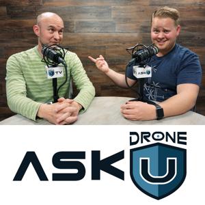
Ask Drone U

Ask Drone U

Download on the App Store
  • Favorites

    61

    Followers

  • Typical duration

    41 min

    per episode

Based on Podcast App listening data

Ask Drone U episodes

  • ADU 01179: How Can I Make My Drone “Remote ID Compatible”?
    Today's question is about drone remote-id. How can you make your drone "remote-id compatible"? Is this something that you should be even worrying about right now?
    Our caller for today, Jack has a question about drone remote-id. Back in December 2020, drone remote-id rules were finalized by the FAA. Once these restrictive rules kick in, it will become mandatory to broadcast your drone's location via remote-id. So, is your drone already compatible? And if not, are there any modules that you can attach to your drone to ensure compliance?
    Do you need to worry about this if you are an FPV drone pilot?
    Additionally, we also discuss the need to cultivate greater awareness, the definition of the navigable airspace, and whether (or not) this new rule will succeed in higher compliance. Thanks for the great question, Jack. Fly Safe!
    Get Your Biggest and Most Common Drone Certificate Questions Answered by Downloading this FREE Part 107 PDF
    Make sure to get yourself the all-new Drone U landing pad!
    Get your questions answered: https://thedroneu.com/.
    If you enjoy the show, the #1 thing you can do to help us out is to subscribe to it on iTunes. Can we ask you to do that for us real quick? While you’re there, leave us a 5-star review, if you’re inclined to do so. Thanks! https://itunes.apple.com/us/podcast/ask-drone-u/id967352832.
    Become a Drone U Member. Access to over 30 courses, great resources, and our incredible community.
    Follow Us
    Site – https://thedroneu.com/
    Facebook – https://www.facebook.com/droneu
    Instagram – https://instagram.com/thedroneu/
    Twitter – https://twitter.com/thedroneu
    YouTube – https://www.youtube.com/c/droneu
    Timestamps
    [01:00]Should you be worried about remote id right now?
    [02:03]This show is brought to you by our in-person training events
    [03:11]Our plans for the 2021 Fly-In
    [04:43]Today's question is about drone remote id
    [07:42]With remote id still 2 years away, do the patented solutions mean anything at all?
    [08:02]Are the current crop of DJI drones already compliant?
    [08:17]Flying in FRIA's once remote id kicks in
    [10:00]Will your drone be more safe or less safe once you attach a remote id module?
    [10:26]How does the FAA define navigable airspace?
    [11:00]How this restrictive rule will negatively impact STEM education
    [12:03]Cultivating awareness and ensuring compliance among new drone pilots
    [12:40]Is FAA's new training system for recreational pilots a step in the right direction?
    [18:18]Can we expect new remote id modules to hit the market?
    [19:40]How can FPV drones be made remote id compliant?
    23 min
  • ADU 01178: What Is the Best Indoor Mapping Software?
    Today's show is about using software for mapping the interiors of a building.
    Our caller for today, Gary is a long-time ADU listener. He just happened to tune in to one of our older shows where we talked about using the Insta 360 for mapping the interiors of a building. So, Gary went ahead and purchased the Insta 360 for his next drone job where he is doing construction progress monitoring for an interior buildout.
    However, recent updates to a mapping software makes it far easier to use your drone to capture this interior data. Tune in to receive some of the latest and most exciting updates! Enjoy!
    Get Your Biggest and Most Common Drone Certificate Questions Answered by Downloading this FREE Part 107 PDF
    Make sure to get yourself the all-new Drone U landing pad!
    Get your questions answered: https://thedroneu.com/.
    If you enjoy the show, the #1 thing you can do to help us out is to subscribe to it on iTunes. Can we ask you to do that for us real quick? While you’re there, leave us a 5-star review, if you’re inclined to do so. Thanks! https://itunes.apple.com/us/podcast/ask-drone-u/id967352832.
    Become a Drone U Member. Access to over 30 courses, great resources, and our incredible community.
    Follow Us
    Site – https://thedroneu.com/
    Facebook – https://www.facebook.com/droneu
    Instagram – https://instagram.com/thedroneu/
    Twitter – https://twitter.com/thedroneu
    YouTube – https://www.youtube.com/c/droneu
    Timestamps
    [01:30] Today's show is brought to you by our 3D modeling class
    [02:00] Today's show is about interior 3D modeling
    [05:28] Now, we have a drone mapping software that allows us to map building interiors
    [06:34] Why do we at Drone U use Matterport for mapping interiors of a building?
    [08:00] Taking 360-degree images of a construction site using DroneDeploy
    15 min
  • ADU 01177: Are Drones Allowed in National Parks?
    Today's show is about flying drones in National Parks.
    Back in January, US Filmmaker Gordon Price sued U.S. Attorney General William Barr. The contentious issue was the fees that Gordon had to pay to shoot in a National Park. The outcome of this case left many in the drone industry confused, and wondering if they can or cannot fly in National Parks with the right permits.
    On today's show, we break down the outcome of this civil court case to reveal what it means for the drone industry. You will learn whether or not this court ruling has reversed the June 2014 memo which prohibited drones from flying in National Parks. In addition to drone photography and videography, we also reveal the impact of this case outcome on still photography and videography.
    Some of the other questions that we answer on this show:
    Does this new court ruling affect both Part 107 and recreational pilots?
    Can drone pilots fly in the wilderness area?
    What is "low-impact" filming? Is low-impact filming permissible in National Parks?
    Get Your Biggest and Most Common Drone Certificate Questions Answered by Downloading this FREE Part 107 PDF
    Make sure to get yourself the all-new Drone U landing pad!
    Get your questions answered: https://thedroneu.com/.
    If you enjoy the show, the #1 thing you can do to help us out is to subscribe to it on iTunes. Can we ask you to do that for us real quick? While you’re there, leave us a 5-star review, if you’re inclined to do so. Thanks! https://itunes.apple.com/us/podcast/ask-drone-u/id967352832.
    Become a Drone U Member. Access to over 30 courses, great resources, and our incredible community.
    Follow Us
    Site – https://thedroneu.com/
    Facebook – https://www.facebook.com/droneu
    Instagram – https://instagram.com/thedroneu/
    Twitter – https://twitter.com/thedroneu
    YouTube – https://www.youtube.com/c/droneu
    Timestamps
    [03:35]Can you film in national parks with a photography permit?
    [05:10]Join us for our 3D interactive modeling class
    [08:25]Today's question is about flying drones in national parks
    [09:29]Price vs. Barr - Filmmaker sues the government over "unconstitutional" permit fees
    [10:10]As per the guidance released by the NPS on Feb 22, filming activities are allowed if you have a permit
    [12:27]How does this court ruling impact drone pilots and ground photographers?
    [14:30]Do drones fall under the low-impact filming category? What impact does this ruling have on drone pilots?
    [16:43]Does this new ruling reverse the June 2014 memo which prohibited drone pilots from flying in National Parks?
    [19:20]Understanding the "low impact filming" category and all related exceptions; do drones fall in the "low-impact" category?
    [24:40]What about tethered drones? Can you fly tethered drones over National Parks?
    [27:55]Can drone pilots legally fly in the wilderness areas?
    [30:30]Does this new ruling permit videographers to fly in National Parks while prohibiting still photographers/
    [32:00]Can you fly your drone over National Parks as long as you take off and land from non-NPS land?

    43 min
  • ADU 01176: How Do I Repeat the Same Drone Shot?
    Today's question is about flying the same shot on multiple days and seasons.
    Our caller for today, Ryan from Indiana is a landscape photographer who has come up with a great question about flying the same shot on multiple days or seasons. Is it possible to get your drone to fly the same path and shoot at the same angles again and again?
    On today's show, you will learn how to do exactly that using the Litchi app. Additionally, you will also learn how to eliminate variables so that you can get consistent data again and again. Thanks for the great question, Ryan. Fly Safe!
    Get Your Biggest and Most Common Drone Certificate Questions Answered by Downloading this FREE Part 107 PDF
    Make sure to get yourself the all-new Drone U landing pad!
    Get your questions answered: https://thedroneu.com/.
    If you enjoy the show, the #1 thing you can do to help us out is to subscribe to it on iTunes. Can we ask you to do that for us real quick? While you’re there, leave us a 5-star review, if you’re inclined to do so. Thanks! https://itunes.apple.com/us/podcast/ask-drone-u/id967352832.
    Become a Drone U Member. Access to over 30 courses, great resources, and our incredible community.
    Follow Us
    Site – https://thedroneu.com/
    Facebook – https://www.facebook.com/droneu
    Instagram – https://instagram.com/thedroneu/ Twitter – https://twitter.com/thedroneu
    YouTube – https://www.youtube.com/c/droneu
    Timestamps
    [01:14]Today's question is about flying the same shot on multiple days/seasons
    [02:38]Flying the same point multiple times using the Litchi App
    [03:15]Eliminating variables when flying the same shot multiple times
    [05:07]How to get your drone to flying the same camera path again and again
    [09:00]Importance of continuous learning
    14 min
  • ADU 01175: Which Drone Handles Signal Interference Best?
    Today's show is about flying drones in areas of heavy interference like NYC.
    Our caller for today, Guy from NYC has come up with an interesting question. As you may be aware, an old avigation law makes it illegal to fly drones in NYC. However, we might see this archaic law being scrapped shortly. So, Guy is wondering if he can use drones to conduct visual facade inspections of tall buildings.
    On today's show, you will learn the best and safest drones to fly in areas of heavy interference such as NYC. If you found this show interesting, you might want to check out our detailed blog post, Flying Drones in NYC - Drone Laws Explained Enjoy!
    Get Your Biggest and Most Common Drone Certificate Questions Answered by Downloading this FREE Part 107 PDF
    Make sure to get yourself the all-new Drone U landing pad!
    Get your questions answered: https://thedroneu.com/.
    If you enjoy the show, the #1 thing you can do to help us out is to subscribe to it on iTunes. Can we ask you to do that for us real quick? While you’re there, leave us a 5-star review, if you’re inclined to do so. Thanks! https://itunes.apple.com/us/podcast/ask-drone-u/id967352832.
    Become a Drone U Member. Access to over 30 courses, great resources, and our incredible community.
    Follow Us
    Site – https://thedroneu.com/
    Facebook – https://www.facebook.com/droneu
    Instagram – https://instagram.com/thedroneu/
    Twitter – https://twitter.com/thedroneu
    YouTube – https://www.youtube.com/c/droneu
    Timestamps
    [01:32]Today's question is about flying a drone in areas of heavy interference
    [03:00]Avoiding over-reliance on technology and learning to fly in manual mode
    [05:00]Newer crop of drones with powerful range-finders
    [05:33]Why the Skydio 2 is NOT a safe drone to fly
    [08:02]Drone U Recommended drones for facade inspections in interference heavy environments
    [09:25]Would it be a good use of DJI's new FPV drone for visual inspections?
    [10:00]Flying the Phantom with prop guards
    [10:20]Is it legal to fly a drone in NYC?
    ?????
    13 min
  • ADU 01174: Marketing Tips to Stand Out From Competitors
    Today's show is about marketing a new drone business.
    Our caller for today, Ian is all of 16, and he just got his Part 107 license. Like most drone pilots, Ian wishes to start off with real estate before moving on to more complicated (and lucrative) jobs. But, he is finding himself discouraged by the intense competition. How can Ian make a dent in a marketplace dotted with older, far more experienced pilots? And how can he come up with a great and irresistible offer?
    Drawing from their considerable experience, Rob and Paul share some nuanced tips to help Ian out. Among other things, you will learn how to leverage autonomous systems to massively scale up your business. You will also get some branding tips so that you can showcase your skills in the right way. Thanks for the great question, Ian. Fly Safe!
    Get Your Biggest and Most Common Drone Certificate Questions Answered by Downloading this FREE Part 107 PDF
    Make sure to get yourself the all-new Drone U landing pad!
    Get your questions answered: https://thedroneu.com/.
    If you enjoy the show, the #1 thing you can do to help us out is to subscribe to it on iTunes. Can we ask you to do that for us real quick? While you’re there, leave us a 5-star review, if you’re inclined to do so. Thanks! https://itunes.apple.com/us/podcast/ask-drone-u/id967352832.
    Become a Drone U Member. Access to over 30 courses, great resources, and our incredible community.
    Follow Us
    Site – https://thedroneu.com/
    Facebook – https://www.facebook.com/droneu
    Instagram – https://instagram.com/thedroneu/
    Twitter – https://twitter.com/thedroneu
    YouTube – https://www.youtube.com/c/droneu
    Timestamps
    [02:04]Our sponsor for today is our new sales class
    [05:37]Today's question is about starting young and marketing a new drone business
    [07:02]How can you get people to trust you when you are young?
    [08:20]Coming up with your own unique mechanism to stand out in a crowded market space
    [11:03]How have some drone pilots drastically scaled up their business in the wake of covid?
    [12:05]How can you provide more value and greater convenience to your customers?
    [13:26]Two growth areas that you should be exploring right now
    [14:40]Marketing yourself the right way
    [16:40]Can you get more drone jobs if you fly FPV?
    [17:35]With the massive stimulus, is the construction industry set for a boom?
    [17:47]Creating autonomous systems for attaining massive scale
    [19:27]Check out our comprehensive Business Class for some detailed insights
    [21:08]Do you have a good website that showcases your skills?
    ??????
    27 min
  • ADU 01173: Drone Mapping Software and Data Capture Strategies
    Today's show is about drone mapping software and acquisition strategies.
    Our caller for today, Bob has come up with a great follow-up question today. Bob listened to our previous show, "Which Pix4D Version Should I Use for Mapping a Roof?" And he has some in-depth questions about mapping software and acquisition strategies.
    Specifically, how can you prevent jagged lines in drone models? Can the use of manual tie-points help you create better-looking models? On today's show, you will learn that your acquisition strategy is program-dependent. We discuss different mapping software like Drone Deploy, Pix4D Mapper, and Pix4D React. And reveal our preferred acquisition strategy for each software.
    If you are a professional mapper looking to up your game, today's show will be particularly interesting to you. Enjoy!
    Get Your Biggest and Most Common Drone Certificate Questions Answered by Downloading this FREE Part 107 PDF
    Make sure to get yourself the all-new Drone U landing pad!
    Get your questions answered: https://thedroneu.com/.
    If you enjoy the show, the #1 thing you can do to help us out is to subscribe to it on iTunes. Can we ask you to do that for us real quick? While you’re there, leave us a 5-star review, if you’re inclined to do so. Thanks! https://itunes.apple.com/us/podcast/ask-drone-u/id967352832.
    Become a Drone U Member. Access to over 30 courses, great resources, and our incredible community.
    Follow Us
    Site – https://thedroneu.com/
    Facebook – https://www.facebook.com/droneu
    Instagram – https://instagram.com/thedroneu/
    Twitter – https://twitter.com/thedroneu
    YouTube – https://www.youtube.com/c/droneu
    Timestamps
    [02:02]Today's show is brought to you by PROPS and our Mapping Bootcamp
    [04:26]Today's question is about creating lifelike and beautiful drone models
    [07:11]Is your acquisition method program-dependent?
    [07:47]What is the recommended acquisition strategy for Pix4D React?
    [09:42]Choosing the right processing template and how it impacts your map quality
    [12:10]Using MTP's for combining data sets of two separate projects
    [14:20]Why aligning rather than merging datasets is preferable
    [15:15]Why consistent white balance is important for creating MTP's
    [16:40]Are there any processing engines that do not require MTP's?
    [18:40]Can you create an accurate 3D model using cloud-based software like DroneDeploy?
    ?????
    24 min
  • ADU 01172: Which Free Drone Mapping Software Should I Use?
    Today's question is about free drone mapping software.
    Our caller, Ken from NJ wants to get into drone mapping. And while he wants to improve his mapping skills, understandably, he does not want to spend hundreds of dollars after mapping software right now.
    So, are there any free mapping software that Ken can use as a practice tool?
    On today's show, we discuss different options like Open Drone Map, Capture Reality, and even Pix4D and Drone Deploy. This show will be particularly useful for those who are contemplating getting into the lucrative mapping industry. Enjoy!  
    Resources:
    Drone Mapping Guide - https://learning.thedroneu.com/what-is-drone-mapping-software/?v=1
    Free Drone Map - https://www.opendronemap.org/
    Get Your Biggest and Most Common Drone Certificate Questions Answered by Downloading this FREE Part 107 PDF
    Make sure to get yourself the all-new Drone U landing pad!
    Get your questions answered: https://thedroneu.com/.
    If you enjoy the show, the #1 thing you can do to help us out is to subscribe to it on iTunes. Can we ask you to do that for us real quick? While you’re there, leave us a 5-star review, if you’re inclined to do so. Thanks! https://itunes.apple.com/us/podcast/ask-drone-u/id967352832.
    Become a Drone U Member. Access to over 30 courses, great resources, and our incredible community.
    Follow Us
    Site – https://thedroneu.com/
    Facebook – https://www.facebook.com/droneu
    Instagram – https://instagram.com/thedroneu/
    Twitter – https://twitter.com/thedroneu
    YouTube – https://www.youtube.com/c/droneu
    Timestamps
    [02:10]Today's show is brought to you by Drone U's Mapping Bootcamp
    [03:22]Today's question is about free mapping software
    [04:37]Drone U Recommended free mapping software to help you get started
    [05:47]What are the capabilities of Capture Reality's free software?
    [06:34]Hone your mapping skills by getting a free two week trial with Pix4D Mapper or Drone Deploy
    [12:35]Watch out for our next show where we shall be talking about DJI's FPV Drone
     
    ?????
    15 min
  • ADU 01171: Should a New Part 107 Pilot Buy a Mavic Air 2?
    Today's show is about the DJI Mavic Air 2. Can you build a long-term, profitable business with this entry-level DJI drone?
    Our caller for today, John is a new drone pilot who has recently invested in the DJI Mavic Mini 2. John is facing buyer's remorse as he feels that he should have gone for a more powerful, sophisticated drone instead.
    While he was looking for a commercially viable option, he is worried that he has wasted his money after a "toy". Has John made a wrong purchase? Can he carve out a place in the marketplace when there are other pilots flying more powerful drones like the Mavic 2 Pro, Phantom, and Inspire? 
    Tune in to find out. Thanks for the great question, John. Fly Safe!
    Get Your Biggest and Most Common Drone Certificate Questions Answered by Downloading this FREE Part 107 PDF
    Make sure to get yourself the all-new Drone U landing pad!
    Get your questions answered: https://thedroneu.com/.
    If you enjoy the show, the #1 thing you can do to help us out is to subscribe to it on iTunes. Can we ask you to do that for us real quick? While you’re there, leave us a 5-star review, if you’re inclined to do so. Thanks! https://itunes.apple.com/us/podcast/ask-drone-u/id967352832.
    Become a Drone U Member. Access to over 30 courses, great resources, and our incredible community.
    Follow Us
    Site – https://thedroneu.com/
    Facebook – https://www.facebook.com/droneu
    Instagram – https://instagram.com/thedroneu/
    Twitter – https://twitter.com/thedroneu
    YouTube – https://www.youtube.com/c/droneu
    Timestamps
    [01:24]Toy or tool - how do you treat your drone?
    [03:00]Is the DJI Mavic Mini 2 a good option for Part 107 pilots?
    [04:13]Today's show is made to you by our newest drone program, PROPS
    [06:15]Today's question is about the DJI Mavic Air 2?
    [08:35]Can you build a profitable drone business with great skills but an inferior drone?
    [09:09]Is the DJI Mavic Air 2 a good drone for shooting real estate videos?
    [10:06]Mavic 2 Pro vs. Mavic 2 Air - how do they compare?
    [10:52]What are some of the disadvantages of owning entry-level DJI drones like the Mavic Air 2 or Mavic Mini 2?
    [11:50]Can you shoot smooth cinematic shots with an entry-level drone?
    [12:41]So, is the DJI Mavic Air 2 a commercially viable drone?
    [14:10]Why Paul still swears by the Phantom 4 Pro
    [16:07]Can you build your business with just an iPhone and Osmo?
    ????
    20 min
  • ADU 01170: Which Drone Mapping Software Should I Use?
    Today we compare different drone mapping software and reveal the most accurate option so that you can avoid any legal liabilities.
    Our caller for Trav is from Australia and has a question about drone mapping. And specifically, drone mapping software. Trav wants to know which processing software can produce the most accurate drone maps so that he avoid any legal liabilities.
    Great question, Trav. This question is particularly relevant to drone uses like surveying. More and more drone pilots are getting into trouble with Surveying Boards when they don't follow the right systems and workflows.
    On today's show, while we recommend the best mapping software option for Trav, we also reveal some best practices so that you can avoid human error, inaccuracies, and the ensuing legal liabilities. Thanks for the great question. Fly Safe!
    Get Your Biggest and Most Common Drone Certificate Questions Answered by Downloading this FREE Part 107 PDF
    Make sure to get yourself the all-new Drone U landing pad!
    Get your questions answered: https://thedroneu.com/.
    If you enjoy the show, the #1 thing you can do to help us out is to subscribe to it on iTunes. Can we ask you to do that for us real quick? While you’re there, leave us a 5-star review, if you’re inclined to do so. Thanks! https://itunes.apple.com/us/podcast/ask-drone-u/id967352832.
    Become a Drone U Member. Access to over 30 courses, great resources, and our incredible community.
    Follow Us
    Site – https://thedroneu.com/
    Facebook – https://www.facebook.com/droneu
    Instagram – https://instagram.com/thedroneu/
    Twitter – https://twitter.com/thedroneu
    YouTube – https://www.youtube.com/c/droneu
    Timestamps
    [01:28]How will DJI's new FPV drone impact the drone industry as a whole?
    [04:39]Following the right systems and workflows for avoiding legal liabilities
    [07:33]Today's question is about drone mapping accuracy
    [10:47]Accurate drone maps are a function of mapping engines and human skills
    [12:25]The correct way to mark a GCP
    [15:00]Understanding GSD
    [17:36]As per statistical research, which is the most accurate processing engine
    [20:09]Why it is imperative to zoom in when marking GCP's
    [21:06]Understanding ellipsoid error and how to minimize it
    [23:10]Which is the most popular point cloud constructor?
    [23:10]Is Drone Deploy more accurate than Pix4D when it comes to building orthomosaics?
    [23:54]Pix4D Desktop vs. Pix4D Cloud - which is the best option for generating accurate drone maps?
    [24:39]Why are so many drone pilots getting into trouble with the Board of Surveyors?
    [31:55]Some more tips for generating accurate drone maps
    ????
    34 min

About Ask Drone U

From the publisher's feed

We’re Drone U, a group of guys who have turned their passion for flight into a profitable business. We love hearing from our fans, and we love helping by answering their questions. That’s why we…

Best of Ask Drone U

Ranked by our users in the last 21 days

More shows like Ask Drone U

Freakonomics Radio by Freakonomics Radio + Stitcher

Freakonomics Radio

31,904 Listeners

Hidden Brain by Hidden Brain, Shankar Vedantam

Hidden Brain

43,315 Listeners

The Tim Ferriss Show by Tim Ferriss: Bestselling Author, Human Guinea Pig

The Tim Ferriss Show

16,041 Listeners

The Investor's Podcast (We Study Billionaires)  - The Investor’s Podcast Network by The Investor's Podcast Network

The Investor's Podcast (We Study Billionaires) - The Investor’s Podcast Network

3,324 Listeners

Drone Radio Show by Randy Goers

Drone Radio Show

59 Listeners

How I Built This with Guy Raz by Guy Raz | Wondery

How I Built This with Guy Raz

30,130 Listeners

Modern Wisdom by Chris Williamson

Modern Wisdom

4,079 Listeners

The Peter Attia Drive by Peter Attia, MD

The Peter Attia Drive

7,922 Listeners

Drone to 1K Podcast by Drone Launch Academy by Drone Launch Academy

Drone to 1K Podcast by Drone Launch Academy

312 Listeners

My First Million by Hubspot Media

My First Million

2,644 Listeners

Do You Know Drones? by Jason San Souci

Do You Know Drones?

5 Listeners

The Shawn Ryan Show by Shawn Ryan

The Shawn Ryan Show

46,014 Listeners

All-In with Chamath, Jason, Sacks & Friedberg by All-In Podcast, LLC

All-In with Chamath, Jason, Sacks & Friedberg

10,150 Listeners

Drone News Update by Pilot Institute

Drone News Update

16 Listeners

Your Drone Questions. Answered. by Drone Launch Academy

Your Drone Questions. Answered.

9 Listeners