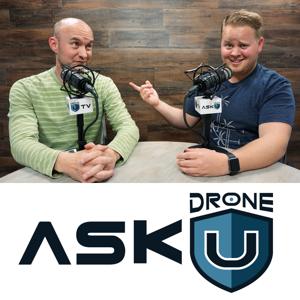
Ask Drone U

Ask Drone U

Download on the App Store
  • Favorites

    61

    Followers

  • Typical duration

    42 min

    per episode

Based on Podcast App listening data

Ask Drone U episodes

  • ADU 0961: How Does Maps Made Easy Compare to Pix4D?
    In today's show, we reveal the pros & cons of different drone mapping software. Specifically, we compare Pix4D, Maps Made Easy, and Drone Deploy.

    We have talked about Pix4D many times in our previous shows. John, our caller for today, is wondering if Maps Made Easy is a good option compared to Pix4D.

    To answer John's question, we first breakdown drone mapping software into three main categories: 1) Acquisition 2) Processing 3) All-in-one. Can you use Maps Made Easy for data acquisition AND data processing? And, what are some unique benefits of using Maps Made Easy? You will also learn WHY you should avoid using an all-in-one mapping software like DroneDeploy.

    We also reveal the advantages of using Pix4D for processing your mapping data. Learn how you can build better looking and more accurate drone maps and models using Pix4D. Towards the end, we speculate how drone mapping software will evolve in the future. Thanks for the great question, John. Fly safe!

    Check out Drone U's Comprehensive Guide to Drone Mapping, Acquisition & Processing Software.

    Make sure to get yourself the all-new Drone U landing pad!

    Get your questions answered: https://thedroneu.com/.

    If you enjoy the show, the #1 thing you can do to help us out is to subscribe to it on iTunes. Can we ask you to do that for us real quick? While you're there, leave us a 5-star review, if you're inclined to do so. Thanks! https://itunes.apple.com/us/podcast/ask-drone-u/id967352832.

    Become a Drone U Member.

    Looking for simple, fast, and transparent coverage that gives you peace of mind? Our friends at Skywatch are offering affordable on-demand drone insurance that rewards YOU for flying safely. Check them out NOW! Both hourly and monthly options available.

    Follow us:
    Site - https://thedroneu.com/
    Facebook - https://www.facebook.com/droneu
    Instagram - https://instagram.com/thedroneu/
    Twitter - https://twitter.com/thedroneu
    YouTube - https://www.youtube.com/c/droneu

    Get your copy of “Livin’ the Drone Life” – http://amzn.to/2nalUDH
    Get your copy of our Part 107 Study Guide – //amzn.to/2omQatT
    Check out our upcoming Mapping Classes – https://www.thedroneu.com/droneu-events

    Timestamps

    Today's question is about the pros & cons of different drone mapping software
    Is Maps Made Easy suitable for data acquisition and data processing?
    Understanding the difference between acquisition and processing software
    What are the limitations of using an all-in-one application like DroneDeploy?
    Paul explains drone mapping workflow
    Can you build better looking and more accurate models using Pix4D?
    How to accurately mark GCP's in Pix4D
    What is one unique benefit of using Maps Made Easy?
    How will drone mapping software evolve in the future?
    27 min
  • ADU 0960: How Can I Convince My Employer to Hire a Part 107 Licensed Pilot?
    In today's show, we reveal the dangers of hiring unlicensed drone operators without a Part 107 license.


    Our caller, a Part 107 certified pilot is facing a rather unique predicament. His employer, a roofing company is using an unlicensed pilot for some inspection work. How can our caller convince his employer to hire him, a Part 107 pilot instead?

    Our caller should first try and educate his client about the risks of hiring non-Part 107 pilots. Anyone flying without a Part 107 license is risking hefty fines and huge liabilities in case of an accident. But, what can our caller do if his employer still refuses to hire a federally authorized drone pilot like him? Should he inform the FSDO? Tune in to find out. Thanks for the great question. Fly Safe!

    Make sure to get yourself the all-new Drone U landing pad!

    The LUME CUBE AIR is the smallest, lightest and most compact lighting solution in the market. This awesome product is a must-have for professionals who want better photos and pictures.

    Get your questions answered: https://thedroneu.com/.

    If you enjoy the show, the #1 thing you can do to help us out is subscribe to it on iTunes. Can we ask you to do that for us really quick? While you're there, leave us a 5-star review, if you're inclined to do so. Thanks! https://itunes.apple.com/us/podcast/ask-drone-u/id967352832.

    Become a Drone U Member.

    Looking for simple, fast, and transparent coverage that gives you peace of mind? Our friends at Skywatch are offering affordable on-demand drone insurance that rewards YOU for flying safely. Check them out NOW! Both hourly and monthly options available.

    Follow us:
    Site - https://thedroneu.com/
    Facebook - https://www.facebook.com/droneu
    Instagram - https://instagram.com/thedroneu/
    Twitter - https://twitter.com/thedroneu
    YouTube - https://www.youtube.com/c/droneu

    Get your copy of “Livin’ the Drone Life” – http://amzn.to/2nalUDH
    Get your copy of our Part 107 Study Guide – //amzn.to/2omQatT
    Check out our upcoming Mapping Classes – https://www.thedroneu.com/droneu-events

    Timestamps

    Today's question is about dealing with unlicensed operators, and the companies that hire them
    Is there a lack of awareness pertaining to Part 107 certification?
    How can you convince your employer to hire Part 107 certified pilots?
    Paul cites a recent FOA request to reveal how the FAA deals with illegal drone pilots
    Understanding the risks and liabilities of using unlicensed operators
    Paul sums up today's show
    Is the FAA likely to enforce action against illegal drone operators?
    21 min
  • ADU 0959: Can You Remove Inaccuracies by Using Drones in an ALTA Survey?
    In today's show, we share the benefits of incorporating drone technology in an ALTA survey.

    Our caller, Randy, has a question about ALTA surveys. Randy is wondering whether a significant proportion of ALTA surveys are incorrect. And if so, what is the margin of error? While it is not possible to define the margin of error, we share how human inaccuracies in traditional surveying results in poor quality data.


    How can you expect to get accurate survey data when surveyor associates (without surveying licenses) are the ones making measurements? Other factors such as the use of wooden markers, manually jotting down survey measurements, and hand-drawn survey drawings further contribute to data inaccuracy.

    In contrast, when you opt for a drone survey, you introduce many layers of efficiencies while significantly paring down human intervention. You will learn how a more accurate, faster, and cheaper option can create a win-win for you (the drone pilot) and your client. Thanks for the great question, Randy. Fly safe!

    Make sure to get yourself the all-new Drone U landing pad!

    Get your questions answered: https://thedroneu.com/.

    If you enjoy the show, the #1 thing you can do to help us out is to subscribe to it on iTunes. Can we ask you to do that for us real quick? While you're there, leave us a 5-star review, if you're inclined to do so. Thanks! https://itunes.apple.com/us/podcast/ask-drone-u/id967352832.

    Become a Drone U Member.

    Looking for simple, fast, and transparent coverage that gives you peace of mind? Our friends at Skywatch are offering affordable on-demand drone insurance that rewards YOU for flying safely. Check them out NOW! Both hourly and monthly options available.

    Follow us:
    Site - https://thedroneu.com/
    Facebook - https://www.facebook.com/droneu
    Instagram - https://instagram.com/thedroneu/
    Twitter - https://twitter.com/thedroneu
    YouTube - https://www.youtube.com/c/droneu

    Get your copy of “Livin’ the Drone Life” – http://amzn.to/2nalUDH
    Get your copy of our Part 107 Study Guide – //amzn.to/2omQatT
    Check out our upcoming Mapping Classes – https://www.thedroneu.com/droneu-events

    Timestamps

    Today's question is about using drones in an ALTA survey
    Tips & Tricks for acquiring accurate survey data using drones
    Why are a large proportion of ALTA surveys inaccurate?
    Using drones in an ALTA survey results in reduced human intervention and greater accuracy
    Can surveying companies generate more business and higher profitability by using drones?
    What is the margin of error in an ALTA survey?
    Share, Review and Subscribe our show. Your encouragement keeps us going!
    17 min
  • ADU 0958: Are Part 107 Rules Applicable to Law Enforcement Officers?
    In today's show, we reveal if Part 107 rules and regulations apply to public safety officers.

    Our caller, William, is wondering if public safety officers are subject to the same rules and regulations as other drone pilots. Do public safety officers need to procure Part 107 waivers for flying at night or flying over people?

    To answer William's question, we first discuss the TWO ways public safety officers can set flight: by getting a Part 107 license or a COA. But, is getting a Part 107 easier than getting a COA? Are there any particular benefits to getting a COA? Does a COA allow a public safety officer to fly in an emergency? All of these questions will be answered in today's episode.

    You will learn how the FAA is helping public safety officers set up their own drone programs. We also share why the Mavic 2 Enterprise is the ideal drone for first responders. This episode should be useful for public safety officers and drone pilots interested in (or currently) flying in the public safety sphere. Thanks for the great question, William. Fly safe!

    Make sure to get yourself the all-new Drone U landing pad!

    Get your questions answered: https://thedroneu.com/.

    If you enjoy the show, the #1 thing you can do to help us out is to subscribe to it on iTunes. Can we ask you to do that for us real quick? While you're there, leave us a 5-star review, if you're inclined to do so. Thanks! https://itunes.apple.com/us/podcast/ask-drone-u/id967352832.

    Also, the folks over at Go Professional Cases are offering a special discount for Drone U members. GPC designs the highest quality professional cases for your drone and GoPro. And they will even custom design a case for you. Use the promo code DRONEU15 to avail a killer deal.

    Become a Drone U Member.

    Looking for simple, fast, and transparent coverage that gives you peace of mind? Our friends at Skywatch are offering affordable on-demand drone insurance that rewards YOU for flying safely. Check them out NOW! Both hourly and monthly options available.

    Follow us:
    Site - https://thedroneu.com/
    Facebook - https://www.facebook.com/droneu
    Instagram - https://instagram.com/thedroneu/
    Twitter - https://twitter.com/thedroneu
    YouTube - https://www.youtube.com/c/droneu

    Get your copy of “Livin’ the Drone Life” – http://amzn.to/2nalUDH
    Get your copy of our Part 107 Study Guide – //amzn.to/2omQatT
    Check out our upcoming Mapping Classes – https://www.thedroneu.com/droneu-events/

    Timestamps

    Learn about our awesome sponsor, GoProfessional Cases
    Today's question is about drone regulations that apply to law enforcement officers
    Does a law enforcement officer need a Part 107 license?
    Do law enforcement officers need to follow Part 107 rules for flying at night?
    Some reasons why the Mavic 2 Enterprise is ideal for first responders
    Can Part 107 rules be waived for public safety officers in emergencies?
    How can the FAA help public safety officers set up their drone program?
    What is the first step for law enforcement agencies who wish to set up their drone program?
    Which is the right COA for a public agency?
    What is a Blanket Area COA?
    Part 107 vs. Blanket COA - which is the better option?
    What are the benefits of a jurisdictional COA and emergency COA?
    Are there any additional laws that police officers need to follow?
    15 min
  • BONUS: Drone News – DJI News, DJI Halts Phantom 4 Production, Impossible Drones
    DJI Halts Phantom 4 Production, US-1 by Impossible Aerospace, Drones for Herding Sheep and Spotting Koalas, Free Solo Movie and More by Ask Drone U
    In this week's drone news, we share some important DJI News. Our first big story is about the Phantom 4 Pro. DJI has officially stated that the Phantom 4 Pro is out of production. Why has DJI halted production of their most popular drone? Could it be their recent scandal involving corporate fraud? Or, is DJI gearing up for the Phantom 5 launch?

    In our next story, we discuss a unique drone, the US-1 by Impossible Aerospace. A large battery and some clever engineering allow this drone to stay up in the air for up to 2 hours. Priced at $7,000, will this innovative product find acceptance in the drone market? Next, we share how a drone pilot in Georgia was electrocuted while attempting to retrieve his drone from a tree and the safety precautions necessary to avoid that from happening to you.

    Our last story is about the Oscar-winning documentary, Free Solo. According to speculations, a drone might have been used to film scenes inside the Yosemite National Park. As you may recall, drones are not allowed inside National Parks unless you take off and land from OUTSIDE the National Park. So, did the film crew indeed flout regulations by flying inside a National Park?

    Other stories include drones for herding sheep and spotting koalas in Australia. Tune in now!

    Make sure to get yourself the all-new Drone U landing pad!

    Get your questions answered: https://thedroneu.com/.

    If you enjoy the show, the #1 thing you can do to help us out is to subscribe to it on iTunes. Can we ask you to do that for us real quick? While you're there, leave us a 5-star review, if you're inclined to do so. Thanks! https://itunes.apple.com/us/podcast/ask-drone-u/id967352832.

    Become a Drone U Member.

    Looking for simple, fast, and transparent coverage that gives you peace of mind? Our friends at Skywatch are offering affordable on-demand drone insurance that rewards YOU for flying safely. Check them out NOW! Both hourly and monthly options available.

    Follow us:
    Site - https://thedroneu.com/
    Facebook - https://www.facebook.com/droneu
    Instagram - https://instagram.com/thedroneu/
    Twitter - https://twitter.com/thedroneu
    YouTube - https://www.youtube.com/c/droneu

    Get your copy of “Livin’ the Drone Life” – http://amzn.to/2nalUDH
    Get your copy of our Part 107 Study Guide – //amzn.to/2omQatT
    Check out our upcoming Mapping Classes – https://www.thedroneu.com/droneu-events/

    Timestamps

    Phantom 4 Pro is officially out of production
    US-1, a drone by Impossible Aerospace, can fly for up to 2 hours
    Herding sheep with the Mavic 2 Enterprise
    Drone pilot in Georgia electrocuted when trying to retrieve his drone
    Drone with thermal cameras used to spot koalas in Australia
    Was a drone used in Free Solo for capturing some El Capitan scenes?
    20 min
  • ADU 0957: As a Professional Drone Mapper, How Do I Differentiate Myself from the Competition?
    In today's show, we discuss different strategies that skilled and experienced drone mappers can employ to make their business stand out from the competition.

    Our caller, Glen, is a professional drone mapper with extensive experience and deep technical knowledge. Glen is livid that inexperienced drone pilots are taking on complex mapping jobs that they are not equipped to do. How can Glen advertise his skills and convince the client to hire him instead?

    An effective way of addressing Glen's problem is through educating the client. Often clients are unaware of the complexities of drone mapping. You will learn how visual and verbal communication can help the client realize that creating accurate maps is not possible without survey-grade equipment and the right mapping workflow.

    Paul reveals the various topics of discussion that will help showcase your mapping knowledge to your potential clients. Topics discussed include correctly setting GCP's, eliminating mean projection error, removing the ellipsoid error, operating mapping software, and much more. Thanks for the great question, Glen. Fly safe!

    Make sure to get yourself the all-new Drone U landing pad!

    Get your questions answered: https://thedroneu.com/.

    If you enjoy the show, the #1 thing you can do to help us out is to subscribe to it on iTunes. Can we ask you to do that for us real quick? While you're there, leave us a 5-star review, if you're inclined to do so. Thanks! https://itunes.apple.com/us/podcast/ask-drone-u/id967352832.

    Become a Drone U Member.

    Looking for simple, fast, and transparent coverage that gives you peace of mind? Our friends at Skywatch are offering affordable on-demand drone insurance that rewards YOU for flying safely. Check them out NOW! Both hourly and monthly options available.

    Follow us:
    Site - https://thedroneu.com/
    Facebook - https://www.facebook.com/droneu
    Instagram - https://instagram.com/thedroneu/
    Twitter - https://twitter.com/thedroneu
    YouTube - https://www.youtube.com/c/droneu

    Get your copy of “Livin’ the Drone Life” – http://amzn.to/2nalUDH
    Get your copy of our Part 107 Study Guide – //amzn.to/2omQatT
    Check out our upcoming Mapping Classes – https://www.thedroneu.com/droneu-events/

    Timestamps

    Today we discuss how professional mappers can differentiate themselves in a crowded marketplace
    Can novice pilots with poor technical knowledge find success within the mapping industry?
    Should professional mappers educate clients who are not aware about the various complexities of drone mapping?
    How to mark your GCP's when you do not have any reference images
    Three ways of educating prospective clients
    How to make a marketing video that best showcases your mapping skills and addresses your target audience
    Importance of adhering to a proper workflow for generating accurate drone maps
    Tips & Tricks for accurately marking GCP's
    Can you generate an accurate drone map by using an all-in-one application like DroneDeploy?
    Importance of getting a thorough education before making your foray into drone mapping
    Some more tips for accurately marking GCP's
    What are some benefits of using the Drone U landing pad?
    25 min
  • ADU 0956: How Can I Use Drones for Golf Course Marketing?
    In today's show, we discuss how you can use drones for golf course marketing.

    Our caller sees a massive opportunity in doing flyovers for golf courses.  Most of the golf courses in his city are using shoddy marketing footage prepped by novice drone pilots. How can our caller best showcase his creative flying skills to convince the golf course to hire him instead?

    To answer the caller's question, we first discuss how our caller can provide better value to golf courses. You will learn which deliverables will adequately highlight the beauty of a golf course. We also share how providing the right deliverable can help golfers better navigate the course.

    Next, we discuss the ART of selling. What are some steps that you can take that will convince the golf course to hire you? You may have heard that sales is a numbers game, but what does that mean for you and your business? We also discuss some effective negotiation tactics guaranteed to give you the competitive edge. Thanks for the great question. Fly safe!

    Make sure to get yourself the all-new Drone U landing pad!

    Get your questions answered: https://thedroneu.com/.

    If you enjoy the show, the #1 thing you can do to help us out is to subscribe to it on iTunes. Can we ask you to do that for us real quick? While you're there, leave us a 5-star review, if you're inclined to do so. Thanks! https://itunes.apple.com/us/podcast/ask-drone-u/id967352832.

    Become a Drone U Member.

    Looking for simple, fast, and transparent coverage that gives you peace of mind? Our friends at Skywatch are offering affordable on-demand drone insurance that rewards YOU for flying safely. Check them out NOW! Both hourly and monthly options available.

    Follow us:
    Site - https://thedroneu.com/
    Facebook - https://www.facebook.com/droneu
    Instagram - https://instagram.com/thedroneu/
    Twitter - https://twitter.com/thedroneu
    YouTube - https://www.youtube.com/c/droneu

    Get your copy of “Livin’ the Drone Life” – http://amzn.to/2nalUDH
    Get your copy of our Part 107 Study Guide – //amzn.to/2omQatT
    Check out our upcoming Mapping Classes – https://www.thedroneu.com/droneu-events/

    Timestamps

    Today's question is about using drones for golf course marketing
    What is the best way to showcase your drone footage to golf courses?
    Tips & Tricks for showcasing the beauty of a golf course
    Can your drone footage help golfers navigate the course?
    Understanding your target audience is crucial for effective marketing
    Will a poorly made marketing video by a novice drone pilot do more harm than good?
    How to master the ART of selling
    Are you majorly underselling yourself?
    How to overcome your fear of selling and rejection
    Why starting with "no" is an effective negotiation tool
    29 min
  • ADU 0955: DJI Osmo vs. Ronin-S – Which is the Best Option for Shooting Real Estate Interiors?
    In today's show, we discuss the best option for shooting real estate interiors. Does the Ronin-S have a clear edge over the Osmo when it comes to shooting interior footage?

    Our caller has been shooting real estate, events, and weddings for nearly twenty years now. He is wondering if Paul still uses the DJI Osmo for shooting real estate interiors. Paul reveals that he has switched over to the Ronin-S, and states his reasons for doing so. You will learn why the Ronin-S is excellent for shooting real estate interiors, especially if you already own a high-end DSLR.

    But, does that mean that the Osmo is no longer a viable option for professionals? We discuss the importance of carefully evaluating client requirements BEFORE purchasing equipment. Towards the end, Paul also shares some great tips for setting up a Ronin-S.

    Make sure to get yourself the all-new Drone U landing pad!

    Get your questions answered: https://thedroneu.com/.

    If you enjoy the show, the #1 thing you can do to help us out is to subscribe to it on iTunes. Can we ask you to do that for us real quick? While you're there, leave us a 5-star review, if you're inclined to do so. Thanks! https://itunes.apple.com/us/podcast/ask-drone-u/id967352832.

    Also, the folks over at Go Professional Cases are offering a special discount for Drone U members. GPC designs the highest quality professional cases for your drone and GoPro. And they will even custom design a case for you. Use the promo code DRONEU15 to avail a killer deal.

    Become a Drone U Member.

    Looking for simple, fast, and transparent coverage that gives you peace of mind? Our friends at Skywatch are offering affordable on-demand drone insurance that rewards YOU for flying safely. Check them out NOW! Both hourly and monthly options available.

    Follow us:
    Site - https://thedroneu.com/
    Facebook - https://www.facebook.com/droneu
    Instagram - https://instagram.com/thedroneu/
    Twitter - https://twitter.com/thedroneu
    YouTube - https://www.youtube.com/c/droneu

    Get your copy of “Livin’ the Drone Life” – http://amzn.to/2nalUDH
    Get your copy of our Part 107 Study Guide – //amzn.to/2omQatT
    Check out our upcoming Mapping Classes – https://www.thedroneu.com/droneu-events/
    Timestamps

    A Special Thanks to our sponsor, Go Professional Cases
    Today's question is about shooting real estate interiors
    Is the Osmo still a good option for shooting real estate interiors?
    Ronin-S vs. DJI Osmo - which is the better option for shooting real estate interiors?
    Tips and Tricks for setting up your Ronin-S
    12 min
  • ADU 0954: What Is the Most Practical and Cost-Effective Workflow for Survey-Grade Drone Mapping?
    In today's show, we reveal the most cost-effective workflow for drone mapping. You will also learn the pros & cons of different drones in terms of their mapping ability.

    Our caller wishes to generate survey-grade maps and models WITHOUT spending thousands of dollars after high-grade drone equipment. With the GPS technology necessary to complete these types of jobs being prohibitively expensive, this is undoubtedly a difficult task. But not an impossible one.

    To answer this question, we share different GPS systems and their capabilities. Do you need a GPS system that can connect to a network? Is Reach RS by Emlid a practical solution for drone mappers? What about high-end GPS systems by Leica and Trimble? You will learn how you can limit your capital expenditure by renting high-grade GPS systems. In fact, Drone U members shall be able to rent Leica GPS systems at highly affordable rates in the near future!

    We also discuss the pros and cons of using Aeropoints in drone mapping. While this may be a cost-effective option, will drone mappers find it challenging to get a surveyor to sign off on their maps?

    Towards the end, Paul recommends an alternative mapping workflow that will result in greater reliability. Thanks for the great question. Fly safe!

    Make sure to get yourself the all-new Drone U landing pad!

    Get your questions answered: https://thedroneu.com/.

    If you enjoy the show, the #1 thing you can do to help us out is to subscribe to it on iTunes. Can we ask you to do that for us real quick? While you're there, leave us a 5-star review, if you're inclined to do so. Thanks! https://itunes.apple.com/us/podcast/ask-drone-u/id967352832.

    Become a Drone U Member.

    Looking for simple, fast, and transparent coverage that gives you peace of mind? Our friends at Skywatch are offering affordable on-demand drone insurance that rewards YOU for flying safely. Check them out NOW! Both hourly and monthly options available.

    Follow us:
    Site - https://thedroneu.com/
    Facebook - https://www.facebook.com/droneu
    Instagram - https://instagram.com/thedroneu/
    Twitter - https://twitter.com/thedroneu
    YouTube - https://www.youtube.com/c/droneu

    Get your copy of “Livin’ the Drone Life” – http://amzn.to/2nalUDH
    Get your copy of our Part 107 Study Guide – //amzn.to/2omQatT
    Check out our upcoming Mapping Classes – https://www.thedroneu.com/droneu-events/

    Timestamps

    Today's question is about the most cost-effective workflow in drone mapping
    Do you need a GPS with network connectivity?
    How GCP's can help eliminate vertical inaccuracies
    What accuracies should you achieve in survey-grade photogrammetry?
    Is Reach RS by Emlid a practical solution for drone mappers?
    Can you reliably and accurately make network corrections with the Phantom 4 RTK?
    Are Leica and Trimble GPS systems easy and intuitive to work with?
    Do you need a cellular AND corrections network for RTK GPS?
    Drone U members will be able to rent Leica GPS systems at affordable rates.
    Is Aeropoints a feasible solution for drone mapping?
    Will a surveyor sign off on your maps if you are using Aeropoints?
    Can do away with GCP's entirely if you are using Aeropoints?
    Do you need a corrections network if you are using Phantom 4 Pro and Aeropoints?
    How long does it take Aeropoints to post-process mapping data?
    Paul reveals how you can create greater reliability in your mapping workflow
    Paul sums up today's show

    19 min
  • ADU 0953: How to Select the Best Hardware and Software for Drone Mapping and Inspections
    In today's show, we discuss the hardware and software options for drone mapping and inspections.

    Our caller, Donahue, is calling from outside the United States. Donahue is interested in taking up cell tower mapping jobs with his new Inspire 2 Pro. He also wishes to provide his drone services to the construction and surveying industry. Is the Inspire 2 Pro the right drone for Donahue? And, which is the best mapping application given his rather unique requirements?

    To answer this question, we first break down mapping applications into three major categories - data acquisition, data processing, and all-in-one solutions. Should you acquire and process data using an all-in-one solution like DroneDeploy? You will learn why you are better off using applications like Pix4D, MapsMadeEasy, or GSPro.

    We also debate if it is more cost-effective to execute mapping jobs using a consumer drone like the Phantom 4 Pro. For all this and much more, tune in to our latest show. Thanks for the great question, Donahue. Fly safe!

    Make sure to get yourself the all-new Drone U landing pad!

    Get your questions answered: https://thedroneu.com/.

    If you enjoy the show, the #1 thing you can do to help us out is to subscribe to it on iTunes. Can we ask you to do that for us real quick? While you're there, leave us a 5-star review, if you're inclined to do so. Thanks! https://itunes.apple.com/us/podcast/ask-drone-u/id967352832.

    Become a Drone U Member.

    Looking for simple, fast, and transparent coverage that gives you peace of mind? Our friends at Skywatch are offering affordable on-demand drone insurance that rewards YOU for flying safely. Check them out NOW! Both hourly and monthly options available.

    Follow us:
    Site - https://thedroneu.com/
    Facebook - https://www.facebook.com/droneu
    Instagram - https://instagram.com/thedroneu/
    Twitter - https://twitter.com/thedroneu
    YouTube - https://www.youtube.com/c/droneu

    Get your copy of “Livin’ the Drone Life” – http://amzn.to/2nalUDH
    Get your copy of our Part 107 Study Guide – //amzn.to/2omQatT
    Check out our upcoming Mapping Classes – https://thedroneu.clickfunnels.com/drone-u-mapping-classesEO

    Timestamps

    Today's question is about the best hardware and software for drone mapping and inspection
    Is there an application specifically for cell tower mapping?
    What is the main advantage of using DJI Ground Station Pro for cell tower mapping?
    Paul breaks down mapping applications into three MAJOR categories
    Should you use an all-in-one mapping application like DroneDeploy?
    Main considerations for choosing a mapping application for data processing
    Should you use the Inspire 2 for mapping and inspections? Which drone camera should you pair with the Inspire 2?
    Are drone users preferring consumer drones over enterprise drones?
    Good training and education is crucial for executing complex mapping jobs
    Paul shares some interesting details about our new Comprehensive Mapping Class
    Do you need a CrystalSky monitor to run DJI Ground Station Pro?
    What is the main benefit of using MapsMadeEasy?
    Which is the best application for processing mapping data?
    What are some main disadvantages of using a cloud-based application like DroneDeploy?
    24 min

About Ask Drone U

From the publisher's feed

We’re Drone U, a group of guys who have turned their passion for flight into a profitable business. We love hearing from our fans, and we love helping by answering their questions. That’s why we…

Best of Ask Drone U

Ranked by our users in the last 21 days

More shows like Ask Drone U

Freakonomics Radio by Freakonomics Radio + Stitcher

Freakonomics Radio

31,898 Listeners

Hidden Brain by Hidden Brain, Shankar Vedantam

Hidden Brain

43,335 Listeners

The Tim Ferriss Show by Tim Ferriss: Bestselling Author, Human Guinea Pig

The Tim Ferriss Show

16,039 Listeners

The Investor's Podcast (We Study Billionaires)  - The Investor’s Podcast Network by The Investor's Podcast Network

The Investor's Podcast (We Study Billionaires) - The Investor’s Podcast Network

3,327 Listeners

Drone Radio Show by Randy Goers

Drone Radio Show

59 Listeners

How I Built This with Guy Raz by Guy Raz | Wondery

How I Built This with Guy Raz

30,135 Listeners

Modern Wisdom by Chris Williamson

Modern Wisdom

4,070 Listeners

The Peter Attia Drive by Peter Attia, MD

The Peter Attia Drive

7,935 Listeners

Drone to 1K Podcast by Drone Launch Academy by Drone Launch Academy

Drone to 1K Podcast by Drone Launch Academy

312 Listeners

My First Million by Hubspot Media

My First Million

2,647 Listeners

Do You Know Drones? by Jason San Souci

Do You Know Drones?

5 Listeners

The Shawn Ryan Show by Shawn Ryan

The Shawn Ryan Show

46,034 Listeners

All-In with Chamath, Jason, Sacks & Friedberg by All-In Podcast, LLC

All-In with Chamath, Jason, Sacks & Friedberg

10,142 Listeners

Drone News Update by Pilot Institute

Drone News Update

16 Listeners

Your Drone Questions. Answered. by Drone Launch Academy

Your Drone Questions. Answered.

9 Listeners