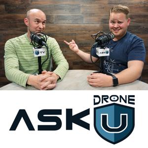
Ask Drone U

Ask Drone U

Download on the App Store
  • Favorites

    61

    Followers

  • Typical duration

    42 min

    per episode

Based on Podcast App listening data

Ask Drone U episodes

  • ADU 0918: How to Get Speedy Airspace Approval Using LAANC
    In today's show we answer your LAANC questions. What factors should you watch out for while getting your LAANC approval? Is there any way to shorten the approval process?

    Paul and Josh team up yet again to answer some commonly asked questions pertaining to LAANC. Which is the best app to get your LAANC approval? How long will it take you? We also share how you can speed up the approval process for non-LAANC airports.

    While wrapping up this informative show, we discuss if the introduction of DJI's GEO V 2.0 will lead to greater restrictions for drone pilots. Tune in now, and Fly Safe!

    Join us for our first intensive weekend of mapping instruction in the New Year from January 18-20, 2019 in Charleston, SC

    Make sure to get yourself a Drone U landing pad!

    Get your questions answered: http://askdroneu.com/.

    If you enjoy the show, the #1 thing you can do to help us out is subscribe to it on iTunes. Can we ask you to do that for us really quick? While you're there, leave us a 5-star review, if you're inclined to do so. Thanks! https://itunes.apple.com/us/podcast/ask-drone-u/id967352832.

    Become a Drone U Member. Access over 30 courses, resources, plus our incredible community. Try it out for $1.

    Looking for simple, fast and transparent coverage that gives you peace of mind? Our friends at Skywatch are offering affordable on-demand drone insurance that rewards YOU for flying safe. Check them out NOW! Both hourly and monthly options available.

    Follow us:
    Site - http://thedroneu.com/
    Facebook - https://www.facebook.com/droneu
    Instagram - https://instagram.com/thedroneu/
    Twitter - https://twitter.com/thedroneu
    YouTube - https://www.youtube.com/c/droneu

    Get your copy of "Livin’ the Drone Life" - http://amzn.to/2nalUDH
    Get your copy of our Part 107 Study Guide - http://amzn.to/2omQatT

    Timestamps

    Today's question is about getting airspace approval using LAANC
    Which is the best app to get your LAANC approval?
    What information does the KittyHawk app collate?
    Are there a lot of airports which are not available on the LAANC system?
    How can Drone U help you to learn about airspace?
    How long does it take to get authorization via LAANC?
    How long will it take you to avail authorization for non-LAANC aiports? Will going through the DroneZone portal speed up the entire process?
    How to unlock red zone on your drone
    DJI launches its new geofencing system, GEO V 2.0
    13 min
  • ADU 0917: How to Implement Comprehensive Drone Mapping Workflow by Learning the Smallest Nuances of RTK and PPK GPS
    In today's show, Paul and Josh team up to discuss comprehensive drone mapping workflow. You will learn about the minutest nuances of RTK and PPK GPS which will help you implement the correct workflow for acquiring survey grade data.

    Drone pilots often come to us with questions pertaining to RTK and PPK GPS. Does a RTK drone mean that you will end up using RTK GPS? Do you need to connect to a network in order to remove ellipsoid error? We discuss if the newly launched Phantom 4 RTK will indeed shorten your mapping workflow.

    Can you really do away with GCPs when using Phantom 4 RTK? Paul and Josh dive down the rabbit hole and share the smallest nuances. You will also learn how to correctly use Propeller Aeropoints for setting GCPs in drone mapping. This short episode is loaded with value guaranteed to give you the competitive advantage. Tune in now! Fly Safe!

    Join us for our first intensive weekend of mapping instruction in the New Year from January 18-20, 2019 in Charleston, SC

    Make sure to get yourself a Drone U landing pad!

    Get your questions answered: http://askdroneu.com/.

    If you enjoy the show, the #1 thing you can do to help us out is subscribe to it on iTunes. Can we ask you to do that for us really quick? While you're there, leave us a 5-star review, if you're inclined to do so. Thanks! https://itunes.apple.com/us/podcast/ask-drone-u/id967352832.

    Follow us:
    Site - http://thedroneu.com/
    Facebook - https://www.facebook.com/droneu
    Instagram - https://instagram.com/thedroneu/
    Twitter - https://twitter.com/thedroneu
    YouTube - https://www.youtube.com/c/droneu

    Get your copy of "Livin’ the Drone Life" - http://amzn.to/2nalUDH
    Get your copy of our Part 107 Study Guide - http://amzn.to/2omQatT

    Become a Drone U Member. Access over 30 courses, resources, plus our incredible community. Try it out for $1.

    Looking for simple, fast and transparent coverage that gives you peace of mind? Our friends at Skywatch are offering affordable on-demand drone insurance that rewards YOU for flying safe. Check them out NOW! Both hourly and monthly options available.

    Timestamps

    In today's show we learn about PPK and RTK GPS in order to implement correct drone mapping workflow
    Does a RTK drone mean that you will be able to use RTK GPS?
    What is terrestrial RTK GPS?
    Do you need internet connectivity when using RTK GPS in order to remove ellipsoid error?
    What is a geiod error?
    What is PPK GPS, and what is the workflow for using PPK GPS?
    Will you be able to connect to a network and provide corrections when using a RTK drone?
    Learn why elevation error or Z axis error is the most difficult to correct
    Should you use Propellor Aeropoints for setting GCP's in drone mapping?
    Can you conduct drone mapping without GCP's when using Phantom 4 RTK?
    Do you need checkpoints in drone mapping?
    Can you shorten your workflow with the Phantom 4 RTK?
    Does the Phantom 4 RTK provide excellent value for money?
    Paul sums up today's episode
    16 min
  • ADU 0916: Drone News This Week – Airmap’s Geofencing for Drones, Phantom 4 V2 Shortage, Phantom 5 Launch, DJI’s Osmo Pocket and Drones for Public Safety with Drone DJ
    In today's show, Paul and Haye team up yet again to bring you some of the most interesting drone stories of last week.

    We kickstart this show by talking about Airmap's Geofencing alerts that aim to facilitate safer drone flights. According to Airmap, flying near buildings and structures is particularly hazardous. Is there any substance to this claim? Next, we talk about the current shortage for Phantom 4 V2. Does this mean that the Phantom 5 launch is on the anvil?

    Paul and Haye also share their experience of visiting the Good Morning America Studio for DJI's launch of the Osmo Pocket. We wrap up this informative show by discussing how Americans perceive the use of drones for public safety. Tune in for some great news. Fly Safe!

    Drone U partners with Pix4D to offer an intensive Accident Scene Reconstruction Training at the NTSB Training Academy in Ashburn, VA from Dec 4-7. Click HERE to learn more!

    Make sure to get yourself a Drone U landing pad!

    Get your questions answered: http://askdroneu.com/.

    Become a Drone U Member. Access over 30 courses, resources, plus our incredible community. Try it out for $1.

    Looking for simple, fast and transparent coverage that gives you peace of mind? Our friends at Skywatch are offering affordable on-demand drone insurance that rewards YOU for flying safe. Check them out NOW! Both hourly and monthly options available.

    If you enjoy the show, the #1 thing you can do to help us out is subscribe to it on iTunes. Can we ask you to do that for us really quick? While you're there, leave us a 5-star review, if you're inclined to do so. Thanks! https://itunes.apple.com/us/podcast/ask-drone-u/id967352832.

    Follow us:
    Site - http://thedroneu.com/
    Facebook - https://www.facebook.com/droneu
    Instagram - https://instagram.com/thedroneu/
    Twitter - https://twitter.com/thedroneu
    YouTube - https://www.youtube.com/c/droneu

    Get your copy of "Livin’ the Drone Life" - http://amzn.to/2nalUDH
    Get your copy of our Part 107 Study Guide - http://amzn.to/2omQatT

    Timestamps

    Paul welcomes Haye to the show
    Airmap comes out with Geofencing alerts to facilitate safer drone flight
    Brendan Schulman from DJI clarifies that flying near building and other structures is not hazardous
    Citing a recent study which points out how Americans are getting more and more comfortable with flying drones
    Is the Phantom 4 Version 2 out of stock? Does this mean that the Phantom 5 launch is on the anvil?
    Is the Mavic 2 Pro a good replacement for the Phantom 4 Pro?
    Check out DJI Pro's YouTube channel where they provide some great tips and tricks for using the Ronin 2
    Discussing the recent DJI launch event at Good Morning America Studio
    Learn about the soon-to-be launched Mavic remote
    Watch out DroneDJ's review on the DJI Osmo Pocket
    What is public perception pertaining to the use of drones for public safety?
    Do not miss out on a unique opportunity to learn about Accident Reconstruction Training at the NTSB center in Ashburn, VA. Limited Seats Available!
    Do not forget to Share, Review and Subscribe. Your encouragement keeps us going.
    14 min
  • BONUS EPISODE: Osmo Pocket Challenges GoPro for Ultimate Compact Gimbaled Camera
    Paul is filming from Good Morning America studio this morning as he attended the Osmo pocket launch. The Osmo pocket offers a variety of features and accessories that prove to make the little gimbaled camera  a serious competitor to any compact camera.

    How does the Osmo Pocket compare to the GoPro? Can you mount the Osmo Pocket on your car? And, can you grab underwater footage with the Osmo Pocket? Tune in to this comprehensive review to discover why this compact camera will place superior film-making capabilities at your disposal.

    Drone U partners with Pix4D to offer an intensive Accident Scene Reconstruction Training at the NTSB Training Academy in Ashburn, VA from Dec 4-7. Click HERE to learn more!

    Make sure to get yourself a Drone U landing pad!

    Get your questions answered: http://askdroneu.com/.

    Become a Drone U Member. Access over 30 courses, resources, plus our incredible community. Try it out for $1.

    Looking for simple, fast and transparent coverage that gives you peace of mind? Our friends at Skywatch are offering affordable on-demand drone insurance that rewards YOU for flying safe. Check them out NOW! Both hourly and monthly options available.

    If you enjoy the show, the #1 thing you can do to help us out is subscribe to it on iTunes. Can we ask you to do that for us really quick? While you're there, leave us a 5-star review, if you're inclined to do so. Thanks! https://itunes.apple.com/us/podcast/ask-drone-u/id967352832.

    Follow us:
    Site - http://thedroneu.com/
    Facebook - https://www.facebook.com/droneu
    Instagram - https://instagram.com/thedroneu/
    Twitter - https://twitter.com/thedroneu
    YouTube - https://www.youtube.com/c/droneu

    Get your copy of "Livin’ the Drone Life" - http://amzn.to/2nalUDH
    Get your copy of our Part 107 Study Guide - http://amzn.to/2omQatT

    Timestamps

    Paul joins us from Good Morning America studio for the Osmo Pocket Launch
    Learn about the many awesome features of the Osmo Pocket
    How does the GoPro compare to the Osmo Pocket? Learn how you have superior film-making capabilities at your disposal due to the mechanical gimbal on the Osmo Pocket
    The Osmo Pocket comes with intelligent camera features that are typically found in drones
    Learn how you can do horizon moves and tilts using FPV mode
    Can you mount the Osmo Pocket on your car?
    How much does the Osmo Pocket cost?
    We start broadcasting from inside the Good Morning studio
    A brief history of DJI's product development: the first three axis gimbal, the Ronin series and the Osmo series
    The three axis gimbal renders the Osmo perfect for professional filmmakers as well as hobby videographers
    How compact is the Osmo Pocket?
    Discussing the powerful sensor on the Osmo Pocket through which you can shoot 4k60fps
    How to navigate the 1 inch touchscreen on the Osmo Pocket
    Active track and Face track features renders the Osmo Pocket perfect for shooting selfies
    How to attach your smartphone to the Osmo Pocket, and use the MIMO app to generate a short story
    Learn about Osmo Pocket's impressive underwater capabilities
    You can shoot time-lapse and motion-lapse with the Osmo Pocket
    Learn about the built in microphone
    Can you replace a damaged product free of charge? Learn about their warranty, Osmo Shield
    How can you can buy the Osmo pocket? How much will it cost you?
    0 min
  • ADU 0915: How to Set Ground Control Points for Greatest Accuracy in Construction Mapping
    Today's question is about using ground control points in construction. What is the correct workflow for laying out GCPs on a construction site? Can you lay GCPs on a construction site and use this information again and again?

    We have a great drone mapping question today. Our caller is wondering if he can get away with using Ground Control Points in the initial flight only. In order to answer his question, we discuss the entire workflow for laying out GCPs. How many GCPs should you use? How should you lay them out? Can you use Propeller Aeropoints for setting GCPs on a construction site.

    Towards the end of the show, Paul has a great TIP for correcting Z axis errors using Ground Control Points. This show is loaded with some great information. Tune in now!

    Recently crashed your drone? Unable to find trained technicians who can repair your drone quickly and at a reasonable rate? Don’t fret. The cool folks at Fortress UAV can help you get your drone back up in the air in as little as 7 days! Use Promo Code “DroneU” to get 10% off. Check them out now!

    Drone U partners with Pix4D to offer an intensive Accident Scene Reconstruction Training at the NTSB Training Academy in Ashburn, VA from Dec 4-7. Click HERE to learn more!

    Make sure to get yourself a Drone U landing pad!

    Get your questions answered: http://askdroneu.com/.

    Become a Drone U Member. Access over 30 courses, resources, plus our incredible community. Try it out for $1.

    Looking for simple, fast and transparent coverage that gives you peace of mind? Our friends at Skywatch are offering affordable on-demand drone insurance that rewards YOU for flying safe. Check them out NOW! Both hourly and monthly options available.

    If you enjoy the show, the #1 thing you can do to help us out is subscribe to it on iTunes. Can we ask you to do that for us really quick? While you're there, leave us a 5-star review, if you're inclined to do so. Thanks! https://itunes.apple.com/us/podcast/ask-drone-u/id967352832.

    Follow us:
    Site - http://thedroneu.com/
    Facebook - https://www.facebook.com/droneu
    Instagram - https://instagram.com/thedroneu/
    Twitter - https://twitter.com/thedroneu
    YouTube - https://www.youtube.com/c/droneu

    Get your copy of "Livin’ the Drone Life" - http://amzn.to/2nalUDH
    Get your copy of our Part 107 Study Guide - http://amzn.to/2omQatT

    Timestamps

    Learn about our cool sponsor, Fortress UAV
    Today's question is about using GCP's in construction
    Please Share, Review and Subscribe. Your encouragement keeps us going.
    Can you lay GCP's on the site, and use this information again and again?
    Should you leave your GCP's on the site?
    How many GCP's should you use? How should you lay them out?
    What should you use for your GCP's?
    Importance of having good overlap in your GCP's
    When do you need GCP's? Can you use scale constraints instead?
    Benefits of using Propeller Aeropoints for setting GCP's on a construction site
    Do you need to leave your GCP's on the site?
    14 min
  • ADU 0914: How to Select the Best Drone and Implement Optimum Mapping Workflow in Construction
    Today's question is about drone mapping in construction and agriculture. Which is the best mapping application and drone to acquire and process data accurately in each of these fields?

    Our caller, John has come up with a two-part mapping question today. The first part of this question is about mapping applications. Why should you AVOID using an all-in-one mapping application? How do cloud-based applications compare to desktop solutions? We discuss the pros and cons of different applications such as Pix4D, MapsMadeEasy and SkyCatch.

    In the second part of this question, we discuss the best drones for mapping. Can you use a single drone for construction and agricultural mapping? Can you use the Yuneec H520 with its CGOET sensor for agricultural mapping? Or, is the Phantom 4 Pro your best bet?

    In this show, we go down the rabbit hole to discuss the entire mapping workflow. Tune in for some great information. Thanks for the question, John. Fly Safe!

    Recently crashed your drone? Unable to find trained technicians who can repair your drone quickly and at a reasonable rate? Don’t fret. The cool folks at Fortress UAV can help you get your drone back up in the air in as little as 7 days! Use Promo Code “DroneU” to get 10% off. Check them out now!

    Drone U partners with Pix4D to offer an intensive Accident Scene Reconstruction Training at the NTSB Training Academy in Ashburn, VA from Dec 4-7. Click HERE to learn more!

    Make sure to get yourself a Drone U landing pad!

    Get your questions answered: http://askdroneu.com/.

    Become a Drone U Member. Access over 30 courses, resources, plus our incredible community. Try it out for $1.

    Looking for simple, fast and transparent coverage that gives you peace of mind? Our friends at Skywatch are offering affordable on-demand drone insurance that rewards YOU for flying safe. Check them out NOW! Both hourly and monthly options available.

    If you enjoy the show, the #1 thing you can do to help us out is subscribe to it on iTunes. Can we ask you to do that for us really quick? While you're there, leave us a 5-star review, if you're inclined to do so. Thanks! https://itunes.apple.com/us/podcast/ask-drone-u/id967352832.

    Follow us:
    Site - http://thedroneu.com/
    Facebook - https://www.facebook.com/droneu
    Instagram - https://instagram.com/thedroneu/
    Twitter - https://twitter.com/thedroneu
    YouTube - https://www.youtube.com/c/droneu

    Get your copy of "Livin’ the Drone Life" - http://amzn.to/2nalUDH
    Get your copy of our Part 107 Study Guide - http://amzn.to/2omQatT

    Timestamps

    Paul thanks the Women and Drones Group
    Please Share, Review and Subscribe. Your encouragement keeps us going.
    Legally, are there any restrictions on what drone mappers CAN do and CANNOT do?
    Do not miss out on being a part of our intensive Accident Reconstruction Training at the NTSB center. Limited seats available!
    Learn about our cool sponsor, Fortress UAV
    Today's question is about drone mapping in agriculture and construction
    Can you conduct drone mapping for construction and agriculture with the same drone?
    Do you need a multi-spectral sensor for Agricultural mapping?
    The importance of a proper education before taking on complex mapping jobs
    Nuances of data acquisition in drone mapping
    Can you measure accurate volumes via drone mapping without using GCP's?
    Learn about our soon-to-be launched mapping class
    Should you use an all-in-one mapping solution?
    Desktop vs. Cloud Mapping Applications - Reasons why desktop based applications are preferable
    Should you use applications like SkyCatch which allow on-site processing?

    35 min
  • ADU 0914: How to Select the Best Drone and Implement Optimum Mapping Workflow in Construction
    Today's question is about drone mapping in construction and agriculture. Which is the best mapping application and drone to acquire and process data accurately in each of these fields?

    Our caller, John has come up with a two-part mapping question today. The first part of this question is about mapping applications. Why should you AVOID using an all-in-one mapping application? How do cloud-based applications compare to desktop solutions? We discuss the pros and cons of different applications such as Pix4D, MapsMadeEasy and SkyCatch.

    In the second part of this question, we discuss the best drones for mapping. Can you use a single drone for construction and agricultural mapping? Can you use the Yuneec H520 with its CGOET sensor for agricultural mapping? Or, is the Phantom 4 Pro your best bet?

    In this show, we go down the rabbit hole to discuss the entire mapping workflow. Tune in for some great information. Thanks for the question, John. Fly Safe!

    Recently crashed your drone? Unable to find trained technicians who can repair your drone quickly and at a reasonable rate? Don’t fret. The cool folks at Fortress UAV can help you get your drone back up in the air in as little as 7 days! Use Promo Code “DroneU” to get 10% off. Check them out now!

    Drone U partners with Pix4D to offer an intensive Accident Scene Reconstruction Training at the NTSB Training Academy in Ashburn, VA from Dec 4-7. Click HERE to learn more!

    Make sure to get yourself a Drone U landing pad!

    Get your questions answered: https://thedroneu.com/.

    Become a Drone U Member.

    Looking for simple, fast and transparent coverage that gives you peace of mind? Our friends at Skywatch are offering affordable on-demand drone insurance that rewards YOU for flying safe. Check them out NOW! Both hourly and monthly options available.

    If you enjoy the show, the #1 thing you can do to help us out is subscribe to it on iTunes. Can we ask you to do that for us really quick? While you're there, leave us a 5-star review, if you're inclined to do so. Thanks! https://itunes.apple.com/us/podcast/ask-drone-u/id967352832.

    Follow us:
    Site - https://thedroneu.com/
    Facebook - https://www.facebook.com/droneu
    Instagram - https://instagram.com/thedroneu/
    Twitter - https://twitter.com/thedroneu
    YouTube - https://www.youtube.com/c/droneu

    Get your copy of "Livin’ the Drone Life" - //amzn.to/2nalUDH
    Get your copy of our Part 107 Study Guide - //amzn.to/2omQatT

    Timestamps

    Paul thanks the Women and Drones Group
    Please Share, Review and Subscribe. Your encouragement keeps us going.
    Legally, are there any restrictions on what drone mappers CAN do and CANNOT do?
    Do not miss out on being a part of our intensive Accident Reconstruction Training at the NTSB center. Limited seats available!
    Learn about our cool sponsor, Fortress UAV
    Today's question is about drone mapping in agriculture and construction
    Can you conduct drone mapping for construction and agriculture with the same drone?
    Do you need a multi-spectral sensor for Agricultural mapping?
    The importance of a proper education before taking on complex mapping jobs
    Nuances of data acquisition in drone mapping
    Can you measure accurate volumes via drone mapping without using GCP's?
    Learn about our soon-to-be launched mapping class
    Should you use an all-in-one mapping solution?
    Desktop vs. Cloud Mapping Applications - Reasons why desktop based applications are preferable
    Should you use applications like SkyCatch which allow on-site processing?
    Which are the best mapping applications for data acquisition?
    Discussing the benefits of using MapsMadeEasy
    33 min
  • ADU 0913: How Do I Effectively Communicate the Benefits of Drone Technology for Stockpile Volumetric Measurement?
    Today's show is about using drones for stockpile volumetric measurement. How can you convey the benefits of drone technology to your boss, and convince him to make a switch?

    Our caller, Phil is working for a company that uses airplane photography to take stockpile inventory. They are refusing to switch to drone technology - which is resulting in higher costs and poor accuracy. To answer Phil's question, we discuss the proper workflow for data acquisition and processing. Should you use GCPs to measure your stockpiles? And, should you opt for a drone with a global shutter?

    To wrap up the show, we state 4 SOLID reasons for using drone technology for stockpile volumetric measurement. Thanks for the great question, Phil. Fly Safe!

    Recently crashed your drone? Unable to find trained technicians who can repair your drone quickly and at a reasonable rate? Don’t fret. The cool folks at Fortress UAV can help you get your drone back up in the air in as little as 7 days! Use Promo Code “DroneU” to get 10% off. Check them out now!

    Drone U partners with Pix4D to offer an intensive Accident Scene Reconstruction Training at the NTSB Training Academy in Ashburn, VA from Dec 4-7. Click HERE to learn more!

    Make sure to get yourself a Drone U landing pad!

    Get your questions answered: http://askdroneu.com/.

    Become a Drone U Member. Access over 30 courses, resources, plus our incredible community. Try it out for $1.

    Looking for simple, fast and transparent coverage that gives you peace of mind? Our friends at Skywatch are offering affordable on-demand drone insurance that rewards YOU for flying safe. Check them out NOW! Both hourly and monthly options available.

    If you enjoy the show, the #1 thing you can do to help us out is subscribe to it on iTunes. Can we ask you to do that for us really quick? While you're there, leave us a 5-star review, if you're inclined to do so. Thanks! https://itunes.apple.com/us/podcast/ask-drone-u/id967352832.

    Follow us:
    Site - http://thedroneu.com/
    Facebook - https://www.facebook.com/droneu
    Instagram - https://instagram.com/thedroneu/
    Twitter - https://twitter.com/thedroneu
    YouTube - https://www.youtube.com/c/droneu

    Get your copy of "Livin’ the Drone Life" - http://amzn.to/2nalUDH
    Get your copy of our Part 107 Study Guide - http://amzn.to/2omQatT

    Timestamps

    Learn about our cool sponsor, Fortress UAV
    Today's question is about convincing your employer about the benefits of drone technology
    Reasons why folks are close minded and afraid of stepping out of their comfort zone
    How to effectively communicate the benefits of drone technology
    Is it worthwhile using a service like Stockpile Reports?
    The Phantom 4 with a global shutter is a great alternative for volumetric measurement
    How to set ground control points for volumetric measurement
    Do you need GCP's for volumetric measurement?
    4 solid reasons for using drone technology for volumetric measurements
    Paul's recommendation: "Never Split the Difference"
    21 min
  • ADU 0912: Can You Get into Trouble If Someone Else Is Using Your Part 107 Certificate?
    Today's show is about Part 107 certification. What if another drone pilot hits someone while using your Part 107 certification? Are you liable for damages?

    Our caller, Geoff has come up with a question that many of you must be wondering about. Geoff is worried that an unlicensed pilot might be flying using his certificate. What should be Geoff's course of action? Should he call the FSDO on this person?

    We discuss various scenarios to answer if you can indeed get into trouble in such a scenario. Thanks for the great question, Geoff. Fly Safe!

    Get your questions answered: http://askdroneu.com/.

    Drone U partners with Pix4D to offer an intensive Accident Scene Reconstruction Training at the NTSB Training Academy in Ashburn, VA from Dec 4-7. Click HERE to learn more!

    Become a Drone U Member. Try us out for 14 days and access our 34 courses, including Part 107 training, plus our amazing community for $1.

    Looking for simple, fast and transparent coverage that gives you peace of mind? Look no more. The cool folks at Skywatch are offering affordable on-demand drone insurance that rewards YOU for flying safe. Check them out NOW! Both hourly and monthly options available.

    If you enjoy the show, the #1 thing you can do to help us out is subscribe to it on iTunes. Can we ask you to do that for us really quick? While you're there, leave us a 5-star review, if you're inclined to do so. Thanks! https://itunes.apple.com/us/podcast/ask-drone-u/id967352832.

    Follow us:
    Site - http://thedroneu.com/
    Facebook - https://www.facebook.com/droneu
    Instagram - https://instagram.com/thedroneu/
    Twitter - https://twitter.com/thedroneu
    YouTube - https://www.youtube.com/c/droneu

    Get your copy of "Livin’ the Drone Life" - http://amzn.to/2nalUDH
    Get your copy of our Part 107 Study Guide - http://amzn.to/2omQatT

    Timestamps

    Today's question is about someone else using your Part 107 certificate
    Is it okay to share your certificate with clients?
    Are you liable for damages if someone uses your certificate?
    Is the RPIC responsible for the job?
    Will the law punish those found using another pilot's Part 107 certificate?
    If someone steals your Part 107 license and hits someone, are you liable for damages?
    How to report misuse of Part 107 certificate to FSDO
    Should you confront someone whom you suspect of misusing your Part 107 certificate?
    16 min
  • ADU 0912: Can You Get into Trouble If Someone Else Is Using Your Part 107 Certificate?
    Today's show is about Part 107 certification. What if another drone pilot hits someone while using your Part 107 certification? Are you liable for damages?

    Our caller, Geoff has come up with a question that many of you must be wondering about. Geoff is worried that an unlicensed pilot might be flying using his certificate. What should be Geoff's course of action? Should he call the FSDO on this person?

    We discuss various scenarios to answer if you can indeed get into trouble in such a scenario. Thanks for the great question, Geoff. Fly Safe!

    Get your questions answered: https://thedroneu.com/.

    Drone U partners with Pix4D to offer an intensive Accident Scene Reconstruction Training at the NTSB Training Academy in Ashburn, VA from Dec 4-7. Click HERE to learn more!

    Become a Drone U Member.

    Looking for simple, fast and transparent coverage that gives you peace of mind? Look no more. The cool folks at Skywatch are offering affordable on-demand drone insurance that rewards YOU for flying safe. Check them out NOW! Both hourly and monthly options available.

    If you enjoy the show, the #1 thing you can do to help us out is subscribe to it on iTunes. Can we ask you to do that for us really quick? While you're there, leave us a 5-star review, if you're inclined to do so. Thanks! https://itunes.apple.com/us/podcast/ask-drone-u/id967352832.

    Follow us:
    Site - https://thedroneu.com/
    Facebook - https://www.facebook.com/droneu
    Instagram - https://instagram.com/thedroneu/
    Twitter - https://twitter.com/thedroneu
    YouTube - https://www.youtube.com/c/droneu

    Get your copy of "Livin’ the Drone Life" - //amzn.to/2nalUDH
    Get your copy of our Part 107 Study Guide - //amzn.to/2omQatT

    Timestamps

    Today's question is about someone else using your Part 107 certificate
    Is it okay to share your certificate with clients?
    Are you liable for damages if someone uses your certificate?
    Is the RPIC responsible for the job?
    Will the law punish those found using another pilot's Part 107 certificate?
    If someone steals your Part 107 license and hits someone, are you liable for damages?
    How to report misuse of Part 107 certificate to FSDO
    Should you confront someone whom you suspect of misusing your Part 107 certificate?
    20 min

About Ask Drone U

From the publisher's feed

We’re Drone U, a group of guys who have turned their passion for flight into a profitable business. We love hearing from our fans, and we love helping by answering their questions. That’s why we…

Best of Ask Drone U

Ranked by our users in the last 21 days

More shows like Ask Drone U

Freakonomics Radio by Freakonomics Radio + Stitcher

Freakonomics Radio

31,898 Listeners

Hidden Brain by Hidden Brain, Shankar Vedantam

Hidden Brain

43,335 Listeners

The Tim Ferriss Show by Tim Ferriss: Bestselling Author, Human Guinea Pig

The Tim Ferriss Show

16,039 Listeners

The Investor's Podcast (We Study Billionaires)  - The Investor’s Podcast Network by The Investor's Podcast Network

The Investor's Podcast (We Study Billionaires) - The Investor’s Podcast Network

3,327 Listeners

Drone Radio Show by Randy Goers

Drone Radio Show

59 Listeners

How I Built This with Guy Raz by Guy Raz | Vox Media

How I Built This with Guy Raz

30,135 Listeners

Modern Wisdom by Chris Williamson

Modern Wisdom

4,070 Listeners

The Peter Attia Drive by Peter Attia, MD

The Peter Attia Drive

7,935 Listeners

Drone to 1K Podcast by Drone Launch Academy by Drone Launch Academy

Drone to 1K Podcast by Drone Launch Academy

312 Listeners

My First Million by Hubspot Media

My First Million

2,647 Listeners

Do You Know Drones? by Jason San Souci

Do You Know Drones?

5 Listeners

The Shawn Ryan Show by Shawn Ryan

The Shawn Ryan Show

46,034 Listeners

All-In with Chamath, Jason, Sacks & Friedberg by All-In Podcast, LLC

All-In with Chamath, Jason, Sacks & Friedberg

10,142 Listeners

Drone News Update by Pilot Institute

Drone News Update

16 Listeners

Your Drone Questions. Answered. by Drone Launch Academy

Your Drone Questions. Answered.

9 Listeners