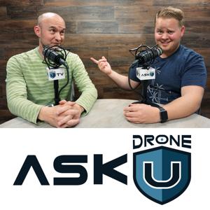
Ask Drone U

Ask Drone U

Download on the App Store
  • Favorites

    61

    Followers

  • Typical duration

    42 min

    per episode

Based on Podcast App listening data

Ask Drone U episodes

  • Wedding Day Special
    Paul's wedding day has finally arrived! On this very special day, you will hear Rob (married for 27 years) and McKeyla (married for 15 years) give out some great marriage advice to Paul.

    Many congratulations to Sarah and Paul! You do not want to miss this fun filled episode. Tune in now.

    The 2018 Drone U Fly-in is your opportunity to build community, get inspired and fly better. Get practical, hands-on flight instruction from industry’s best. Limited spots available. Reserve now!

    Make sure to get yourself a Drone U landing pad!

    Get your questions answered: http://askdroneu.com/.

    If you enjoy the show, the #1 thing you can do to help us out is subscribe to it on iTunes. Can we ask you to do that for us really quick? While you're there, leave us a 5-star review, if you're inclined to do so. Thanks! https://itunes.apple.com/us/podcast/ask-drone-u/id967352832.

    Follow us:
    Site - http://thedroneu.com/
    Facebook - https://www.facebook.com/droneu
    Instagram - https://instagram.com/thedroneu/
    Twitter - https://twitter.com/thedroneu
    YouTube - https://www.youtube.com/c/droneu

    Get your copy of "Livin’ the Drone Life" - http://amzn.to/2nalUDH
    Get your copy of our Part 107 Study Guide - http://amzn.to/2omQatT
    8 min
  • ADU 0801: How to Start a Drone Business for Less Than $1,000
    Today's question is about starting your drone business for less than $1,000. Can you build a successful small business for less than $1,000?

    Our caller, Joshua wants to set up his own successful small business. But he has a problem. He just has a grand to spare. Which drone can he buy with this limited budget? And, which are the drone jobs that he should be going after? Should he start off with real estate jobs? Or, should he aim for UAV mapping jobs? Tune in to find out. Fly Safe!

    The 2018 Drone U Fly-in is your opportunity to build community, get inspired and fly better. Get practical, hands-on flight instruction from industry’s best. Limited spots available. Reserve now!

    Make sure to get yourself a Drone U landing pad!

    Get your questions answered: http://askdroneu.com/.

    If you enjoy the show, the #1 thing you can do to help us out is subscribe to it on iTunes. Can we ask you to do that for us really quick? While you're there, leave us a 5-star review, if you're inclined to do so. Thanks! https://itunes.apple.com/us/podcast/ask-drone-u/id967352832.

    Follow us:
    Site - http://thedroneu.com/
    Facebook - https://www.facebook.com/droneu
    Instagram - https://instagram.com/thedroneu/
    Twitter - https://twitter.com/thedroneu
    YouTube - https://www.youtube.com/c/droneu

    Get your copy of "Livin’ the Drone Life" - http://amzn.to/2nalUDH
    Get your copy of our Part 107 Study Guide - http://amzn.to/2omQatT

    Timestamps

    Paul shares details for the forthcoming Drone U Fly-in
    Today's question is about setting up your drone business; can you set up a successful small business for less than $1,000?
    Can you buy a good drone with just $1,000
    Should new entrants in the drone industry start off with real estate jobs? Or, can they consider UAV mapping jobs?
    9 min
  • ADU 0800: How to Acquire and Process Data for Greater Accuracy in 3D Drone Mapping
    Today's question is about 3D mapping. Do you need to introduce multiple orbits for making an accurate 3D model with your drone? How can you map overhanging structures? What makes Phantom 4 Pro the best drone for UAV mapping?

    In our 800th episode, we suggest ways via which you can excel in 3D mapping with your drone. Do you need to introduce multiple orbits while mapping a complex structure? Learn how you can deal with this increased complexity in 3D mapping. We also discuss how you can get survey grade data using photogrammetry.

    Next, we talk about the best drones and cameras for UAV mapping. How does the Phantom 4 Pro compare to the Yuneec H520 for UAV mapping? Learn why global shutters can help you achieve greater accuracy in 3D mapping. You will also receive some great tips for processing your data. Can you process vertical image captures with other ones? Tune in to find out. We thank Simon from Norway for the question. Fly Safe!

    The 2018 Drone U Fly-in is your opportunity to build community, get inspired and fly better. Get practical, hands-on flight instruction from industry’s best. Limited spots available. Reserve now!

    Make sure to get yourself a Drone U landing pad!

    Get your questions answered: http://askdroneu.com/.

    If you enjoy the show, the #1 thing you can do to help us out is subscribe to it on iTunes. Can we ask you to do that for us really quick? While you're there, leave us a 5-star review, if you're inclined to do so. Thanks! https://itunes.apple.com/us/podcast/ask-drone-u/id967352832.

    Follow us:
    Site - http://thedroneu.com/
    Facebook - https://www.facebook.com/droneu
    Instagram - https://instagram.com/thedroneu/
    Twitter - https://twitter.com/thedroneu
    YouTube - https://www.youtube.com/c/droneu

    Get your copy of "Livin’ the Drone Life" - http://amzn.to/2nalUDH
    Get your copy of our Part 107 Study Guide - http://amzn.to/2omQatT

    Timestamps

    Paul thanks all Drone U sponsors
    Today's question is about improving accuracy in 3D drone mapping and modeling
    What is the minimum number of orbits that you need to make in 3D mapping? Do you need more orbits while mapping a complex structure?
    Expert tips for building accurate 3D maps when you are introducing multiple orbits
    Can you get survey grade data with photogrammetry?
    Which is the best drone for UAV mapping ? We compare the Phantom 4 Pro and Yuneec H 520
    Learn how the focal length on your camera affects the ground sampling distance
    Does a global shutter in the Phantom 4 render it better for UAV mapping? We discuss how a linear rolling shutter in the Yuneec H520 affects mapping results
    Paul urges everyone to check out the Pix4D podcast
    Learn why vertical capture in the Ground Station Pro is far better than Site Scan's Perimeter scan
    Can you merge vertical image capture with other ones?
    Which are the best drone cameras for mapping overhanging structures? We discuss why you are better off using the X4S and X5 over the X7
    Some common mistakes that UAV pilots make with manual tie points
    20 min
  • ADU 0799: Can I Use My Drone to Shoot a Football Game?
    Today's question is about drones for filming football games. Can you film a football game without flying over people? Which is the best drone and camera to record football games?

    Our caller wishes to use his drone for filming football. Can he do so without flouting any FAA drone laws? We also discuss why using the Inspire 1 along with the Z3 camera to record football games is a smart move. Tune in to this fun and informative episode. Fly Safe!

    The 2018 Drone U Fly-in is your opportunity to build community, get inspired and fly better. Get practical, hands-on flight instruction from industry’s best. Limited spots available. Reserve now!

    Make sure to get yourself a Drone U landing pad!

    Get your questions answered: http://askdroneu.com/.

    If you enjoy the show, the #1 thing you can do to help us out is subscribe to it on iTunes. Can we ask you to do that for us really quick? While you're there, leave us a 5-star review, if you're inclined to do so. Thanks! https://itunes.apple.com/us/podcast/ask-drone-u/id967352832.

    Follow us:
    Site - http://thedroneu.com/
    Facebook - https://www.facebook.com/droneu
    Instagram - https://instagram.com/thedroneu/
    Twitter - https://twitter.com/thedroneu
    YouTube - https://www.youtube.com/c/droneu

    Get your copy of "Livin’ the Drone Life" - http://amzn.to/2nalUDH
    Get your copy of our Part 107 Study Guide - http://amzn.to/2omQatT

    Timestamps

    We share details of the forthcoming Drone U Fly-in
    Today's question is about using drones for filming football
    Tips and tricks for using a drone for filming football without flying over people
    Why should you use the Inspire 1 with the Z3 camera to record football games?
    Is there any way you can fly your drone over people?
    9 min
  • ADU 0798: Is the Intel Insight Platform the Mapping Automation System the Industry Has Been Waiting For?
    Today's episode is about Intel Insight, a Mapping Automation System. Anil Nanduri, VP and GM, Intel Drone Team talks about this amazing drone software at AUVSI 2018. How is Intel helping drones become smarter? How will the asset based approach of Intel Insight result in greater efficiency and flexibility? Will Intel Insight help enterprises scale up their drone operations?

    Anil starts off by talking about the drone industry and its varied applications. Do we have the infrastructure in place to scale up drone operations? Does our current technology allow us to seamlessly share data back and forth?

    Anil moves on to provide some background information about Intel and Intel Insight. Is Intel Insight compatible with drone applications like Pix4D? Will it result in greater efficiency and flexibility? Anil demonstrates the enterprise centric capabilities of Intel Insight by running the platform live from a client system. Is this asset based system the one that the drone industry has been waiting for? Tune in to learn more. Fly Safe!

    The 2018 Drone U Fly-in is your opportunity to build community, get inspired and fly better. Get practical, hands-on flight instruction from industry’s best. Limited spots available. Reserve now!

    Make sure to get yourself a Drone U landing pad!

    Get your questions answered: http://askdroneu.com/.

    If you enjoy the show, the #1 thing you can do to help us out is subscribe to it on iTunes. Can we ask you to do that for us really quick? While you're there, leave us a 5-star review, if you're inclined to do so. Thanks! https://itunes.apple.com/us/podcast/ask-drone-u/id967352832.

    Follow us:
    Site - http://thedroneu.com/
    Facebook - https://www.facebook.com/droneu
    Instagram - https://instagram.com/thedroneu/
    Twitter - https://twitter.com/thedroneu
    YouTube - https://www.youtube.com/c/droneu

    Get your copy of "Livin’ the Drone Life" - http://amzn.to/2nalUDH
    Get your copy of our Part 107 Study Guide - http://amzn.to/2omQatT

    Timestamps

    Discussing the ability of a drone to capture data and its varied applications
    Why is it important to understand what your customer cares about?
    How does Intel help drones become smarter? We talk about sensors, AI and software
    The importance of transferring data easily
    Discussing the need for cloud technology to become faster and more efficient to allow for seamless data sharing
    The need to create an infrastructure to process vast amounts of data
    What are some of the changes that need to take place if we wish to scale up drone applications?
    What is Intel's role in the drone industry?
    The importance of data processing in order to provide actionable insights
    Anil shares some background information about Intel insight platform
    Marketing Video highlighting capabilities of Intel Insight platform
    Which are some of the applications that are compatible with Intel Insight?
    How can we make inspection processes more efficient with drones?
    Demonstrating the enterprise centric capabilities of Intel Insight by running the platform live from a client system
    Does the Intel Insight platform have an asset based approach? Why is this asset-based approach critical?
    Learn how Intel Insight platform provides greater flexible by allowing back-office people to process data
    Demonstrating the various tools that can be used while processing data
    Can you view  a location's flight history using Intel Insight?
    23 min
  • ADU 0797: How Drone Mapping Can Help Crime Scene Investigations and What to Look for
    Today's episode is about using drone mapping for crime scene investigations. We are joined by Neal Carter, an accident re-constructionist. Paul and Neal discuss why drone mapping for accident reconstruction has gained in popularity. Can you get better data with drone mapping? And, is it quicker to use drone mapping?

    Paul and Neal go into the nitty gritty of crime scene investigations. Learn how crime scene investigations are researched. What are the various KPI's that are are looked at while investigating a crime scene? And, what is the consequence of processing mapping data incorrectly? Tune in to find out. Fly Safe!

    The 2018 Drone U Fly-in is your opportunity to build community, get inspired and fly better. Get practical, hands-on flight instruction from industry’s best. Limited spots available. Reserve now!

    Make sure to get yourself a Drone U landing pad!

    Get your questions answered: http://askdroneu.com/.

    If you enjoy the show, the #1 thing you can do to help us out is subscribe to it on iTunes. Can we ask you to do that for us really quick? While you're there, leave us a 5-star review, if you're inclined to do so. Thanks! https://itunes.apple.com/us/podcast/ask-drone-u/id967352832.

    Follow us:
    Site - http://thedroneu.com/
    Facebook - https://www.facebook.com/droneu
    Instagram - https://instagram.com/thedroneu/
    Twitter - https://twitter.com/thedroneu
    YouTube - https://www.youtube.com/c/droneu

    Get your copy of "Livin’ the Drone Life" - http://amzn.to/2nalUDH
    Get your copy of our Part 107 Study Guide - http://amzn.to/2omQatT

    Timestamps

    Paul introduces Neal Carter to listeners
    Neal explains how car scene investigations are conducted
    How does Neal collaborate with police officers?
    What kind of data is available for reconstructing accidents?
    What kind of car accidents does Neal deal with? Is drone mapping done for all accidents?
    How is drone mapping and photogrammetry being used for accident reconstruction?
    Can you get better data using a drone? Is drone mapping data comparable to data derived from a 3D laser scanner?
    Can drone mapping data provide faster data? What is the turnaround time?
    Discussing the criticality of building up your flying skills before venturing into crime scene reconstruction
    What are the various KPI's ? What are the various things that crime scene re-constructionists look at?
    What are the consequences of processing data incorrectly?
    Neal shares his contact information
    Can you learn about accident reconstruction at the Drone U Fly-in?
    13 min
  • ADU 0796: How Remote ID Works and Will Move the UAV Industry Forward
    In today's episode we discuss how Remote ID will impact the drone industry. Vic is joined by Kenji Sughara, a UAS policy expert. Will Remote ID be introduced anytime soon? Which technology will Remote ID work on? Will this lead to any data security and privacy issues?

    Kenji shares details of the Aviation Rulemaking Committee (ARC) which has made this proposal. Were there any major disagreements among ARC members while formulating this proposal? Will the introduction of Remote ID lead to real time tracking of drones? Kenji also discusses the importance of coming up with a cheap, yet easy solution.

    When the Notice for Rulemaking Proposal (NPRM) drops, you shall definitely hear about it from us. Vic provides some great suggestions via which you can constructively affect the decision making process. Fly Safe!

    The 2018 Drone U Fly-in is your opportunity to build community, get inspired and fly better. Get practical, hands-on flight instruction from industry’s best. Limited spots available. Reserve now!

    Make sure to get yourself a Drone U landing pad!

    Get your questions answered: http://askdroneu.com/.

    If you enjoy the show, the #1 thing you can do to help us out is subscribe to it on iTunes. Can we ask you to do that for us really quick? While you're there, leave us a 5-star review, if you're inclined to do so. Thanks! https://itunes.apple.com/us/podcast/ask-drone-u/id967352832.

    Follow us:
    Site - http://thedroneu.com/
    Facebook - https://www.facebook.com/droneu
    Instagram - https://instagram.com/thedroneu/
    Twitter - https://twitter.com/thedroneu
    YouTube - https://www.youtube.com/c/droneu

    Get your copy of "Livin’ the Drone Life" - http://amzn.to/2nalUDH
    Get your copy of our Part 107 Study Guide - http://amzn.to/2omQatT

    Timestamps

    Discussing the origins of Remote ID; how did Aviation Rulemaking Committee (ARC) end up getting involved in this issue?
    Is the importance of Remote ID lost on people? Can Remote ID lead to change in public perception?
    What is the possibility of Remote ID being introduced in the near future?
    Why was the ARC in charge of the Remote ID issue comprised of 70 members?
    Were there any major disagreements among ARC members?
    Discussing the poor representation of UAV operators in ARC
    What are some of the technological challenges in the implementation of Remote ID?
    Is constant tracking of all drones a possibility?
    What were some of the concerns raised by ARC members and UAV operators?
    What is the difference between "broadcast only" and "network" technology?
    Is real time drone tracking required for security reasons?
    Where there any objections with regards to compliance?
    With the introduction of Remote ID, will data security be an issue?
    Discussing the criticality of providing cheap and easy technology
    Shall drone tracking information be available to authorized personnel only?
    Will the drone industry have a chance to comment and get involved in this important issue?
    Kenji speculates how Remote ID will turn out
    What is the likely date by which the NPRM will be made available?
    Vic provides some tips for making constructive comments when the NPRM finally drops
    30 min
  • ADU 0795: How the Smallest Variables Can Have a Huge Effect on Mapping – Interview with Pix4D
    Drone U Chief Pilot, Paul Aitken recently headed off to Denver, Colorado to attend  AUVSI Xponential 2018. In today’s episode he is joined by Angad Singh from Pix4D  to discuss best practices in drone mapping. Paul and Angad talk about Pix4D’s wide ranging capabilities. They provide some expert tips for accurately integrating drones and photogrammetry into your workflow.

    How can you produce accurate drone mapping data for crime scene reconstruction and NDVI mapping? How do you generate the ultimate and most beautiful 3D model using photogrammetry? Can you really produce a good mapping model in windy conditions?

    We also talk at length about camera sensors. Learn how the resolution and focal length of your sensor can impact your image quality. We wrap up this informative episode by talking about using drones in agriculture. Why should you always use a radiometrically calibrated sensor for NDVI mapping? Can drones really help address the global problem or food security? Tune in to this very special episode of Ask Drone U. Fly Safe!

    The 2018 Drone U Fly-in is your opportunity to build community, get inspired and fly better. Get practical, hands-on flight instruction from industry’s best. Limited spots available. Reserve now!

    Make sure to get yourself a Drone U landing pad!

    Get your questions answered: http://askdroneu.com/.

    If you enjoy the show, the #1 thing you can do to help us out is subscribe to it on iTunes. Can we ask you to do that for us really quick? While you're there, leave us a 5-star review, if you're inclined to do so. Thanks! https://itunes.apple.com/us/podcast/ask-drone-u/id967352832.

    Follow us:
    Site - http://thedroneu.com/
    Facebook - https://www.facebook.com/droneu
    Instagram - https://instagram.com/thedroneu/
    Twitter - https://twitter.com/thedroneu
    YouTube - https://www.youtube.com/c/droneu

    Get your copy of "Livin’ the Drone Life" - http://amzn.to/2nalUDH
    Get your copy of our Part 107 Study Guide - http://amzn.to/2omQatT

    Timestamps

    Paul introduces Angad Singh from Pix4D; Angad helps integrate drones and photogrammetry into your workflow
    Can you achieve survey grade data using Pix4D?
    Discussing the importance of intimately understanding how Pix4D works
    Angad talks about the different industries that he works with
    Top 3 industries that are benefiting from drone technology
    Tips and tricks for using drone mapping in crime scene reconstruction
    The challenges of turning a 3 dimensional earth surface in 2 dimensional flatland
    We talk about the immense capabilities of Pix4D
    How does the focal length of the sensor affect the accuracy of your maps?
    Why should you never zoom in or out while doing accident reconstruction?
    How can the ground sampling distance impact the accuracy of your data-set?
    How does the resolution and focal length of the sensor affect image quality?
    How can you get the best possible resolution with a DJI Phantom 4 Pro? Learn how you can achieve a 1 cm Pixel size by processing data in Pix4D
    Will using different templates for processing data from Nadir, cross hatch and orbit missions result in greater accuracy?
    How to produce a visually appealing 3 D model using photogrammetry
    Can you produce good mapping data in windy conditions?
    Angad discusses the various nuances of NDVI mapping
    What is radiometric calibration? We talk about the important of using the right sensor and producing data that is radiometrically calibrated
    How can drones help address the critical issue of food security?
    Learn how the ability of using the Pix4Dag deliverable across different platforms renders it truly beneficial

    36 min
  • ADU 0794: Can I Use Desktop for Drone Mapping in Agriculture?
    Today we talk about processing software for agriculture drone mapping. How do cloud solutions compare to desktop solutions? What are the benefits of using Pix4Dag? Are there any good cloud based drone mapping software for agriculture?

    Our caller, wants to take up NDVI mapping. He is concerned about data security, and wants to go for a desktop based mapping solution. Can he opt for a desktop based drone mapping software? What are the various benefits of using Pix4Dag? Should he opt for Raptor Maps, a cloud based drone mapping software? Tune in to learn the importance of producing a great client deliverable. Fly safe!

    The 2018 Drone U Fly-in is your opportunity to build community, get inspired and fly better. Get practical, hands-on flight instruction from industry’s best. Limited spots available. Reserve now!

    Make sure to get yourself a Drone U landing pad!

    Get your questions answered: http://askdroneu.com/.

    If you enjoy the show, the #1 thing you can do to help us out is subscribe to it on iTunes. Can we ask you to do that for us really quick? While you're there, leave us a 5-star review, if you're inclined to do so. Thanks! https://itunes.apple.com/us/podcast/ask-drone-u/id967352832.

    Follow us:
    Site - http://thedroneu.com/
    Facebook - https://www.facebook.com/droneu
    Instagram - https://instagram.com/thedroneu/
    Twitter - https://twitter.com/thedroneu
    YouTube - https://www.youtube.com/c/droneu

    Get your copy of "Livin’ the Drone Life" - http://amzn.to/2nalUDH
    Get your copy of our Part 107 Study Guide - http://amzn.to/2omQatT

    Timestamps

    Paul shares details about the forthcoming Drone U Fly-in
    We share details about our in person-mapping class in Denver, Colorado from May 13-15
    Today's question is about drone mapping software for agriculture
    Can you process agricultural mapping data on your desktop?
    How can Raptor Maps help you deliver great data to your clients?
    What are the various benefits of using Pix4Dag?
    We talk about the various benefits of producing actionable maps while doing NDVI mapping
    12 min
  • ADU 0793: Is It Worth Buying the DJI Osmo Pro for Shooting Real Estate?
    Today's question is about the DJI Osmo. How does Osmo Plus compare to Osmo Pro? Can you shoot real estate using the DJI Osmo Pro?

    Our caller, Graham is contemplating buying the Osmo Plus or the Osmo Pro for shooting real estate. What extra features does the Osmo Pro offer?  Is it worth spending more for the Osmo Pro? How many variations of the DJI Osmo are available? Thanks to Graham from Austin for the question. Fly safe!

    The 2018 Drone U Fly-in is your opportunity to build community, get inspired and fly better. Get practical, hands-on flight instruction from industry’s best. Limited spots available. Reserve now!

    Make sure to get yourself a Drone U landing pad!

    Get your questions answered: http://askdroneu.com/.

    If you enjoy the show, the #1 thing you can do to help us out is subscribe to it on iTunes. Can we ask you to do that for us really quick? While you're there, leave us a 5-star review, if you're inclined to do so. Thanks! https://itunes.apple.com/us/podcast/ask-drone-u/id967352832.

    Follow us:
    Site - http://thedroneu.com/
    Facebook - https://www.facebook.com/droneu
    Instagram - https://instagram.com/thedroneu/
    Twitter - https://twitter.com/thedroneu
    YouTube - https://www.youtube.com/c/droneu

    Get your copy of "Livin’ the Drone Life" - http://amzn.to/2nalUDH
    Get your copy of our Part 107 Study Guide - http://amzn.to/2omQatT
    5 Unique Ways To Use The Osmo - https://youtu.be/ppR6n8kqbbY

    Timestamps

    Today's question is about the DJI Osmo
    How many variants of the DJI Osmo are available?
    Is it worth spending more for buying the Osmo Pro?
    8 min

About Ask Drone U

From the publisher's feed

We’re Drone U, a group of guys who have turned their passion for flight into a profitable business. We love hearing from our fans, and we love helping by answering their questions. That’s why we…

Best of Ask Drone U

Ranked by our users in the last 21 days

More shows like Ask Drone U

Freakonomics Radio by Freakonomics Radio + Stitcher

Freakonomics Radio

31,898 Listeners

Hidden Brain by Hidden Brain, Shankar Vedantam

Hidden Brain

43,335 Listeners

The Tim Ferriss Show by Tim Ferriss: Bestselling Author, Human Guinea Pig

The Tim Ferriss Show

16,039 Listeners

The Investor's Podcast (We Study Billionaires)  - The Investor’s Podcast Network by The Investor's Podcast Network

The Investor's Podcast (We Study Billionaires) - The Investor’s Podcast Network

3,327 Listeners

Drone Radio Show by Randy Goers

Drone Radio Show

59 Listeners

How I Built This with Guy Raz by Guy Raz | Vox Media

How I Built This with Guy Raz

30,135 Listeners

Modern Wisdom by Chris Williamson

Modern Wisdom

4,070 Listeners

The Peter Attia Drive by Peter Attia, MD

The Peter Attia Drive

7,935 Listeners

Drone to 1K Podcast by Drone Launch Academy by Drone Launch Academy

Drone to 1K Podcast by Drone Launch Academy

312 Listeners

My First Million by Hubspot Media

My First Million

2,647 Listeners

Do You Know Drones? by Jason San Souci

Do You Know Drones?

5 Listeners

The Shawn Ryan Show by Shawn Ryan

The Shawn Ryan Show

46,034 Listeners

All-In with Chamath, Jason, Sacks & Friedberg by All-In Podcast, LLC

All-In with Chamath, Jason, Sacks & Friedberg

10,142 Listeners

Drone News Update by Pilot Institute

Drone News Update

16 Listeners

Your Drone Questions. Answered. by Drone Launch Academy

Your Drone Questions. Answered.

9 Listeners